Browse / United States / Connecticut / Putnam
Putnam
ConnecticutCDP

Putnam
Total population
7,120
Median home value
$245,100
Bachelor's+
Median income
$65,511
Founded
1855
Demographic figures from US Census Bureau · ACS 5-year estimates. Overview below cites Wikipedia and may reference a different year.
- Wind Advisory · ModerateWind Advisory issued September 24 at 1:46PM EDT until September 27 at 2:00AM EDT by NWS Boston/Norton MA
Source: NOAA National Weather Service.
City facts
Facts from Wikidata (CC0).
Overview
Putnam is a town in Windham County, Connecticut. Putnam is part of the Northeastern Connecticut Planning Region. The population was 9,924 at the 2020 census.
Read more on WikipediaHistory & geography
History
Putnam, originally known as Aspinock, then part of Killingly, is a New England mill town incorporated in 1855. Created from sections of Killingly, Pomfret, and Thompson, the town was named in honor of Revolutionary War General Israel Putnam. Putnam was a key contributor in providing clothing and other goods to the Civil War soldiers. There were numerous mills and a train ran through the town, providing transportation for the goods being produced. On August 19, 1955, Putnam was devastated by floods from torrential downpours caused by two hurricanes, which hit Connecticut within the span of a week. Hurricane Connie affected Connecticut on August 13, dropping between four and six inches (152 mm) of rain across the state. Hurricane Diane soaked the state with of rain on August 18–19. The result was flooding in many of the state's rivers, including the Quinebaug River. The resulting torrent of water destroyed homes, businesses and factories. Floating magnesium barrels burst, lighting up the night. The railroad bed was washed away. Toward the end of the twentieth century, the town took advantage of the empty mills and underutilized downtown commercial buildings to develop a large antique center. Antique shops lined Main Street and other areas in town. Beginning in the early 2000s, many of the antique stores begun to close and were replaced by restaurants, small shops, and a vibrant arts community. Putnam was also the unlikely base of operations for the All-Russian Fascist Organization, a pre-war Russian emigre group that advocated fascism for the country under Anastasy Vonsiatsky.
Geography
According to the United States Census Bureau, the town has a total area of 20.4 square miles (52.8 km), of which, 20.3 square miles (52.6 km) are land and 0.1 square mile (0.3 km) (0.54%) is water. The town is drained by the Quinebaug River, which runs north and south through the center of town. A tributary of the Quinebaug, the Five Mile River, runs north and south through East Putnam. Putnam has common boundaries with Thompson on the north (approx. 6 mi.), with Rhode Island on the east (approx. 2 mi.), with Killingly on the south (approx. 7 mi.) and with Pomfret and Woodstock on the west (approx. 4 mi.). The town is crossed by Interstate 395, U.S. Route 44, Connecticut Route 12, Connecticut Route 21 and Connecticut Route 171.
Excerpted from the corresponding Wikipedia article (CC BY-SA).
Demographics & economy
Race & ethnicity
Source: US Census Bureau — American Community Survey, 5-year estimates.
Geography
Coordinates & boundaries from the US Census TIGER/Line shapefiles.
Climate
Current forecast
Forecast for Putnam, CT from NOAA NWS API.
Air quality
Industrial & pollution facilities
Natural hazard risk
Health (adults)
Age-adjusted prevalence estimates from CDC PLACES (latest release).
Walkability
Amenities nearby
Wildlife & biodiversity
Schools
Largest nearby schools
- The Woodstock AcademyHigh · Woodstock · 1,041 students · 15.1:1 ratio
- Killingly High SchoolHigh · Dayville · 788 students · 11.9:1 ratio
- H. H. Ellis Technical High SchoolHigh · Danielson · 668 students · 13.1:1 ratio
- Killingly Intermediate SchoolMiddle · Dayville · 667 students · 11.3:1 ratio
- Putnam Elementary SchoolElementary · Putnam · 571 students · 13.6:1 ratio
- Brooklyn Elementary SchoolElementary · Brooklyn · 532 students · 14:1 ratio
- Killingly Memorial SchoolElementary · Danielson · 532 students · 13.3:1 ratio
- Woodstock Elementary SchoolElementary · Woodstock · 427 students · 14.2:1 ratio
Public K–12 schools within ~10 mi from Urban Institute Education Data Portal (NCES Common Core of Data, 2022).
Earthquake history
Photos
Sights & places nearby
Notable people from here


People born within ~10 km, from Wikidata (CC0). Click any name for their Wikipedia article.
Nearby places in Connecticut
- Mechanicsville2.7 mi away · pop. 721
- Quinebaug6.6 mi away · pop. 1,193
- Witches Woods8.7 mi away · pop. 382
- Moosup13.9 mi away · pop. 2,885
- Stafford Springs20.6 mi away · pop. 4,649
- Willimantic20.8 mi away
- Jewett City21.7 mi away · pop. 3,429
- Coventry Lake23.8 mi away · pop. 2,647
- Mashantucket31.4 mi away · pop. 86
- Hazardville32.3 mi away · pop. 6,022
- Terramuggus34.9 mi away
- Thompsonville35.6 mi away · pop. 7,927
Geography & sun
Elevation, sunrise/sunset and daylight from Open-Meteo. Solar climatology from NASA POWER.
Nearby airports
Public attention
Pageview totals from the Wikimedia Pageviews API.
Books about Putnam

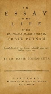
Search results from Open Library.
Recent natural events nearby
Ground air-quality sensors
Recently spotted species
Nearest stream gauge
Events
Gallery
Sources
- • Wikipedia
- • US Census Bureau (ACS 5-year estimates)
- • NOAA National Weather Service
- • Wikidata
- • NCES via Urban Institute Education Data Portal
- • CDC PLACES
- • Open-Meteo / sunrise-sunset.org
- • Wikipedia Pageviews API
- • Open Library