Browse / Germany / Baden-Württemberg / Laupheim
Laupheim
Baden-Württembergtown

Laupheim
Total population
20,213
Demographic figures from Destatis. Overview below cites Wikipedia and may reference a different year.
City facts
Sister cities
Facts from Wikidata (CC0).
Overview
Laupheim is a major district town in southern Germany in the state of Baden-Württemberg. Laupheim was first mentioned in 778 and gained city rights in 1869. One of the main trading routes, from Ulm to Ravensburg and then on towards Lake Constance ran through Laupheim. Having developed from a rural settlement into a small urban area, Laupheim is home to a number of small to medium-sized industries and businesses. One of the largest employers are the German Armed Forces which maintain an airbase close to Laupheim, Laupheim Air Base.
Read more on WikipediaHistory & geography
History
The area in and around Laupheim has been settled from very early times onwards. Archaeological evidence shows that 15000 years ago nomadic tribes roamed the countryside. From ca. 2000 BCE onwards, Celts inhabited this area. From the first century CE until around the year 260 CE, it was part of the Roman province of Raetia, after which the Alamanni invaded the Agri Decumates, eventually also settling in the area that was to become Laupheim. During archaeological excavations in 1840-1842 graves dating from the Merovingian period were discovered in the northern part of the town. Laupheim was first mentioned as Louphaim in a charter dated 778. The charter is still kept in the archives of the monastery of St Gallen, Switzerland. This reference is the earliest of any city in Upper Swabia and any parish in the district of Biberach. Situated in the vicinity of two major trade routes between the Lake of Constance and Ulm and the Swabian Alb and the valley of the river Iller respectively, Laupheim developed into a major settlement. In 853, it was elevated to the status of town when a court responsible for the Rammachgau (also spelled Rammagau) was set up there. During the 9th century, parts of Laupheim came into the possession of the monastery of Weißenburg which was afterwards passed on to successive minor Swabian aristocratic houses. As early as the 10th century, Laupheim possessed a parish church with subsidiaries. In 926, Laupheim and its surroundings were destroyed by the Hungarians. A castle is mentioned around the year 1100. Laupheim appears to have been home of an indigenous noble family, whose members used the suffix von Laupheim. They were attested for the first time in 1110 with Landoldus de Lobhein and seemed to have been in service of the counts of Kirchberg.…
Geography
Laupheim is situated in the region of Upper Swabia approximately 20 km north of Biberach and 20 km south of Ulm on the Bundesstraße 30. Laupheim is the second largest city in the district of Biberach. The original settlement of Laupheim was located close to the Rottum which still runs through the city but since 1950 the city has expanded and sprawls onto the surrounding slopes. With effect of 1 Januar 2016 Laupheim has been awarded the status of major district town. The elevation within the city confines ranges from 509 m (1670 ft) above sea level at the bottom of the valley to 539 m (1768 ft) in the outlying suburban areas. Apart from the city of Laupheim itself, the following once autonomous villages nowadays belong administratively to Laupheim: Baustetten (population 2121), Obersulmetingen (population 1389), Untersulmetingen (population 2082) and Bihlafingen (population 853), which, with an elevation of 580 m (1903 ft), has the highest elevation of the administrative area.
Excerpted from the corresponding Wikipedia article (CC BY-SA).
Geography
Coordinates & boundaries from the US Census TIGER/Line shapefiles.
Climate
Air quality
Walkability
Amenities nearby
Wildlife & biodiversity
Most-observed species
- MallardAnas platyrhynchos Linnaeus, 1758 · Aves1,255
- Eurasian BlackbirdTurdus merula Linnaeus, 1758 · Aves1,166
- Carrion CrowCorvus corone Linnaeus, 1758 · Aves1,079
- Eurasian Blue TitCyanistes caeruleus (Linnaeus, 1758) · Aves996
- Eurasian CootFulica atra Linnaeus, 1758 · Aves971
- Mute SwanCygnus olor (J.F.Gmelin, 1789) · Aves971
- Great TitParus major Linnaeus, 1758 · Aves949
- Graylag GooseAnser anser (Linnaeus, 1758) · Aves933
Citizen-science & research observations from the Global Biodiversity Information Facility (GBIF).
Earthquake history
Most recent
- M 3.4 — 2022-10-16Baden-Wurttemberg, Germany
- M 4 — 2022-07-092 km NNE of Grosselfingen, Germany
- M 3.6 — 2013-07-203 km ESE of Andwil, Switzerland
- M 3.1 — 2008-12-253 km NNW of Saulgau, Germany
- M 2.5 — 2008-12-122 km ESE of Nehren, Germany
- M 2.7 — 2008-07-091 km WSW of Dußlingen, Germany
Events from the USGS Earthquake Catalog (global) (FDSN Event Web Service).
Photos
Sights & places nearby
Notable people from here


People born within ~10 km, from Wikidata (CC0). Click any name for their Wikipedia article.
Nearby places in Baden-Württemberg
Geography & sun
Elevation, sunrise/sunset and daylight from Open-Meteo. Solar climatology from NASA POWER.
Nearby airports
Public attention
Pageview totals from the Wikimedia Pageviews API.
Books about Laupheim
Search results from Open Library.
Recent natural events nearby
Ground air-quality sensors
Recently spotted species
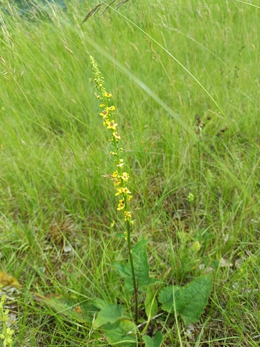
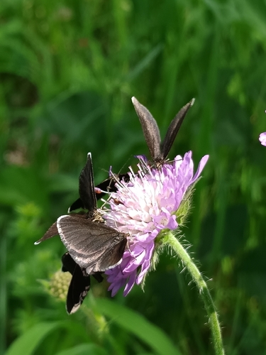




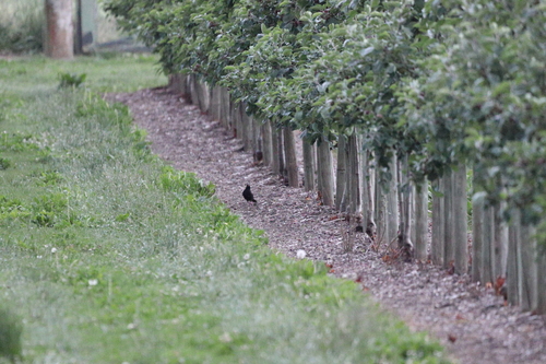

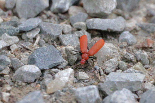
Research-grade observations from iNaturalist (within ~15 mi).
Events
Gallery
Geotagged photos within ~6 miles of Laupheim, from Wikimedia Commons contributors.
 0 mi
0 mi 0.1 mi
 0.1 mi
 0.1 mi
 0.1 mi
 0.1 mi
 0.1 mi
 0.1 mi
 0.1 mi
 0.1 mi
 0.1 mi
.jpg) 0.1 mi
0.1 mi.jpg) 0.1 mi
0.1 mi.jpg) 0.1 mi
0.1 mi 0.1 mi
.jpg) 0.1 mi
0.1 mi 0.1 mi
_-_geo.hlipp.de_-_5730.jpg) 0.2 mi
0.2 mi 0.2 mi
 0.2 mi
 0.2 mi
 0.2 mi
.jpg) 0.2 mi
0.2 mi 0.2 mi
Photos via Wikimedia Commons — see each image page for license & attribution.
Official Identifiers
Destatis — German Federal Statistical Office
- AGS
- 08426070
- Population (Wikidata)
- 23,044
- Wikidata
- Q574314
Amtlicher Gemeindeschlüssel (AGS) via Wikidata P439
Sources
- • Wikipedia
- • Wikimedia Commons
- • Wikidata
- • USGS Earthquake Catalog (global feed)
- • GBIF (Global Biodiversity Information Facility)
- • iNaturalist
- • Open-Meteo / sunrise-sunset.org
- • Wikipedia Pageviews API
- • Open Library
- • Wikidata SPARQL (CC0) — population, area, elevation, inception, head of government, Commons image
- • Destatis — German Federal Statistical Office — Amtlicher Gemeindeschlüssel (AGS) via Wikidata P439