Browse / Algeria / Tlemcen / Tlemcen
Tlemcen
Tlemcencity

Tlemcen
Total population
140,158
Demographic figures from Office National des Statistiques (Algeria). Overview below cites Wikipedia and may reference a different year.
City facts
Facts from Wikidata (CC0).
Overview
Tlemcen is the second-largest city in northwestern Algeria after Oran and the capital of Tlemcen Province. The city has developed leather, carpet, and textile industries, which it exports through the port of Rachgoun. It had a population of 140,158, as of the 2008 census.
Read more on WikipediaHistory & geography
History
The areas surrounding Tlemcen were inhabited during the Neolithic period, as evidenced by the discovery of polished axes in the caves of Boudghene by Gustave-Marie Bleicher in 1875. There are three important prehistoric sites in the region: lake Karar, located one kilometer south of Remchi; the rock shelters of Mouilah, 5 km north of Maghnia; and the deposit called "d'Ouzidan", 2 km west of Aïn El Hout. The shelters found at the Mouilah and Boudghene show evidence of long periods of pre-historic human habitation. In AD 17, Tacfarinas led the Gaetuli to revolt against the Romans. Tlemcen became a military outpost of Ancient Rome in the 2nd century CE under the name of Pomaria. It was then an important city in the North Africa see of the Roman Catholic Church, where it was the center of a diocese. Its bishop, Victor, was a prominent representative at the Council of Carthage (411), and its bishop Honoratus was exiled in 484 by the Vandal king Huneric for denying Arianism. It was a center of a large Christian population for many centuries after the city's Arab conquest in 708 AD. In the later eighth century and the ninth century, the city became a Kingdom of Banu Ifran with a Sufri Kharijite orientation. These same Berber Kharijis also began to develop various small Saharan oases and to link them into regular trans-Saharan caravan routes terminating at Tlemcen, beginning a process that would determine Tlemcen's historical role for almost all of the next millennium. In the late 8th century a settlement named Agadir existed on the site of former Roman Pomaria. Idris I founded a congregational mosque here, the Great Mosque of Agadir, circa 790 (no longer extant). The fusion of the two settlements of Tagrart and Agadir over time became what is now Tlemcen.…
Excerpted from the corresponding Wikipedia article (CC BY-SA).
Geography
Coordinates & boundaries from the US Census TIGER/Line shapefiles.
Climate
Air quality
Walkability
Amenities nearby
Wildlife & biodiversity
Earthquake history
Photos
Sights & places nearby
Notable people from here


People born within ~10 km, from Wikidata (CC0). Click any name for their Wikipedia article.
Nearby places in Tlemcen
- Zalboun7.2 mi away
- Ain Taslit17.3 mi away
- Muhammad Salah28.1 mi away
- Dar Mtaa el Anabra46.8 mi away
- Meinedo579.2 mi away · pop. 4,052
- Casais582.1 mi away · pop. 1,401
- Ferreiró592.8 mi away
- Veli Rat1070.2 mi away · pop. 91
- Brgulje1073.2 mi away · pop. 63
- Zverinac1073.6 mi away · pop. 55
- Brbinj1074.3 mi away · pop. 70
- Savar1074.3 mi away · pop. 35
Geography & sun
Elevation, sunrise/sunset and daylight from Open-Meteo. Solar climatology from NASA POWER.
Nearby airports
Public attention
Pageview totals from the Wikimedia Pageviews API.
Books about Tlemcen


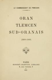

Search results from Open Library.
Recent natural events nearby
Ground air-quality sensors
Recently spotted species
Events
Gallery
Sources
- • Wikipedia
- • Wikidata
- • Open-Meteo / sunrise-sunset.org
- • Wikipedia Pageviews API
- • Open Library