Browse / Ireland / Dublin / Dublin
Dublin
Dublincity

Dublin
Total population
554,554
Air quality index
Demographic figures from Central Statistics Office (Ireland). Overview below cites Wikipedia and may reference a different year.
City facts
Sister cities
Facts from Wikidata (CC0).
Overview
Dublin is the capital and largest city of Ireland. Situated on Dublin Bay at the mouth of the River Liffey, it is in the province of Leinster, and is bordered on the south by the Dublin Mountains, part of the Wicklow Mountains range. Dublin is the largest city by population on the island of Ireland; at the 2022 census, the city council area had a population of 592,713, while the city, including suburbs, had a population of 1,263,219, and County Dublin had a population of 1,501,500. Various definitions of a metropolitan Greater Dublin Area exist.
Read more on WikipediaHistory & geography
History
Humans have inhabited the area of Dublin Bay since prehistoric times. Fish traps discovered from excavations during the construction of the Convention Centre Dublin indicate human habitation as far back as 6,000 years ago. Further traps were discovered closer to the old settlement of the city of Dublin on the south quays near St. James's Gate, which indicate mesolithic human activity. Ptolemy's map of Ireland, of about 140 AD, provides possibly the earliest reference to a settlement near Dublin. Ptolemy, the Greco-Roman astronomer and cartographer, called it Eblana polis (). The Viking settlement of about 841 was preceded by a Christian ecclesiastical settlement known as Duibhlinn, from which Dyflin took its name. The Irish government recognised 988 as the year in which the city was settled and that this first settlement would later become the city of Dublin; Dublin celebrated its 'official' millennium in 1988. Beginning in the 9th and 10th centuries, two settlements later became modern Dublin. The subsequent Scandinavian settlement centred on the River Poddle, a tributary of the Liffey in an area now known as Wood Quay. The Dubhlinn was a pool on the lowest stretch of the Poddle, where ships used to moor. This pool was finally fully infilled during the early 18th century, as the city grew. The Dubhlinn lay where the Castle Garden is now located, opposite the Chester Beatty Library within Dublin Castle. Táin Bó Cuailgne ("The Cattle Raid of Cooley") refers to Dublind rissa ratter Áth Cliath, meaning "Dublin, which is called Ath Cliath". In 841, the Vikings established a fortified base in Dublin. The town grew into a substantial commercial centre under Olaf Guthfrithson in the mid-to-late 10th century and, despite some attacks by the native Irish, it remained…
Geography
Dublin is situated at the mouth of the River Liffey and its urban area encompasses approximately in east-central Ireland. It is bordered by the Dublin Mountains, a low mountain range and sub-range of the Wicklow Mountains, to the south, and surrounded by flat farmland to the north and west. The city itself was founded where the River Poddle met the Liffey. The early Viking settlement was also facilitated by the small Steine or Steyne River, the larger Camac and the Bradogue, in particular. Two secondary rivers further divide the city: the River Tolka, running southeast into Dublin Bay, and the River Dodder, running northeast to near the mouth of the Liffey. These, along with the Liffey, have multiple tributaries. Many lesser rivers and streams also flow to the sea within the suburban parts of the city. Two canals – the Grand Canal on the southside and the Royal Canal on the northside – ring the inner city on their way from the west, both connecting with the River Shannon. Similar to much of the rest of northwestern Europe, Dublin has a maritime climate (Cfb) with mild-warm summers, cool winters, and little temperature extremes. At Merrion Square, the coldest month is February, with an average minimum temperature of . The warmest month is July, with an average maximum temperature of . Due to the urban heat island effect, Dublin city has the warmest summertime nights in Ireland. The average minimum temperature at Merrion Square in July is . The lowest July temperature ever recorded at the station was on 3 July 1974. The highest temperature officially recorded in Dublin is on 18 July 2022, at the Phoenix Park. A non-official record of was recorded at Phoenix Park in July 1876. Dublin's sheltered location on the east coast makes it the driest place in…
Excerpted from the corresponding Wikipedia article (CC BY-SA).
Geography
Coordinates & boundaries from the US Census TIGER/Line shapefiles.
Climate
10-year averages from ERA5 reanalysis (Open-Meteo).
Air quality
Current readings from Open-Meteo Air Quality API (Copernicus CAMS European reanalysis).
Walkability
Amenities nearby
Wildlife & biodiversity
Most-observed species
- Herring GullLarus argentatus Pontoppidan, 1763 · Aves16,834
- Hooded CrowCorvus cornix Linnaeus, 1758 · Aves14,257
- Eurasian MagpiePica pica (Linnaeus, 1758) · Aves14,251
- Common Wood-PigeonColumba palumbus Linnaeus, 1758 · Aves13,146
- European RobinErithacus rubecula (Linnaeus, 1758) · Aves11,051
- European StarlingSturnus vulgaris Linnaeus, 1758 · Aves9,751
- Eurasian BlackbirdTurdus merula Linnaeus, 1758 · Aves9,677
- Black-headed GullChroicocephalus ridibundus (Linnaeus, 1766) · Aves9,420
Citizen-science & research observations from the Global Biodiversity Information Facility (GBIF).
Earthquake history
Most recent
- M 3.2 — 2005-12-1427 km E of Wicklow, Ireland
Events from the USGS Earthquake Catalog (global) (FDSN Event Web Service).
Photos
Sights & places nearby
Notable people from here


People born within ~10 km, from Wikidata (CC0). Click any name for their Wikipedia article.
Nearby places in Dublin
- Goatstown4.1 mi away
- Dundrum4.2 mi away
- Castleknock4.5 mi away
- Ballyboden4.8 mi away · pop. 5,193
- Blanchardstown5.6 mi away · pop. 68,156
- Clondalkin5.8 mi away · pop. 45,165
- Tallaght6 mi away · pop. 101,055
- Ballyogan6.8 mi away
- Mulhuddart6.8 mi away
- Cornelscourt6.8 mi away
- Swords7.8 mi away · pop. 40,776
- Dalkey8 mi away
Geography & sun
Elevation, sunrise/sunset and daylight from Open-Meteo. Solar climatology from NASA POWER.
Nearby airports
Public attention
Pageview totals from the Wikimedia Pageviews API.
Books about Dublin


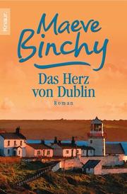



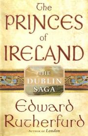
Search results from Open Library.
Recent natural events nearby
Ground air-quality sensors
Recently spotted species
Events
Notable, recurring, and historical events associated with Dublin, sourced from Wikidata.
- 11th Irish Film & Television AwardsApr 5, 2014award ceremony
- 10th Irish Film & Television AwardsFeb 9, 2013award ceremony
- March for a Better WayNov 27, 2010demonstration
- Jan 1, 2005
- Apr 24, 2004
- Q110645479Jun 24, 1967sporting event
- Mar 22, 1959
Source: Wikidata (CC0).
Gallery
Geotagged photos within ~6 miles of Dublin, from Wikimedia Commons contributors.


.jpg)
.jpg)
.jpg)
.jpg)
.jpg)
.jpg)
.jpg)
.jpg)
.jpg)
.jpg)
.jpg)
.jpg)

_(32837826406).jpg)
_(32832530856).jpg)
_(32030566634).jpg)
_(32497479360).jpg)
_(32074320853).jpg)


_-_geograph.org.uk_-_3965352.jpg)
Photos via Wikimedia Commons — see each image page for license & attribution.
Official Identifiers
Logainm — Placenames Database of Ireland
- Logainm ID
- 1375542
- Population (Wikidata)
- 592,713
- Wikidata
- Q1761
Logainm ID via Wikidata P5097
Sources
- • Wikipedia
- • Open-Meteo (ERA5 reanalysis)
- • Wikimedia Commons
- • Wikidata
- • Open-Meteo Air Quality (CAMS)
- • USGS Earthquake Catalog (global feed)
- • GBIF (Global Biodiversity Information Facility)
- • Open-Meteo / sunrise-sunset.org
- • Wikipedia Pageviews API
- • Open Library
- • Logainm — Placenames Database of Ireland — Logainm ID via Wikidata P5097