Browse / United States / Illinois / Henry
Henry
Illinoiscity

Henry
Total population
2,441
Median home value
$117,000
Bachelor's+
Median income
$65,577
Founded
1834
Demographic figures from US Census Bureau · ACS 5-year estimates. Overview below cites Wikipedia and may reference a different year.
City facts
Facts from Wikidata (CC0).
Overview
Henry is a city in Marshall County, Illinois, United States. The population was 2,320 at the 2020 census. It is part of the Peoria Metropolitan Statistical Area.
Read more on WikipediaHistory & geography
History
Henry is named after General James D. Henry and was initially surveyed in 1834. The topography of the land on the west side of the Illinois River, with relatively steep banks rising well above river level, assured early settlers that their homes would not flood. Its slogan, "Best Town in Illinois by a Dam Site", is derived from the city's distinction of having the first lock and dam built on the Illinois River. It was completed in 1870 at a cost of $400,000.
Geography
Henry is located in northern Marshall County and is bordered to the east by the Illinois River, which forms the boundary with Putnam County. Illinois Route 18 passes through the center of Henry as Third Street and School Street, leading southwest across the Illinois River on the Henry Bridge, then east to Streator. Illinois Route 29 passes through the west side of the city, leading north and east to Spring Valley and southwest to Peoria. According to the U.S. Census Bureau, Henry has a total area of , of which are land and , or 3.85%, are water, The sands and gravels underlying the terrace on which Henry lies were deposited by the Kankakee Torrent about 19,000 BP calibrated years ago. Within the Illinois River valley, these sediments typically range from thick. These and other Wisconsinan coarse-grained, fluvial sands and gravel within Illinois have been named after the city of Henry and are currently known as the Henry Formation, a geological formation. The parts of the Henry Formation which are of fluvial or glaciofluvial origin are designated as the Mackinaw facies of the Henry Formation. The original exposure from which the Henry Formation was named was a former sand and gravel pit that was located along Illinois Highway 29, north of Henry.
Excerpted from the corresponding Wikipedia article (CC BY-SA).
Demographics & economy
Race & ethnicity
Source: US Census Bureau — American Community Survey, 5-year estimates.
Geography
Coordinates & boundaries from the US Census TIGER/Line shapefiles.
Climate
Current forecast
Forecast for Henry, IL from NOAA NWS API.
Air quality
Industrial & pollution facilities
Natural hazard risk
Health (adults)
Age-adjusted prevalence estimates from CDC PLACES (latest release).
Walkability
Amenities nearby
Wildlife & biodiversity
Schools
Largest nearby schools
- Henry-Senachwine Grade SchoolElementary · Henry · 397 students · 13.2:1 ratio
- Midland Elementary SchoolElementary · Lacon · 274 students · 17.1:1 ratio
- Midland Middle SchoolMiddle · Sparland · 196 students · 13.1:1 ratio
- Midland High SchoolHigh · Varna · 195 students · 15:1 ratio
- Henry-Senachwine High SchoolHigh · Henry · 142 students · 8.4:1 ratio
Public K–12 schools within ~10 mi from Urban Institute Education Data Portal (NCES Common Core of Data, 2022).
Earthquake history
Photos
Sights & places nearby
Notable people from here


People born within ~10 km, from Wikidata (CC0). Click any name for their Wikipedia article.
Nearby places in Illinois
- Magnolia8.4 mi away · pop. 232
- McNabb8.7 mi away · pop. 233
- Hennepin9.5 mi away · pop. 929
- Hopewell10.6 mi away · pop. 604
- Granville12.2 mi away · pop. 1,472
- De Pue14.9 mi away · pop. 1,532
- Lostant15.1 mi away
- Oglesby19.2 mi away
- LaSalle20.2 mi away · pop. 9,498
- Malden21.3 mi away · pop. 460
- Metamora22.3 mi away
- Cherry22.7 mi away · pop. 534
Geography & sun
Elevation, sunrise/sunset and daylight from Open-Meteo. Solar climatology from NASA POWER.
Nearby airports
Public attention
Pageview totals from the Wikimedia Pageviews API.
Books about Henry


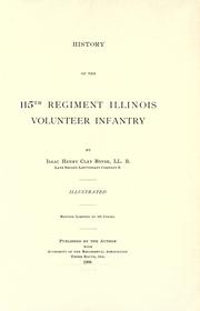

Search results from Open Library.
Recent natural events nearby
Ground air-quality sensors
Recently spotted species
Nearest stream gauge
Events
Gallery
Sources
- • Wikipedia
- • US Census Bureau (ACS 5-year estimates)
- • NOAA National Weather Service
- • Wikidata
- • NCES via Urban Institute Education Data Portal
- • CDC PLACES
- • Open-Meteo / sunrise-sunset.org
- • Wikipedia Pageviews API
- • Open Library