Browse / United States / Illinois / Mitchell
Mitchell
IllinoisCDP
Total population
1,092
Median home value
$110,500
Bachelor's+
Median income
$60,450
Demographic figures from US Census Bureau · ACS 5-year estimates. Overview below cites Wikipedia and may reference a different year.
- Heat Advisory · ModerateHeat Advisory issued September 17 at 2:19AM CDT until September 19 at 8:00PM CDT by NWS St Louis MO
Source: NOAA National Weather Service.
City facts
Facts from Wikidata (CC0).
Overview
Mitchell is an unincorporated community and census-designated place (CDP) in Madison County, Illinois, United States. As of the 2020 census, its population was 1,217. It is part of the Metro East region of greater St. Louis.
Read more on WikipediaHistory & geography
History
Two brothers from Chicago, John Jay and William H. Mitchell, settled in the area in 1870 and bought about of Mississippi River bottomland, which they drained to operate a cattle ranch. When the Chicago and Alton Railroad built its line from Alton toward East St. Louis, John Mitchell promoted the railroad and established a stop he named for himself, Mitchell Station. The Wabash and other lines soon laid tracks through the area, and Mitchell grew as a rail junction. When U.S. Route 66 was commissioned in 1926, it ran through Mitchell along the corridor now followed by Illinois Route 203. The Luna Cafe, built in 1924, became a well-known stop on the highway and remains in business; its neon sign, later restored with help from the Friends of the Mother Road, is a local landmark. According to local legend the cafe also housed a Prohibition-era gambling room and an upstairs brothel and drew visits from the gangster Al Capone, although these stories are undocumented.
Geography
Mitchell is located in western Madison County at the junction of Interstate 270 and Illinois Route 203, part of former U.S. Route 66, approximately northeast of downtown St. Louis. It is bordered to the south and east by Pontoon Beach, to the northeast by Edwardsville, and to the northwest by the unincorporated community of Brooks. Granite City is to the southwest via IL 203. A few years ago, Mitchell tried to become an independent city, but that vote was never allowed because of court challenges from nearby communities. According to the U.S. Census Bureau, the Mitchell CDP has an area of , all land. The community sits on the Mississippi River floodplain, known in the region as American Bottom. The lone school in the town is Mitchell Elementary School. Near town to the east is the Gateway Commercial Business Center, a place of trucking companies and more. Also located in Mitchell is the Luna Cafe, a historic landmark along old Route 66.
Excerpted from the corresponding Wikipedia article (CC BY-SA).
Demographics & economy
Race & ethnicity
Source: US Census Bureau — American Community Survey, 5-year estimates.
Geography
Coordinates & boundaries from the US Census TIGER/Line shapefiles.
Climate
Current forecast
Forecast for Mitchell, IL from NOAA NWS API.
Air quality
Industrial & pollution facilities
Natural hazard risk
Health (adults)
Age-adjusted prevalence estimates from CDC PLACES (latest release).
Walkability
Amenities nearby
Wildlife & biodiversity
Schools
Largest nearby schools
- Edwardsville High SchoolHigh · Edwardsville · 2,354 students · 18.5:1 ratio
- Granite City High SchoolHigh · Granite City · 1,805 students · 19:1 ratio
- Collinsville Middle SchoolMiddle · Collinsville · 950 students · 15.1:1 ratio
- Liberty Middle SchoolMiddle · Edwardsville · 896 students · 16.6:1 ratio
- Dorris Intermediate SchMiddle · Collinsville · 884 students · 14.3:1 ratio
- Coolidge Junior High SchMiddle · Granite City · 871 students · 18.5:1 ratio
- Grigsby Intermediate SchoolMiddle · Granite City · 829 students · 16.9:1 ratio
- Lincoln Middle SchoolMiddle · Edwardsville · 818 students · 15.7:1 ratio
Public K–12 schools within ~10 mi from Urban Institute Education Data Portal (NCES Common Core of Data, 2022).
Earthquake history
Photos
Sights & places nearby
Notable people from here


People born within ~10 km, from Wikidata (CC0). Click any name for their Wikipedia article.
Nearby places in Illinois
- Glen Carbon5.3 mi away
- Edwardsville5.4 mi away · pop. 26,474
- Madison5.4 mi away · pop. 2,900
- Maryville6.7 mi away
- East Alton8.5 mi away · pop. 5,689
- Brooklyn8.8 mi away · pop. 729
- Caseyville9.6 mi away
- Bethalto9.8 mi away
- East St. Louis10.5 mi away
- Holiday Shores13.7 mi away
- Cahokia Heights13.8 mi away
- Marine16.4 mi away
Geography & sun
Elevation, sunrise/sunset and daylight from Open-Meteo. Solar climatology from NASA POWER.
Nearby airports
Public attention
Pageview totals from the Wikimedia Pageviews API.
Books about Mitchell



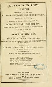
Search results from Open Library.
Recent natural events nearby
Ground air-quality sensors
Recently spotted species
Nearest stream gauge
Events
Gallery
Sources
- • Wikipedia
- • US Census Bureau (ACS 5-year estimates)
- • NOAA National Weather Service
- • Wikidata
- • NCES via Urban Institute Education Data Portal
- • CDC PLACES
- • Open-Meteo / sunrise-sunset.org
- • Wikipedia Pageviews API
- • Open Library