Browse / United States / Indiana / Nappanee
Nappanee
Indianacity

Nappanee
Total population
6,815
Median home value
$238,600
Bachelor's+
Median income
$68,892
Demographic figures from US Census Bureau · ACS 5-year estimates. Overview below cites Wikipedia and may reference a different year.
City facts
Facts from Wikidata (CC0).
Overview
Nappanee is a city in Elkhart and Kosciusko counties in the U.S. state of Indiana. The population was 6,648 as of the 2010 U.S. census and had grown to 6,913 by the 2020 U.S. census. The name Nappanee is thought to mean "flour" in the Algonquian language.
Read more on WikipediaHistory & geography
History
Several hundred years ago, the indigenous Mound Builders built their settlements in an area to the north of the city's marshes. Pottawatomi arrived in the area from near Green Bay, Wisconsin in the 1700s, partially displacing the previous Miami inhabitants. The Pottawatomis had settlements on the Elkhart River at Elkhart, Goshen, and Waterford, and at Monoquet between Leesburg and Warsaw in what became Kosciusko County, Indiana. Thus, the Plymouth-Goshen Road near Nappanee probably follows the course of an old Indian Trail. The first European settlers came to the area in 1830, as various treaties and a process the Pottawatomi call the "Trail of Death" led to the relocation of Native Americans away from their traditional territories. By 1870, seven farms had been established and forty people were settled around Nappanee. Locke Township had been founded in 1836 and named after Samuel Lockwood, and by 1863 a settlement called Wisler Town existed, but the actual platting of the village of Locke Town, approximately six miles from Nappanee, took place in December 1867. It would receive its last addition in 1874, the year that Nappanee was platted (on December 12, 1874). The B&O Railroad sought a route westward from Sandusky, Ohio to the booming inland port of Chicago, Illinois in 1872. While the land around what became Nappanee and nearby Bremen was flat, permitting a straight crossing from Walkerton, it was also marshy, which led to various engineering challenges. The section through Nappanee was finally completed as a single track in the late summer of 1874 and replaced by steel rails in 1882. Farmers sold the railroad land so that its tracks would run right next to Nappanee on its route to Chicago, although the railroad was unable to acquire the five acres needed to…
Geography
According to the 2010 census, the city has a total area of of land. Nappanee is now surrounded by fertile farmland as the headwaters of the Wabash River in northern Indiana, but initially was one of the least desirable areas of what became Elkhart County, due to dense woods and widespread swamps, particularly tamarack marshes. The water drains into two watersheds—precipitation south of what became Market Street drains into the Wabash River, thence to the Ohio River, Mississippi River, and ultimately the Gulf of Mexico. Precipitation north of Market Street drains into the Great Lakes, and ultimately the St. Lawrence River and the Atlantic Ocean.
Excerpted from the corresponding Wikipedia article (CC BY-SA).
Demographics & economy
Race & ethnicity
Source: US Census Bureau — American Community Survey, 5-year estimates.
Geography
Coordinates & boundaries from the US Census TIGER/Line shapefiles.
Climate
Air quality
Industrial & pollution facilities
Natural hazard risk
Health (adults)
Walkability
Amenities nearby
Wildlife & biodiversity
Schools
Earthquake history
Photos
Sights & places nearby
Notable people from here
Nearby places in Indiana
- Wakarusa5.9 mi away
- Milford8.2 mi away · pop. 1,661
- Wyatt10.5 mi away
- Lake of the Woods11.8 mi away · pop. 663
- Bourbon11.9 mi away · pop. 1,760
- Etna Green12 mi away
- Goshen12.3 mi away · pop. 34,517
- Benton12.7 mi away · pop. 384
- Syracuse12.9 mi away
- Warsaw15.8 mi away
- Millersburg16.5 mi away · pop. 1,077
- Gilmer Park17.4 mi away
Geography & sun
Elevation, sunrise/sunset and daylight from Open-Meteo. Solar climatology from NASA POWER.
Nearby airports
Public attention
Pageview totals from the Wikimedia Pageviews API.
Books about Nappanee
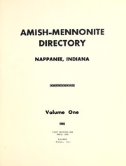


Search results from Open Library.
Recent natural events nearby
Ground air-quality sensors
Recently spotted species
Nearest stream gauge
Events
Gallery
Sources
- • Wikipedia
- • US Census Bureau (ACS 5-year estimates)
- • Wikidata
- • Open-Meteo / sunrise-sunset.org
- • Wikipedia Pageviews API
- • Open Library