Browse / United States / Indiana / New Amsterdam
New Amsterdam
Indianatown

New Amsterdam
Total population
92
Median home value
$95,200
Bachelor's+
Median income
$111,087
Demographic figures from US Census Bureau · ACS 5-year estimates. Overview below cites Wikipedia and may reference a different year.
City facts
Facts from Wikidata (CC0).
Overview
New Amsterdam is a town located in Washington Township, Harrison County, Indiana, United States, along the Ohio River. As of the 2020 census, the city population was 12. As of the 2020 Census, New Amsterdam was the smallest city, town, or Census Designated Place in the state of Indiana. River Forest was the smallest in 2010 when it had 22, but had risen to 26. New Amsterdam officially became the smallest town in Indiana with the population being 12, down from 27 in 2010.
Read more on WikipediaHistory & geography
History
The first settlers in what became New Amsterdam were James Riley and Jacob Youstler. Starting in 1815, they lived in New Amsterdam for several years before relocating further north. The town was formally platted on September 19, 1815, by Jacob Funk and Samuel McAdams. The town relied on the Ohio River for its growth, as it was the main transportation route for migrating settlers as well as traders up and down river. Steamboats were active on the river during the 19th century and contributed to the growth of waterfront towns. In the 1860 census, New Amsterdam was the largest town in Harrison County. Floods played a large part in the decline of the town. The Great Ohio River flood of 1937 destroyed 75% of the structures in the town. The only original building remaining in the town is the old country store. A marker on the second story of the building shows the height of the water in the 1937 Flood. Today, the town has a general store, a Baptist church, a Methodist church, a town hall and a cemetery.
Geography
New Amsterdam is located at (38.101894, -86.274821). According to the 2010 census, New Amsterdam has a total area of , of which (or 80%) is land and (or 20%) is water.
Excerpted from the corresponding Wikipedia article (CC BY-SA).
Demographics & economy
Race & ethnicity
Source: US Census Bureau — American Community Survey, 5-year estimates.
Geography
Coordinates & boundaries from the US Census TIGER/Line shapefiles.
Climate
Current forecast
Forecast for New Amsterdam, IN from NOAA NWS API.
Air quality
Industrial & pollution facilities
Natural hazard risk
Health (adults)
Walkability
Amenities nearby
Wildlife & biodiversity
Schools
Largest nearby schools
- Heth-Washington Elementary SchoolElementary · Central · 150 students · 16.7:1 ratio
Public K–12 schools within ~10 mi from Urban Institute Education Data Portal (NCES Common Core of Data, 2022).
Earthquake history
Photos
Sights & places nearby
Notable people from here

People born within ~10 km, from Wikidata (CC0). Click any name for their Wikipedia article.
Nearby places in Indiana
- Mauckport6.8 mi away · pop. 49
- Alton7.8 mi away · pop. 37
- Leopold16.6 mi away · pop. 150
- Marengo18.9 mi away
- English19.2 mi away · pop. 1,008
- Georgetown21.8 mi away · pop. 3,800
- Floyds Knobs26.6 mi away · pop. 4,515
- Cannelton28.4 mi away
- Schnellville31 mi away · pop. 95
- New Pekin31.1 mi away · pop. 1,372
- Ferdinand33 mi away
- Paoli33.1 mi away · pop. 3,125
Geography & sun
Elevation, sunrise/sunset and daylight from Open-Meteo. Solar climatology from NASA POWER.
Nearby airports
Public attention
Pageview totals from the Wikimedia Pageviews API.
Books about New Amsterdam
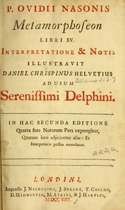


Search results from Open Library.
Recent natural events nearby
Ground air-quality sensors
Recently spotted species


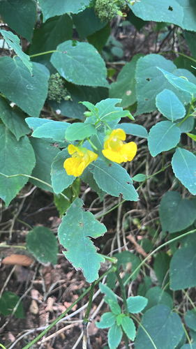



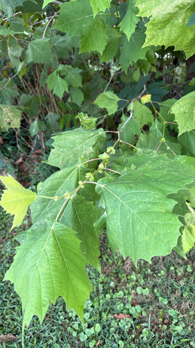


Research-grade observations from iNaturalist (within ~15 mi).
Nearest stream gauge
Events
Gallery
Sources
- • Wikipedia
- • US Census Bureau (ACS 5-year estimates)
- • NOAA National Weather Service
- • Wikidata
- • NCES via Urban Institute Education Data Portal
- • iNaturalist
- • Open-Meteo / sunrise-sunset.org
- • Wikipedia Pageviews API
- • Open Library