Browse / India / West Bengal / Uluberia
Uluberia
West Bengalcity

Uluberia
Total population
222,200
Demographic figures from Ministry of Statistics (India). Overview below cites Wikipedia and may reference a different year.
City facts
Facts from Wikidata (CC0).
Overview
Uluberia is a city and a municipality of Howrah district in the Indian state of West Bengal. It is the headquarter of the Uluberia subdivision. It is a part of the area covered by Kolkata Metropolitan Development Authority (KMDA).
Read more on WikipediaHistory & geography
History
In 1687, Uluberia, which was a scanty hamlet of a group of houses, served as a refuge for the retreating British Army after they were defeated by Shaista Khan near Hooghly. In Gadiara, the confluence of Hooghly, Damodar and Rupnarayan, Robert Clive commissioned the construction of Fort Mornington in Gadiara. Around late 1760s, it was completely built. It served as an important post of British dominance and prevention of piracy up in the Ganges. In 1873 the present Uluberia subdivision was constituted in the name of “Mahishrekha” which was subsequently renamed as Uluberia in 1882. Two years before the administration of subdivision was consolidated (1871), the British launched a massive Orisha Canal Scheme to provide irrigation facilities. A few years later, to save water utility costs, the canal passing through Uluberia and other areas of South Bengal was detached from the main canal and named Midnapore Canal. William Carey (missionary) , the famous Baptist visited Uluberia several times during late 19th century. During 1930s, Civil disobedience movement, there was huge uprising in Shyampur police station. After becoming congress president Subhas Chandra Bose gave speech in Gorur Hat of Uluberia in 1938. During WW2, Uluberia frequently faced blackouts due to Japanese bombing around areas near Kolkata . To facilitate troops movement towards east, especially from cities like Ranchi ( HQ of XV Corps of British Indian Army ), the famous Military Bridge was constructed on the Canal.
Geography
Uluberia is located at . It has an average elevation of . It is situated on the banks of the river Hooghly. The main road passing through the heart of the city is Orissa trunk road and is also well connected by National Highway 16. This is an unplanned city hence waterlogging is very common during heavy rainfall. One of the other problems is erosion of the Hooghly River and encroachment of land.
Excerpted from the corresponding Wikipedia article (CC BY-SA).
Geography
Coordinates & boundaries from the US Census TIGER/Line shapefiles.
Climate
Air quality
Walkability
Amenities nearby
Wildlife & biodiversity
Earthquake history
Photos
Sights & places nearby
Notable people from here

People born within ~10 km, from Wikidata (CC0). Click any name for their Wikipedia article.
Nearby places in West Bengal
- Pujali2.2 mi away · pop. 37,047
- Budge Budge4.7 mi away · pop. 76,837
- Bagnan8.4 mi away
- Maheshtala9.8 mi away · pop. 448,317
- Domjur13.8 mi away
- Kolaghat14.6 mi away
- Howrah16 mi away · pop. 1,072,161
- Tamluk16.8 mi away · pop. 10,000
- Kolkata18.2 mi away · pop. 4,486,679
- Dankuni19 mi away
- Jangalpara19.3 mi away
- Bally19.7 mi away · pop. 291,972
Geography & sun
Elevation, sunrise/sunset and daylight from Open-Meteo. Solar climatology from NASA POWER.
Nearby airports
Public attention
Pageview totals from the Wikimedia Pageviews API.
Books about this place
Recent natural events nearby
Ground air-quality sensors
Recently spotted species








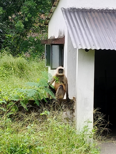
Research-grade observations from iNaturalist (within ~15 mi).
Events
Gallery
Official Identifiers
Local Government Directory (India)
- LGD code
- 801741
- Population (Wikidata)
- 235,345
- Wikidata
- Q2318927
LGD code via Wikidata P5578
Sources
- • Wikipedia
- • Wikidata
- • iNaturalist
- • Open-Meteo / sunrise-sunset.org
- • Wikipedia Pageviews API
- • Local Government Directory (India) — LGD code via Wikidata P5578