Browse / United States / Kentucky / Van Lear
Van Lear
KentuckyCDP

Van Lear
Total population
443
Median home value
$81,100
Bachelor's+
Median income
$35,347
Demographic figures from US Census Bureau · ACS 5-year estimates. Overview below cites Wikipedia and may reference a different year.
City facts
Facts from Wikidata (CC0).
Overview
Van Lear is an unincorporated community and coal town in Johnson County, Kentucky, United States.
Read more on WikipediaHistory & geography
History
Incorporated in 1912, the town was named for a director of Consolidation Coal Company (Consol), Van Lear Black. It owes its existence to the viable efforts of John Caldwell Calhoun Mayo. Mayo bought coal rights to land along Miller's Creek in Johnson County, which he later sold to Northern Coal and Coke, which in turn was later acquired by Consol. Consol built five miles of railroad into the Johnson County property with money loaned by Van Lear Black's Fidelity Trust. Eventually five coal mines were opened and operated in Van Lear from 1910 through 1946. The vast coal deposits were mined from five underground mines around the clock. The miners included immigrant Irish, Italians and Slavs, as well as Appalachians and locals. The mines were integrated; both blacks and whites worked underground. During the boom years the population surpassed 4000. In 1945 Consol merged with the Pittsburgh Coal Company, then divested itself of its Miller's Creek properties. The people who lived in company-owned housing were given first chance to purchase those homes and many did. However, most of the major buildings were torn down.
Geography
Van Lear is located at (37.7712067, -82.7579371). It has an elevation of .
Excerpted from the corresponding Wikipedia article (CC BY-SA).
Demographics & economy
Race & ethnicity
Source: US Census Bureau — American Community Survey, 5-year estimates.
Geography
Coordinates & boundaries from the US Census TIGER/Line shapefiles.
Climate
Current forecast
Forecast for Van Lear, KY from NOAA NWS API.
Air quality
Industrial & pollution facilities
Natural hazard risk
Health (adults)
Walkability
Amenities nearby
Wildlife & biodiversity
Schools
Largest nearby schools
- Johnson Central High SchoolHigh · Paintsville · 955 students · 13.3:1 ratio
- Johnson County Middle SchoolMiddle · Paintsville · 475 students · 11.6:1 ratio
- Paintsville Elementary SchoolElementary · Paintsville · 433 students · 14.9:1 ratio
- Highland Elementary SchoolElementary · Staffordsville · 419 students · 15:1 ratio
- Porter Elementary SchoolElementary · Hagerhill · 412 students · 14.2:1 ratio
- W R Castle Memorial Elementary SchoolElementary · Wittensville · 401 students · 14.3:1 ratio
- Central Elementary SchoolElementary · Paintsville · 338 students · 13:1 ratio
- Paintsville High SchoolHigh · Paintsville · 333 students · 13.3:1 ratio
Public K–12 schools within ~10 mi from Urban Institute Education Data Portal (NCES Common Core of Data, 2022).
Earthquake history
Photos
Sights & places nearby
Notable people from here
Nearby places in Kentucky
- West Van Lear2.2 mi away
- Paintsville4.4 mi away · pop. 4,203
- Prestonsburg6.6 mi away · pop. 3,765
- Dwale10.4 mi away · pop. 170
- Allen11.5 mi away · pop. 157
- Martin14.5 mi away · pop. 494
- Betsy Layne16.9 mi away
- Maytown17.1 mi away · pop. 11
- Salyersville17.4 mi away · pop. 1,708
- Blaine17.9 mi away · pop. 80
- McDowell21.9 mi away · pop. 718
- Wayland22.4 mi away · pop. 316
Geography & sun
Elevation, sunrise/sunset and daylight from Open-Meteo. Solar climatology from NASA POWER.
Nearby airports
Public attention
Pageview totals from the Wikimedia Pageviews API.
Books about Van Lear

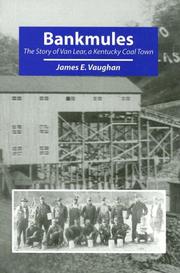

Search results from Open Library.
Recent natural events nearby
Ground air-quality sensors
Recently spotted species
Nearest stream gauge
Events
Gallery
Sources
- • Wikipedia
- • US Census Bureau (ACS 5-year estimates)
- • NOAA National Weather Service
- • Wikidata
- • NCES via Urban Institute Education Data Portal
- • Open-Meteo / sunrise-sunset.org
- • Wikipedia Pageviews API
- • Open Library