Browse / Libya / Al Jafara / Al Aziziya
Al Aziziya
Al Jafaracity
Total population
23,399
Demographic figures from Bureau of Statistics and Census (Libya). Overview below cites Wikipedia and may reference a different year.
City facts
Overview
ʽAziziya, sometimes spelled El Azizia, is a small town and capital of the Jafara district in northwestern Libya, 41 kilometres (25 mi) southwest of the capital Tripoli. From 1918 to 1922, it was the capital of the Tripolitanian Republic, the first formal republic in the Arab world. Before 2001, it was part of the ʽAziziya District and served as its capital. ʽAziziya is a major trade centre of the Sahel Jeffare plateau, being on a trade route from the coast to the Nafusa Mountains and the Fezzan region to the south. As of 2006, the town's population has been estimated at 23,399.
Read more on WikipediaHistory & geography
Geography
Coordinates & boundaries from the US Census TIGER/Line shapefiles.
Climate
Air quality
Walkability
Amenities nearby
Wildlife & biodiversity
Most-observed species
- Culicoides imicola Kieffer, 1913Culicoides imicola Kieffer, 1913 · Insecta62
- Culicoides dewulfi Goetghebuer, 1936Culicoides dewulfi Goetghebuer, 1936 · Insecta62
- Culicoides chiopterus (Meigen, 1830)Culicoides chiopterus (Meigen, 1830) · Insecta62
- Culicoides obsoletus (Meigen, 1818)Culicoides obsoletus (Meigen, 1818) · Insecta61
- Culicoides kingi (Austen, 1912)Culicoides kingi (Austen, 1912) · Insecta61
- Ceratopogon punctatus Meigen, 1804Ceratopogon punctatus Meigen, 1804 · Insecta61
- Culicoides pulicaris (Linnaeus, 1758)Culicoides pulicaris (Linnaeus, 1758) · Insecta60
- Culicoides newsteadi Austen, 1921Culicoides newsteadi Austen, 1921 · Insecta60
Citizen-science & research observations from the Global Biodiversity Information Facility (GBIF).
Earthquake history
Most recent
- M 4.7 — 2013-05-112 km WNW of Al Ajaylat, Libya
Events from the USGS Earthquake Catalog (global) (FDSN Event Web Service).
Photos
Sights & places nearby
Notable people from here
Nearby places in Al Jafara
- Bir Al jadeed2.3 mi away
- Al Tughar9.1 mi away
- Funduq al shibani10.5 mi away
- Al-Nasiriyya10.9 mi away · pop. 2,287
- Sawani Bin Adam12.7 mi away
- Awlad Issa12.8 mi away
- Al-Zahra13.1 mi away
- Al Kayakh13.5 mi away
- la Cazarma13.7 mi away
- Sidi As Sayeh13.9 mi away
- Qasr Bin Ghashir14 mi away · pop. 6,569
- Al Sahla15 mi away
Geography & sun
Elevation, sunrise/sunset and daylight from Open-Meteo. Solar climatology from NASA POWER.
Nearby airports
Public attention
Pageview totals from the Wikimedia Pageviews API.
Books about this place
Recent natural events nearby
Ground air-quality sensors
Recently spotted species
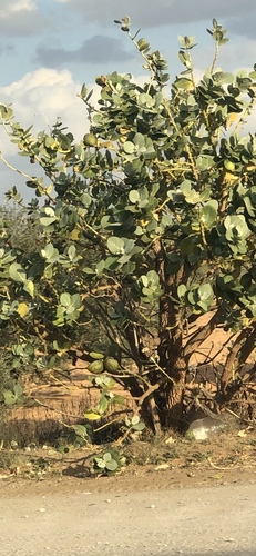
Research-grade observations from iNaturalist (within ~15 mi).
Events
Gallery
Sources
- • Wikipedia
- • Wikidata
- • USGS Earthquake Catalog (global feed)
- • GBIF (Global Biodiversity Information Facility)
- • iNaturalist
- • Open-Meteo / sunrise-sunset.org
- • Wikipedia Pageviews API