Browse / United States / Massachusetts / Brockton
Brockton
Massachusettscity

Brockton
Total population
105,785
Median home value
$459,400
Bachelor's+
Median income
$75,210
Founded
1700
Demographic figures from US Census Bureau · ACS 5-year estimates. Overview below cites Wikipedia and may reference a different year.
City facts
Sister cities
Facts from Wikidata (CC0).
Overview
Brockton is a city in Plymouth County, Massachusetts, United States. Its population was 105,643 at the 2020 United States census, and it is a major economic and commercial hub for the southern part of Greater Boston. Along with Plymouth, it is one of the two county seats of the county. It is the sixth-largest city in Massachusetts and is sometimes referred to as the "City of Champions", due to the success of native boxers Rocky Marciano and Marvin Hagler, as well as its successful Brockton High School sports programs. Two villages within it are Montello and Campello, both of which have MBTA Commuter Rail Stations and post offices. Campello is the smallest neighborhood, but also the most populous. Brockton hosts a baseball team, the Brockton Rox of the Frontier League. It is one of the windiest cities in the United States, with wind speeds in the area averaging 14.3 mph (23.0 km/h).
Read more on WikipediaHistory & geography
History
In 1649, Ousamequin (Massasoit) sold the surrounding Wampanoag land—then known as Saughtucket—to Myles Standish as an addition to Duxbury. Brockton was part of this area, which the English renamed Bridgewater. On June 15, 1821, a portion of the then Bridgewater Township was established as North Bridgewater. North Bridgewater was renamed Brockton, Massachusetts, on May 5, 1874, when community leaders wanted to adopt a distinctive new name to reflect the town's growing industrial importance, in order to attract customers and new businesses. When town booster and trolley-car magnate Ira Copeland (inventor and manufacturer; b. November 14, 1831 West Bridgewater) was on a business trip, he heard a Canadian train conductor announce the Brockville, Ontario station. Copeland considered the name Brockton would suit North Bridgewater. Since Brockville is named after Isaac Brock as an exemplar of leadership, bravery and duty, ergo Brockton is indirectly named after him. He was the British commanding general who was killed by an American sniper at Queenston Heights It also has Dutch/Flemish origins as a topographic name for a "water meadow" (from broek). Ultimately, "Brockton" received 1081 votes (~72%), renaming the town on May 5, 1874. Famous abolitionist Frederick Douglass, spoke to a crowd at the Liberty Tree in Brockton during the pre-Civil War period. During the American Civil War, Brockton was America's largest producer of shoes, and until the latter parts of the 20th century, Brockton had a large shoe and leather products industry. Since the company's 1898 founding, Brockton has been the headquarters city of office supplies retailer W.B. Mason, itself founded to provide those supplies to the city's shoe industry. The city's economy was once based on the shoe…
Geography
According to the United States Census Bureau, the city has a total area of , of which is land and (0.56%) is water. Brockton is the 162nd largest city by land area in the Commonwealth, and the twelfth largest of the twenty-seven towns in Plymouth County. Bordered by Avon to the north, Holbrook to the northeast, Abington to the northeast, Whitman and East Bridgewater to the southeast, West Bridgewater to the south, Easton to the west, and Stoughton to the northwest. Brockton is located 22 miles (35 km) south of Boston, and 30 miles (48 km) northeast of Providence, Rhode Island. Brockton is mostly an urban setting, lying along the Salisbury Plain River, which once powered the many shoe factories of the city. To the northeast lies the Beaver Brook Conservation Land, attached to the southern end of the Ames Nowell State Park in Abington. There are several parks throughout the city, but the largest is D.W. Field Park, an Olmsted-inspired park which includes ponds, Waldo Lake and Brockton Reservoir in Avon, as well as a golf course. According to the Köppen climate classification, Brockton has either a hot-summer humid continental climate (abbreviated Dfa), or a hot-summer humid subtropical climate (abbreviated Cfa), depending on the isotherm used.
Excerpted from the corresponding Wikipedia article (CC BY-SA).
Demographics & economy
Race & ethnicity
Source: US Census Bureau — American Community Survey, 5-year estimates.
Geography
Coordinates & boundaries from the US Census TIGER/Line shapefiles.
Climate
Current forecast
Forecast for Brockton, MA from NOAA NWS API.
Air quality
Industrial & pollution facilities
Natural hazard risk
Health (adults)
Age-adjusted prevalence estimates from CDC PLACES (latest release).
Walkability
Amenities nearby
Wildlife & biodiversity
Most-observed species
- Black-capped ChickadeePoecile atricapillus (Linnaeus, 1766) · Aves30,095
- Blue JayCyanocitta cristata (Linnaeus, 1758) · Aves29,774
- American RobinTurdus migratorius Linnaeus, 1766 · Aves28,830
- Northern CardinalCardinalis cardinalis (Linnaeus, 1758) · Aves27,806
- Tufted TitmouseBaeolophus bicolor (Linnaeus, 1766) · Aves26,771
- Song SparrowMelospiza melodia (A.Wilson, 1810) · Aves22,900
- White-breasted NuthatchSitta carolinensis Latham, 1790 · Aves20,973
- American GoldfinchSpinus tristis (Linnaeus, 1758) · Aves20,651
Citizen-science & research observations from the Global Biodiversity Information Facility (GBIF).
Schools
Largest nearby schools
- Brockton HighHigh · Brockton · 3,679 students · 14.7:1 ratio
- Bridgewater-Raynham RegionalHigh · Bridgewater · 1,390 students · 16:1 ratio
- Whitman Hanson RegionalHigh · Whitman · 1,093 students · 15.4:1 ratio
- South Shore Charter Public SchoolOther · Norwell · 1,054 students · 11.5:1 ratio
- Mitchell Elementary SchoolElementary · Bridgewater · 957 students · 17.1:1 ratio
- Edgar B DavisElementary · Brockton · 930 students · 15:1 ratio
- East Bridgewater JR./SR. High SchoolHigh · East Bridgewater · 904 students · 13.1:1 ratio
- Hingham Middle SchoolMiddle · Hingham · 844 students · 11.3:1 ratio
Public K–12 schools within ~10 mi from Urban Institute Education Data Portal (NCES Common Core of Data, 2022).
Earthquake history
Most recent
- M 3.6 — 2020-11-0810 km S of Bliss Corner, Massachusetts
- M 2.7 — 2018-02-150 km SE of East Kingston, New Hampshire
- M 2.6 — 2015-01-132 km E of Wauregan, Connecticut
- M 3.3 — 2015-01-120 km NE of Wauregan, Connecticut
- M 2.5 — 2007-10-192 km WSW of Littleton Common, Massachusetts
- M 2.5 — 2005-11-174 km S of Plymouth, Massachusetts
Events from the USGS Earthquake Catalog (global) (FDSN Event Web Service).
Photos
Sights & places nearby
Notable people from here


People born within ~10 km, from Wikidata (CC0). Click any name for their Wikipedia article.
Nearby places in Massachusetts
- Duxbury17.9 mi away · pop. 1,994
- Cochituate23.8 mi away
- Ocean Grove26.2 mi away · pop. 3,453
- Peabody31.3 mi away · pop. 54,695
- Bourne32.1 mi away · pop. 1,806
- Boxford40.2 mi away · pop. 2,284
- Yarmouth Port48.8 mi away · pop. 5,961
- Amesbury Town53.2 mi away
- Harwich Center56.2 mi away · pop. 1,774
- Chicopee79.5 mi away · pop. 55,295
- Deerfield86.8 mi away · pop. 458
- Cheshire114.1 mi away · pop. 674
Geography & sun
Elevation, sunrise/sunset and daylight from Open-Meteo. Solar climatology from NASA POWER.
Nearby airports
Public attention
Pageview totals from the Wikimedia Pageviews API.
Books about Brockton
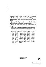
Search results from Open Library.
Recent natural events nearby
Ground air-quality sensors
Recently spotted species
Nearest stream gauge
Live readings from USGS NWIS · measured 2026-10-16 09:10 UTC.
Events
Gallery
Sources
- • Wikipedia
- • US Census Bureau (ACS 5-year estimates)
- • NOAA National Weather Service
- • Wikidata
- • USGS Earthquake Catalog (global feed)
- • USGS NWIS (water data)
- • NCES via Urban Institute Education Data Portal
- • GBIF (Global Biodiversity Information Facility)
- • CDC PLACES
- • Open-Meteo / sunrise-sunset.org
- • Wikipedia Pageviews API
- • Open Library
- • Wikidata SPARQL (CC0) — population, area, elevation, inception, head of government, Commons image