Browse / United States / Massachusetts / Framingham
Framingham
Massachusettscity

Framingham
Total population
73,356
Median home value
$637,700
Bachelor's+
Median income
$110,159
Founded
1650
Air quality index
Demographic figures from US Census Bureau · ACS 5-year estimates. Overview below cites Wikipedia and may reference a different year.
City facts
Sister cities
Facts from Wikidata (CC0).
Overview
Framingham is a city in the Commonwealth of Massachusetts, United States. Incorporated in 1700, it is located in Middlesex County and the MetroWest subregion of the Greater Boston metropolitan area. The city proper covers 25 square miles (65 km2) with a population of 72,362 in 2020, making it the 14th most populous municipality in Massachusetts. Residents voted in favor of adopting a charter to transition from a representative town meeting system to a mayor–council government in April 2017, and the municipality transitioned to city status on January 1, 2018. Before it transitioned, it had been the largest town by population in Massachusetts.
Read more on WikipediaHistory & geography
History
Prior to English settlement, the region around Framingham was inhabited by the indigenous Nipmuc. They lived in encampments established alongside the Washakamaug ("eel fishing place") or what is today called Farm Pond. The Nipmuc Indians used game management techniques through the hunting of deer and beaver, fishing in ponds and streams, as well as established growing areas for the Three Sisters (squash, corn, beans) in the nearby hills. The ancient Indian trail later known as the Old Connecticut Path also ran through this area. During the initial period of colonization of the region by Puritan settlers, the Nipmuc suffered a rapid decline in population due to the introduction of foreign infectious diseases to which they had no immunity and violence related to their raiding settlements. Many of the Nipmuc people were forced into praying towns including nearby Natick. The first European settler in the area was John Stone who established a farm on the west bank of the Sudbury River in 1647. In 1660, Thomas Danforth, an official of the Bay Colony received a grant of land at "Danforth's Farms" and began to accumulate over . Between 1675 and 1676, King Philip's War created great tensions between English settlers and the Nipmuc people in the area. During this time, Nipmuc leader Tantamous, who lived on Nobscot Hill and who resisted Christianization by the English, was arrested with his family members and other Nipmuc men by the colonial government in 1676 for what the colony deemed treason and they were incarcerated on Deer Island. He would escape, be recaptured, and later hanged on Boston Common. In January 1676, a group of Nipmuc men went to the Eames family homestead to demand that they return a supposedly stolen corn harvest. Although the historical record is unclear…
Geography
According to the United States Census Bureau, the city has an area of 26.4 square miles (68.5 km), of which 25.1 square miles (65.1 km) is land and 1.3 square miles (3.4 km) (4.99%) is water. The Golden Triangle was originally a three square mile district on the eastern side of Framingham, bordered by Worcester Rd. (Route 9), Cochituate Rd. (Route 30), and Speen Street in Natick. In 1993, the area began to expand beyond the borders of the triangle with construction of a BJ's Wholesale Club and a Super Stop & Shop just north of Route 30. It now includes the original area plus parts of Old Connecticut Path., Concord St. (Route 126), and Speen St. north of Route 30. Because of the size and complexity of this area, Framingham and Natick cooperatively operate it as a single distinct district with similar zoning. The area is one of the largest shopping districts in New England. The area was formed with the construction of Shoppers World in 1951. Shoppers' World was a large open air shopping mall, the second in the US and the first east of the Mississippi River. The mall drew many other retail construction projects to the area, including Marshalls (1961, rebuilt as Bed Bath & Beyond 1997), Caldor (1966, Rebuilt as Wal-Mart in 2002), Bradlees (1960s, rebuilt as Kohl's in 2002), the Route 30 Mall (1970), an AMC Framingham 15, the Framingham Mall (1978, rebuilt 2000), and Lowe's (formerly the Verizon Building, 2006). Complementary developments in Natick include the Natick Mall (1966, rebuilt in 1991, expanded 2007 & renamed Natick Collection), Sherwood Plaza (1960), Cloverleaf Marketplace (1978), and the Home Depot. In 1994, Shoppers' World was demolished and replaced with a strip mall named Shoppers World. There are also seven hotels and two…
Excerpted from the corresponding Wikipedia article (CC BY-SA).
Demographics & economy
Race & ethnicity
Source: US Census Bureau — American Community Survey, 5-year estimates.
Geography
Coordinates & boundaries from the US Census TIGER/Line shapefiles.
Climate
Current forecast
Forecast for Framingham, MA from NOAA NWS API.
Air quality
Current readings from Open-Meteo Air Quality API (Copernicus CAMS European reanalysis).
Industrial & pollution facilities
Natural hazard risk
Health (adults)
Age-adjusted prevalence estimates from CDC PLACES (latest release).
Walkability
Amenities nearby
Wildlife & biodiversity
Most-observed species
- Blue JayCyanocitta cristata (Linnaeus, 1758) · Aves68,842
- Black-capped ChickadeePoecile atricapillus (Linnaeus, 1766) · Aves64,720
- American RobinTurdus migratorius Linnaeus, 1766 · Aves62,869
- Northern CardinalCardinalis cardinalis (Linnaeus, 1758) · Aves61,236
- Tufted TitmouseBaeolophus bicolor (Linnaeus, 1766) · Aves55,982
- Downy WoodpeckerDryobates pubescens (Linnaeus, 1766) · Aves51,049
- Mourning DoveZenaida macroura (Linnaeus, 1758) · Aves48,668
- Song SparrowMelospiza melodia (A.Wilson, 1810) · Aves48,001
Citizen-science & research observations from the Global Biodiversity Information Facility (GBIF).
Schools
Largest nearby schools
- Framingham High SchoolHigh · Framingham · 2,566 students · 14.7:1 ratio
- Natick HighHigh · Natick · 1,727 students · 12.2:1 ratio
- Lincoln-Sudbury Regional HighHigh · Sudbury · 1,484 students · 11.7:1 ratio
- Hopkinton HighHigh · Hopkinton · 1,234 students · 14.2:1 ratio
- Assabet Valley Vocational High SchoolHigh · Marlborough · 1,128 students · 10.2:1 ratio
- Marlborough HighHigh · Marlborough · 1,064 students · 11:1 ratio
- 1 LT Charles W. Whitcomb SchoolMiddle · Marlborough · 1,044 students · 10.5:1 ratio
- Hopkinton Middle SchoolMiddle · Hopkinton · 972 students · 14.7:1 ratio
Public K–12 schools within ~10 mi from Urban Institute Education Data Portal (NCES Common Core of Data, 2022).
Earthquake history
Most recent
- M 3.6 — 2020-11-0810 km S of Bliss Corner, Massachusetts
- M 2.7 — 2018-02-150 km SE of East Kingston, New Hampshire
- M 2.6 — 2015-01-132 km E of Wauregan, Connecticut
- M 3.3 — 2015-01-120 km NE of Wauregan, Connecticut
- M 2.5 — 2007-10-192 km WSW of Littleton Common, Massachusetts
- M 2.5 — 2005-11-174 km S of Plymouth, Massachusetts
Events from the USGS Earthquake Catalog (global) (FDSN Event Web Service).
Photos
Sights & places nearby
Notable people from here


People born within ~10 km, from Wikidata (CC0). Click any name for their Wikipedia article.
Nearby places in Massachusetts
- Cochituate4.5 mi away
- Peabody28.5 mi away · pop. 54,695
- Boxford33.7 mi away · pop. 2,284
- Ocean Grove41.7 mi away · pop. 3,453
- Duxbury42.8 mi away · pop. 1,994
- Amesbury Town44.8 mi away
- Bourne57.9 mi away · pop. 1,806
- Chicopee58.7 mi away · pop. 55,295
- Deerfield61.7 mi away · pop. 458
- Yarmouth Port74.9 mi away · pop. 5,961
- Harwich Center82.2 mi away · pop. 1,774
- Cheshire89.7 mi away · pop. 674
Geography & sun
Elevation, sunrise/sunset and daylight from Open-Meteo. Solar climatology from NASA POWER.
Nearby airports
Public attention
Pageview totals from the Wikimedia Pageviews API.
Books about Framingham
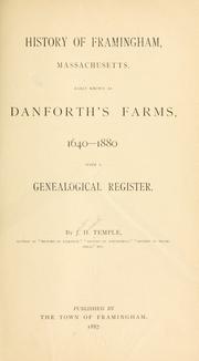

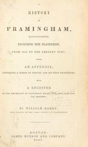
Search results from Open Library.
Recent natural events nearby
Ground air-quality sensors
Recently spotted species
Nearest stream gauge
Events
Gallery
Geotagged photos within ~6 miles of Framingham, from Wikimedia Commons contributors.
 0.3 mi
.jpg) 0.5 mi
0.5 mi.jpg) 0.5 mi
0.5 mi.jpg) 0.5 mi
0.5 mi.jpg) 0.5 mi
0.5 mi.jpg) 0.5 mi
0.5 mi.jpg) 0.5 mi
0.5 mi_-_More_than_24K_views._-_Flickr_-_melmark44.jpg) 0.5 mi
0.5 mi 0.5 mi
.jpg) 0.6 mi
0.6 mi 0.6 mi
 0.6 mi
 0.6 mi
,_September_2024.JPG) 0.6 mi
0.6 mi,_September_2024.JPG) 0.6 mi
0.6 mi 0.6 mi
 0.6 mi
 0.7 mi
 0.7 mi
 0.8 mi
 1 mi
1 mi 1 mi
1 mi 1 mi
1 mi 1.2 mi
Photos via Wikimedia Commons — see each image page for license & attribution.
Sources
- • Wikipedia
- • US Census Bureau (ACS 5-year estimates)
- • NOAA National Weather Service
- • Wikimedia Commons
- • Wikidata
- • Open-Meteo Air Quality (CAMS)
- • USGS Earthquake Catalog (global feed)
- • NCES via Urban Institute Education Data Portal
- • GBIF (Global Biodiversity Information Facility)
- • CDC PLACES
- • Open-Elevation
- • Open-Meteo / sunrise-sunset.org
- • Wikipedia Pageviews API
- • Open Library
- • Wikidata SPARQL (CC0) — population, area, elevation, inception, head of government, Commons image