Browse / United States / Massachusetts / Medford
Medford
Massachusettscity

Medford
Total population
59,354
Median home value
$755,500
Bachelor's+
Median income
$129,540
Founded
1630
Demographic figures from US Census Bureau · ACS 5-year estimates. Overview below cites Wikipedia and may reference a different year.
City facts
Facts from Wikidata (CC0).
Overview
Medford is a city in Middlesex County, Massachusetts, United States. At the time of the 2020 United States census, Medford's population was 59,659. It is home to Tufts University, which has its campus on both sides of the Medford and Somerville border.
Read more on WikipediaHistory & geography
History
Native Americans inhabited the area that would become Medford for thousands of years prior to European colonization of the Americas. At the time of European contact and exploration, Medford was the winter home of the Naumkeag people, who farmed corn and created fishing weirs at multiple sites along the Mystic River. Naumkeag sachem Nanepashemet was killed and buried at his fortification in present-day Medford during a war with the Tarrantines in 1619. The contact period introduced several European infectious diseases which would decimate native populations in virgin soil epidemics, including a smallpox epidemic which in 1633 killed Nanepashemet's sons, sachems Montowompate and Wonohaquaham. Sagamore Park in West Medford is a native burial site from the contact period, which includes the remains of a likely sachem, either Nanepashemet or Wonohaquaham. Medford was settled in 1630 by English colonists as part of Charlestown, of the Massachusetts Bay Colony. The settlement was originally called "Mistick" by Thomas Dudley, based on the Massachusett name for the area's river. Thomas Dudley's party renamed the settlement "Meadford". The name may have come from a description of the "meadow by the ford" in the Mystic River, or from two locations in England that Cradock may have known: the hamlet of Mayford or Metford in Staffordshire near Caverswall, or from the parish of Maidford or Medford (now Towcester, Northamptonshire). In 1634, the land north of the Mystic River was developed as the private plantation of Matthew Cradock, a former governor. Across the river was Ten Hills Farm, which belonged to John Winthrop, Governor of the Massachusetts Bay colony. In 1637, the first bridge (a toll bridge) across the Mystic River was built at the site of the present-day Cradock…
Geography
Medford is located at (42.419996, −71.107942). According to the United States Census Bureau, the city has a total area of , of which is land and (5.79%) is water. A park called the Middlesex Fells Reservation, to the north, lies partly within the city. This preserve is shared by Medford with the municipalities of Winchester, Stoneham, Melrose, and Malden. The Mystic River flows roughly west to southeast through the middle of the city. People from Medford often identify themselves with a particular neighborhood. * West Medford ** Brooks Estates * Fulton Heights/The Heights (North Medford) * Wellington (East Medford) * Glenwood * Lawrence Estates * South Medford * Medford Hillside ** Tufts University (mostly contiguous, situated on Medford Hillside)
Excerpted from the corresponding Wikipedia article (CC BY-SA).
Demographics & economy
Race & ethnicity
Source: US Census Bureau — American Community Survey, 5-year estimates.
Geography
Coordinates & boundaries from the US Census TIGER/Line shapefiles.
Climate
Current forecast
Forecast for Medford, MA from NOAA NWS API.
Air quality
Industrial & pollution facilities
Natural hazard risk
Health (adults)
Age-adjusted prevalence estimates from CDC PLACES (latest release).
Walkability
Amenities nearby
Wildlife & biodiversity
Most-observed species
- American RobinTurdus migratorius Linnaeus, 1766 · Aves166,781
- Blue JayCyanocitta cristata (Linnaeus, 1758) · Aves152,221
- Northern CardinalCardinalis cardinalis (Linnaeus, 1758) · Aves138,284
- Black-capped ChickadeePoecile atricapillus (Linnaeus, 1766) · Aves128,388
- Mourning DoveZenaida macroura (Linnaeus, 1758) · Aves128,150
- House SparrowPasser domesticus (Linnaeus, 1758) · Aves127,878
- Song SparrowMelospiza melodia (A.Wilson, 1810) · Aves122,194
- Downy WoodpeckerDryobates pubescens (Linnaeus, 1766) · Aves108,490
Citizen-science & research observations from the Global Biodiversity Information Facility (GBIF).
Schools
Largest nearby schools
- Lexington HighHigh · Lexington · 2,303 students · 12.3:1 ratio
- Everett HighHigh · Everett · 2,231 students · 13.4:1 ratio
- Newton North HighHigh · Newtonville · 2,099 students · 10.9:1 ratio
- Cambridge Rindge and LatinHigh · Cambridge · 1,867 students · 8.7:1 ratio
- Malden HighHigh · Malden · 1,856 students · 16:1 ratio
- Newton South HighHigh · Newton Centre · 1,837 students · 11.8:1 ratio
- Waltham Sr HighHigh · Waltham · 1,751 students · 10.9:1 ratio
- Mystic Valley Regional Charter SchoolOther · Malden · 1,608 students · 16.8:1 ratio
Public K–12 schools within ~10 mi from Urban Institute Education Data Portal (NCES Common Core of Data, 2022).
Earthquake history
Most recent
- M 3.8 — 2025-01-279 km SE of York Harbor, Maine
- M 2.7 — 2023-12-235 km SW of Chichester, New Hampshire
- M 2.7 — 2018-02-150 km SE of East Kingston, New Hampshire
- M 2.6 — 2015-01-132 km E of Wauregan, Connecticut
- M 3.3 — 2015-01-120 km NE of Wauregan, Connecticut
- M 2.9 — 2010-06-0729 km SE of York Beach, Maine
Events from the USGS Earthquake Catalog (global) (FDSN Event Web Service).
Photos
Sights & places nearby
Notable people from here


People born within ~10 km, from Wikidata (CC0). Click any name for their Wikipedia article.
Nearby places in Massachusetts
- Peabody10.4 mi away · pop. 54,695
- Cochituate14.1 mi away
- Boxford17.8 mi away · pop. 2,284
- Amesbury Town30.5 mi away
- Duxbury34.2 mi away · pop. 1,994
- Ocean Grove48.3 mi away · pop. 3,453
- Bourne54.1 mi away · pop. 1,806
- Yarmouth Port67.3 mi away · pop. 5,961
- Harwich Center73.6 mi away · pop. 1,774
- Chicopee76.6 mi away · pop. 55,295
- Deerfield76.6 mi away · pop. 458
- Cheshire105 mi away · pop. 674
Geography & sun
Elevation, sunrise/sunset and daylight from Open-Meteo. Solar climatology from NASA POWER.
Nearby airports
Public attention
Pageview totals from the Wikimedia Pageviews API.
Books about Medford
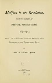

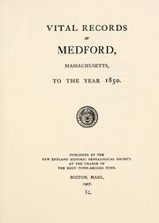
Search results from Open Library.
Recent natural events nearby
Ground air-quality sensors
Recently spotted species
Nearest stream gauge
Events
Gallery
Sources
- • Wikipedia
- • US Census Bureau (ACS 5-year estimates)
- • NOAA National Weather Service
- • Wikidata
- • USGS Earthquake Catalog (global feed)
- • NCES via Urban Institute Education Data Portal
- • GBIF (Global Biodiversity Information Facility)
- • CDC PLACES
- • Open-Meteo / sunrise-sunset.org
- • Wikipedia Pageviews API
- • Open Library
- • Wikidata SPARQL (CC0) — population, area, elevation, inception, head of government, Commons image