Browse / United States / Massachusetts / Lawrence
Lawrence
Massachusettscity

Lawrence
Total population
89,323
Median home value
$517,200
Bachelor's+
Median income
$62,061
Founded
1655
Air quality index
Demographic figures from US Census Bureau · ACS 5-year estimates. Overview below cites Wikipedia and may reference a different year.
City facts
Facts from Wikidata (CC0).
Overview
Lawrence is a city located in Essex County, Massachusetts, United States, on the Merrimack River. At the 2020 census the city had a population of 89,143. Surrounding communities include Methuen to the north, Andover to the southwest, and North Andover to the east. Lawrence and Salem were the county seats of Essex County, until the state abolished county government in 1999. Lawrence is part of the Merrimack Valley.
Read more on WikipediaHistory & geography
History
Native Americans lived along the Merrimack River for thousands of years before European colonization of the Americas. Evidence of farming at Den Rock Park and arrowhead manufacturing on the site where the Wood Mill now sits have been discovered. At the time of contact in the early 1600s, the Pennacook or Pentucket had a presence north of the Merrimack, while Massachusett, Naumkeag, and Agawam controlled territory south of the river. The territory which would later be aggregated into the city of Lawrence was purchased from Pennacooks Sagahew and Passaquo in 1642 for the English settlement of Haverhill, and from Massachusett sachem Cutshamekin in 1646 as a post-hoc payment for the lands surrounding the English settlement of Andover (modern-day North Andover center). The area that would become Lawrence was then part of Methuen and Andover. The first settlement within the present-day city limits came in 1655 with the establishment of a blockhouse in Shawsheen Fields, now South Lawrence. The future site of the city (formerly parts of Andover and Methuen) was purchased by a consortium of local industrialists. The Water Power Association members: Abbott Lawrence, Edmund Bartlett, Thomas Hopkinson of Lowell, John Nesmith and Daniel Saunders, had purchased control of Peter's Falls on the Merrimack River and hence controlled Bodwell's Falls the site of the present Great Stone Dam. The group allotted fifty thousand dollars to buy land along the river to develop. In 1844, the group petitioned the legislature to act as a corporation, known as the Essex Company, which incorporated on April 16, 1845. The first excavations for the Great Stone Dam to harness the Merrimack River's water power were done on August 1, 1845. The Pemberton Mill collapse occurred on January 10, 1860, in…
Geography
According to the United States Census Bureau, the city has a total area of , of which is land and (6.07%) is water. Lawrence is on both sides of the Merrimack River, approximately upstream from the Atlantic Ocean. On the north side of the river, it is surrounded by Methuen. On the south side of the river, the town is bordered by North Andover to the east, and Andover to the south and southwest. Lawrence is approximately southwest of Newburyport, north-northwest of Boston and southeast of Manchester, New Hampshire. Aside from the Merrimack River, other water features include the Spicket River, which flows into the Merrimack from Methuen, and the Shawsheen River, which forms the southeastern border of the city. Lawrence has two power canals that were formerly used to provide hydropower to the mills—one on the north bank of the river, the other on the south. Channeling water into these canals is the Great Stone Dam, which lies across the entire Merrimack and was, at the time of its construction in the 1840s, the largest dam in the world. The highest point in Lawrence is the top of Tower Hill in the northwest corner of the city, rising approximately above sea level. Other prominent hills include Prospect Hill, in the northeastern corner of the city, and Mount Vernon, along the southern edge of the city. Most industrial activity was concentrated in the flatlands along the rivers. Den Rock Park, a wooded conservation district on the southern edge of Lawrence that spans the Lawrence-Andover town line, provides recreation for nature lovers and rock climbers alike. There are also several small parks throughout town. Lawrence is covered by the ZIP Codes 01840, 01841, 01842, and 01843. Lawrence has a humid subtropical climate (Köppen climate classification Cfa), which…
Excerpted from the corresponding Wikipedia article (CC BY-SA).
Demographics & economy
Race & ethnicity
Source: US Census Bureau — American Community Survey, 5-year estimates.
Geography
Coordinates & boundaries from the US Census TIGER/Line shapefiles.
Climate
Current forecast
Forecast for Lawrence, MA from NOAA NWS API.
Air quality
Current readings from Open-Meteo Air Quality API (Copernicus CAMS European reanalysis).
Industrial & pollution facilities
Natural hazard risk
Health (adults)
Age-adjusted prevalence estimates from CDC PLACES (latest release).
Walkability
Amenities nearby
Wildlife & biodiversity
Most-observed species
- Poecile atricapillus (Linnaeus, 1766)Poecile atricapillus (Linnaeus, 1766) · Aves27,809
- Cyanocitta cristata (Linnaeus, 1758)Cyanocitta cristata (Linnaeus, 1758) · Aves25,748
- Baeolophus bicolor (Linnaeus, 1766)Baeolophus bicolor (Linnaeus, 1766) · Aves25,284
- Cardinalis cardinalis (Linnaeus, 1758)Cardinalis cardinalis (Linnaeus, 1758) · Aves25,051
- Dryobates pubescens (Linnaeus, 1766)Dryobates pubescens (Linnaeus, 1766) · Aves21,465
- Sitta carolinensis Latham, 1790Sitta carolinensis Latham, 1790 · Aves21,403
- Turdus migratorius Linnaeus, 1766Turdus migratorius Linnaeus, 1766 · Aves21,355
- Spinus tristis (Linnaeus, 1758)Spinus tristis (Linnaeus, 1758) · Aves19,355
Citizen-science & research observations from the Global Biodiversity Information Facility (GBIF).
Schools
Largest nearby schools
- Lawrence High SchoolHigh · Lawrence · 3,084 students · 13.2:1 ratio
- Haverhill HighHigh · Haverhill · 1,944 students · 12.9:1 ratio
- Methuen HighHigh · Methuen · 1,916 students · 13:1 ratio
- Andover HighHigh · Andover · 1,702 students · 13.3:1 ratio
- Gr Lawrence Regional Vocational TechnicalHigh · Andover · 1,692 students · 11.3:1 ratio
- North Andover HighHigh · North Andover · 1,336 students · 13.8:1 ratio
- Donald P Timony GrammarElementary · Methuen · 1,263 students · 12.4:1 ratio
- Tenney Grammar SchoolElementary · Methuen · 1,254 students · 12.5:1 ratio
Public K–12 schools within ~10 mi from Urban Institute Education Data Portal (NCES Common Core of Data, 2022).
Earthquake history
Most recent
- M 3.8 — 2025-01-279 km SE of York Harbor, Maine
- M 2.7 — 2023-12-235 km SW of Chichester, New Hampshire
- M 2.7 — 2018-02-150 km SE of East Kingston, New Hampshire
- M 2.8 — 2016-03-214 km ESE of Warner, New Hampshire
- M 2.61 — 2013-10-11New Hampshire
- M 3.15 — 2010-09-262 km SW of Canterbury, New Hampshire
Events from the USGS Earthquake Catalog (global) (FDSN Event Web Service).
Photos
Sights & places nearby
Notable people from here


People born within ~10 km, from Wikidata (CC0). Click any name for their Wikipedia article.
Nearby places in Massachusetts
- Boxford9.3 mi away · pop. 2,284
- Amesbury Town14.7 mi away
- Peabody15.1 mi away · pop. 54,695
- Cochituate27.5 mi away
- Duxbury51.6 mi away · pop. 1,994
- Ocean Grove67.2 mi away · pop. 3,453
- Bourne72.5 mi away · pop. 1,806
- Deerfield74 mi away · pop. 458
- Chicopee80.4 mi away · pop. 55,295
- Yarmouth Port83.8 mi away · pop. 5,961
- Harwich Center89.4 mi away · pop. 1,774
- Cheshire102.2 mi away · pop. 674
Geography & sun
Elevation, sunrise/sunset and daylight from Open-Meteo. Solar climatology from NASA POWER.
Nearby airports
Public attention
Pageview totals from the Wikimedia Pageviews API.
Books about Lawrence
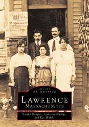
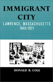

Search results from Open Library.
Recent natural events nearby
Ground air-quality sensors
Recently spotted species


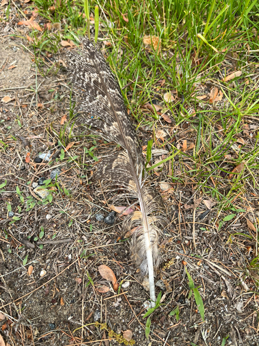


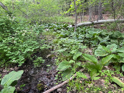

Research-grade observations from iNaturalist (within ~15 mi).
Nearest stream gauge
Live readings from USGS NWIS · measured 2026-05-24 20:30 UTC.
Events
Gallery
Sources
- • Wikipedia
- • US Census Bureau (ACS 5-year estimates)
- • NOAA National Weather Service
- • Wikidata
- • Open-Meteo Air Quality (CAMS)
- • USGS Earthquake Catalog (global feed)
- • USGS NWIS (water data)
- • NCES via Urban Institute Education Data Portal
- • GBIF (Global Biodiversity Information Facility)
- • iNaturalist
- • CDC PLACES
- • Open-Elevation
- • Open-Meteo / sunrise-sunset.org
- • Wikipedia Pageviews API
- • Open Library
- • Wikidata SPARQL (CC0) — population, area, elevation, inception, head of government, Commons image