Browse / United States / Massachusetts / Revere
Revere
Massachusettscity

Revere
Total population
60,012
Median home value
$597,400
Bachelor's+
Median income
$86,969
Founded
1630
Demographic figures from US Census Bureau · ACS 5-year estimates. Overview below cites Wikipedia and may reference a different year.
City facts
Sister cities
Facts from Wikidata (CC0).
Overview
Revere is a city in Suffolk County, Massachusetts. Located approximately 5 miles (8.0 km) northeast of Downtown Boston, Revere is the terminus of the MBTA Blue Line, with three stations located within the city: Wonderland, Revere Beach, and Beachmont. The city borders Massachusetts Bay, and was the site of the Battle of Chelsea Creek. Revere Beach, a three mile (4.8 km) stretch of beach on the city's eastern coast, is the oldest public beach in the United States.
Read more on WikipediaHistory & geography
History
The area's earliest known inhabitants were Native Americans belonging to the Pawtucket tribe and were known to colonists as the "Rumney Marsh Indians." Nanepashemet, known to colonists as "Sagamore George," was the leader, or Great Sachem of the Pawtucket Confederation of Abenaki People of Lynn (which at that time included present day Revere). One branch of Nanepashemet's family is thought to have taken "Rumney Marsh" as their surname. In 1616, an epidemic, probably smallpox, swept the region, killing thousands in its wake. On September 25, 1634, Rumney Marsh was annexed to Boston, which had received its name only four years earlier. Winnisemmet (current Chelsea) and Pullen Point (current Winthrop) were also annexed to Boston. Rumney Marsh was originally divided and allotted to twenty-one of Boston's most prominent citizens. By 1639, the original allotments had been consolidated into seven great farms. Farming was the principal industry of Winnisemmet, and Rumney Marsh in particular. The first county road in North America stretched across Rumney Marsh from the Winnisemmet Ferry to Olde Salem in 1641. During King Philip's War (also known as Metacomet's War), which lasted from 1675 to 1678, the local Native Americans were forcibly removed to what is now Deer Island, where half of those imprisoned died of starvation or exposure. Some were enlisted to help the colonists defeat other native tribes. In 1739, Rumney Marsh, Winnisemmet and Pullen Point were set off from Boston and established as the Town of Chelsea. The largest of the three settlements, Rumney Marsh (later to become North Chelsea) was selected as the Town Center. In 1775, the area played a small role in the American Revolution during the Battle of Chelsea Creek, one of the first naval battles of the…
Excerpted from the corresponding Wikipedia article (CC BY-SA).
Demographics & economy
Race & ethnicity
Source: US Census Bureau — American Community Survey, 5-year estimates.
Geography
Coordinates & boundaries from the US Census TIGER/Line shapefiles.
Climate
Current forecast
Forecast for Revere, MA from NOAA NWS API.
Air quality
Industrial & pollution facilities
Natural hazard risk
Health (adults)
Age-adjusted prevalence estimates from CDC PLACES (latest release).
Walkability
Amenities nearby
Wildlife & biodiversity
Most-observed species
- American RobinTurdus migratorius Linnaeus, 1766 · Aves146,675
- Blue JayCyanocitta cristata (Linnaeus, 1758) · Aves130,659
- Northern CardinalCardinalis cardinalis (Linnaeus, 1758) · Aves121,915
- House SparrowPasser domesticus (Linnaeus, 1758) · Aves118,913
- Mourning DoveZenaida macroura (Linnaeus, 1758) · Aves112,777
- Black-capped ChickadeePoecile atricapillus (Linnaeus, 1766) · Aves107,045
- Song SparrowMelospiza melodia (A.Wilson, 1810) · Aves105,799
- MallardAnas platyrhynchos Linnaeus, 1758 · Aves97,592
Citizen-science & research observations from the Global Biodiversity Information Facility (GBIF).
Schools
Largest nearby schools
- Boston Latin SchoolHigh · Boston · 2,423 students · 19.5:1 ratio
- Revere HighHigh · Revere · 2,084 students · 14.1:1 ratio
- Boston Latin AcademyHigh · Dorchester · 1,723 students · 18.9:1 ratio
- Chelsea HighHigh · Chelsea · 1,611 students · 14.8:1 ratio
- O'Bryant School of Math & ScienceHigh · Roxbury · 1,567 students · 15.4:1 ratio
- Excel Academy Charter SchoolHigh · East Boston · 1,363 students · 10.9:1 ratio
- Roxbury Preparatory Charter SchoolHigh · Roxbury · 1,295 students · 11.5:1 ratio
- East Boston High SchoolHigh · East Boston · 1,276 students · 13.3:1 ratio
Public K–12 schools within ~10 mi from Urban Institute Education Data Portal (NCES Common Core of Data, 2022).
Earthquake history
Most recent
- M 3.8 — 2025-01-279 km SE of York Harbor, Maine
- M 2.7 — 2023-12-235 km SW of Chichester, New Hampshire
- M 2.7 — 2018-02-150 km SE of East Kingston, New Hampshire
- M 2.9 — 2010-06-0729 km SE of York Beach, Maine
- M 2.8 — 2008-03-0925 km SE of York Beach, Maine
- M 2.5 — 2007-10-192 km WSW of Littleton Common, Massachusetts
Events from the USGS Earthquake Catalog (global) (FDSN Event Web Service).
Photos
Sights & places nearby
Notable people from here


People born within ~10 km, from Wikidata (CC0). Click any name for their Wikipedia article.
Nearby places in Massachusetts
- Peabody7.9 mi away · pop. 54,695
- Boxford16.8 mi away · pop. 2,284
- Cochituate19.6 mi away
- Amesbury Town29.8 mi away
- Duxbury30.5 mi away · pop. 1,994
- Ocean Grove49.1 mi away · pop. 3,453
- Bourne51.3 mi away · pop. 1,806
- Yarmouth Port63.2 mi away · pop. 5,961
- Harwich Center69.2 mi away · pop. 1,774
- Chicopee82.5 mi away · pop. 55,295
- Deerfield82.6 mi away · pop. 458
- Cheshire111.1 mi away · pop. 674
Geography & sun
Elevation, sunrise/sunset and daylight from Open-Meteo. Solar climatology from NASA POWER.
Nearby airports
Public attention
Pageview totals from the Wikimedia Pageviews API.
Books about Revere

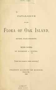
Search results from Open Library.
Recent natural events nearby
Ground air-quality sensors
Recently spotted species
Nearest stream gauge
Events
Gallery
Sources
- • Wikipedia
- • US Census Bureau (ACS 5-year estimates)
- • NOAA National Weather Service
- • Wikidata
- • USGS Earthquake Catalog (global feed)
- • NCES via Urban Institute Education Data Portal
- • GBIF (Global Biodiversity Information Facility)
- • CDC PLACES
- • Open-Meteo / sunrise-sunset.org
- • Wikipedia Pageviews API
- • Open Library
- • Wikidata SPARQL (CC0) — population, area, elevation, inception, head of government, Commons image