Browse / United States / Massachusetts / Somerville
Somerville
Massachusettscity

Somerville
Total population
82,144
Median home value
$894,300
Bachelor's+
Median income
$142,553
Founded
1630
Air quality index
Demographic figures from US Census Bureau · ACS 5-year estimates. Overview below cites Wikipedia and may reference a different year.
City facts
Sister cities
Facts from Wikidata (CC0).
Overview
Somerville is a city located directly to the northwest of Boston, and north of Cambridge, in Middlesex County, Massachusetts, United States. As of the 2020 United States census, the city had a total population of 81,045 people. With an area of 4.12 square miles (10.7 km2), the city has a density of 19,671/sq mi (7,595/km2), making it the most densely populated municipality in New England and the 19th most densely populated incorporated municipality in the country. Somerville was established as a town in 1842, when it was separated from Charlestown. In 1972, 2009, and 2015, the city received the All-America City Award. It is home to Tufts University, which has its campus along the Somerville and Medford border.
Read more on WikipediaHistory & geography
History
The area that would become Somerville was inhabited for thousands of years prior to European colonization, with multiple archaeological sites indicating habitation in the Mystic River watershed as early as the beginning of the Archaic Period (8000–1000 BCE). At the time of English contact in the 1600s, the Somerville area was inhabited by the Mystic Tribe of the Naumkeag people, headed by the Squaw Sachem and her son Wonohaquaham. Though no archaeological sites within Somerville have been identified from this time period, an indigenous settlement near College Hill in Somerville can be inferred from contemporary written records. The Mystic River continued to be an important regional core for the Naumkeag into the period of European colonization in the 16th and 17th centuries. which then included present-day Somerville. In 1639, his mother the Squaw Sachem deeded the land that would become Somerville to English settlers. The territory now constituting the city of Somerville was first settled by Europeans in 1629 as part of Charlestown. In 1629, English surveyor Thomas Graves led a scouting party of 100 Puritans from the settlement of Salem to prepare the site for the Great Migration of Puritans from England. Graves was attracted to the narrow Mishawum Peninsula between the Charles and Mystic rivers, linked to the mainland at the present-day Sullivan Square. The area of earliest settlement was based at City Square on the peninsula, though the territory of Charlestown officially included all of what is now Somerville, as well as Medford, Everett, Malden, Stoneham, Melrose, Woburn, Burlington, and parts of Arlington and Cambridge. From that time until 1842, the area of present-day Somerville was referred to as "beyond the Neck" in reference to the thin spit of land, the…
Geography
According to the United States Census Bureau, Somerville has a total area of , of which is land and , or 2.61%, is water. Somerville is bordered by the cities of Cambridge, Medford, Everett, Arlington and the Boston neighborhood of Charlestown. It is located on the west bank of the Mystic River. Millennia ago, glaciation left a series of drumlins running west to east across the landscape of what would become Somerville. These ridges would later become known as the "Seven Hills" of Somerville (like many other cities claiming to be built on seven hills, following the seven hills of Rome): # Central Hill # Clarendon Hill # Cobble Hill # Ploughed Hill (or Mount Benedict) # Prospect Hill (or Mount Pisgah) # Spring Hill # Winter Hill These hills rise from the floodplain of the Mystic River, and generally run west to east, providing views of Boston to the south and Medford/Everett to the north. Physical boundaries are also defined by prominent waterways: the Mystic River to the north, its tributary Alewife Brook to the west, and the Miller's River to the southeast. Land in early Somerville was used primarily as grazing commons and small farms. After the proliferation of the railroads in the area during the mid-1800s, industrialization transformed the landscape. In the 1800s, the Millers River was used as a sewer and dumping ground for local industry and would be ordered filled by the Commonwealth before the end of the century, for health reasons. As a result of landfill and the elimination of former Cobble Hill, the Millers River marsh was turned into railyards, slaughterhouses and other large-scale land uses. Somerville's commercial property is not concentrated in a recognized downtown central business district but instead is spread over many different nodes or…
Excerpted from the corresponding Wikipedia article (CC BY-SA).
Demographics & economy
Race & ethnicity
Source: US Census Bureau — American Community Survey, 5-year estimates.
Geography
Coordinates & boundaries from the US Census TIGER/Line shapefiles.
Climate
Current forecast
Forecast for Somerville, MA from NOAA NWS API.
Air quality
Current readings from Open-Meteo Air Quality API (Copernicus CAMS European reanalysis).
Industrial & pollution facilities
Natural hazard risk
Health (adults)
Age-adjusted prevalence estimates from CDC PLACES (latest release).
Walkability
Amenities nearby
Wildlife & biodiversity
Most-observed species
- American RobinTurdus migratorius Linnaeus, 1766 · Aves172,571
- Blue JayCyanocitta cristata (Linnaeus, 1758) · Aves158,406
- Northern CardinalCardinalis cardinalis (Linnaeus, 1758) · Aves143,404
- Black-capped ChickadeePoecile atricapillus (Linnaeus, 1766) · Aves133,287
- Mourning DoveZenaida macroura (Linnaeus, 1758) · Aves131,902
- House SparrowPasser domesticus (Linnaeus, 1758) · Aves130,621
- Song SparrowMelospiza melodia (A.Wilson, 1810) · Aves127,612
- MallardAnas platyrhynchos Linnaeus, 1758 · Aves112,332
Citizen-science & research observations from the Global Biodiversity Information Facility (GBIF).
Schools
Largest nearby schools
- Lexington HighHigh · Lexington · 2,303 students · 12.3:1 ratio
- Everett HighHigh · Everett · 2,231 students · 13.4:1 ratio
- Newton North HighHigh · Newtonville · 2,099 students · 10.9:1 ratio
- Cambridge Rindge and LatinHigh · Cambridge · 1,867 students · 8.7:1 ratio
- Malden HighHigh · Malden · 1,856 students · 16:1 ratio
- Newton South HighHigh · Newton Centre · 1,837 students · 11.8:1 ratio
- Waltham Sr HighHigh · Waltham · 1,751 students · 10.9:1 ratio
- Mystic Valley Regional Charter SchoolOther · Malden · 1,608 students · 16.8:1 ratio
Public K–12 schools within ~10 mi from Urban Institute Education Data Portal (NCES Common Core of Data, 2022).
Earthquake history
Most recent
- M 3.8 — 2025-01-279 km SE of York Harbor, Maine
- M 2.7 — 2023-12-235 km SW of Chichester, New Hampshire
- M 3.6 — 2020-11-0810 km S of Bliss Corner, Massachusetts
- M 2.7 — 2018-02-150 km SE of East Kingston, New Hampshire
- M 2.6 — 2015-01-132 km E of Wauregan, Connecticut
- M 3.3 — 2015-01-120 km NE of Wauregan, Connecticut
Events from the USGS Earthquake Catalog (global) (FDSN Event Web Service).
Photos
Sights & places nearby
Notable people from here
Nearby places in Massachusetts
- Peabody12 mi away · pop. 54,695
- Cochituate13.5 mi away
- Boxford19.8 mi away · pop. 2,284
- Duxbury32.2 mi away · pop. 1,994
- Amesbury Town32.7 mi away
- Ocean Grove46.1 mi away · pop. 3,453
- Bourne51.9 mi away · pop. 1,806
- Yarmouth Port65.3 mi away · pop. 5,961
- Harwich Center71.7 mi away · pop. 1,774
- Chicopee76.5 mi away · pop. 55,295
- Deerfield77.3 mi away · pop. 458
- Cheshire105.7 mi away · pop. 674
Geography & sun
Elevation, sunrise/sunset and daylight from Open-Meteo. Solar climatology from NASA POWER.
Nearby airports
Public attention
Pageview totals from the Wikimedia Pageviews API.
Books about Somerville


Search results from Open Library.
Recent natural events nearby
Ground air-quality sensors
Recently spotted species
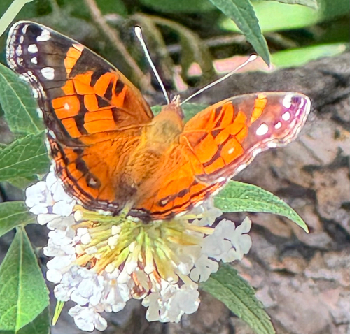
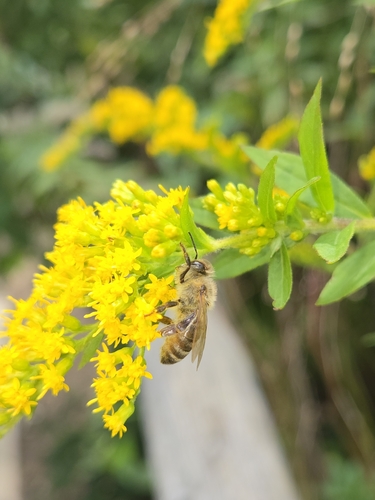
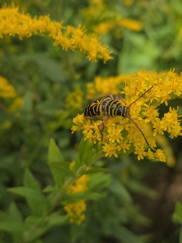
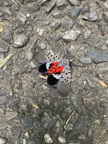

Research-grade observations from iNaturalist (within ~15 mi).
Nearest stream gauge
Live readings from USGS NWIS · measured 2026-09-17 02:30 UTC.
Events
Gallery
Sources
- • Wikipedia
- • US Census Bureau (ACS 5-year estimates)
- • NOAA National Weather Service
- • Wikidata
- • Open-Meteo Air Quality (CAMS)
- • USGS Earthquake Catalog (global feed)
- • USGS NWIS (water data)
- • NCES via Urban Institute Education Data Portal
- • GBIF (Global Biodiversity Information Facility)
- • iNaturalist
- • CDC PLACES
- • Open-Meteo / sunrise-sunset.org
- • Wikipedia Pageviews API
- • Open Library
- • Wikidata SPARQL (CC0) — population, area, elevation, inception, head of government, Commons image