Browse / United States / Massachusetts / Wakefield
Wakefield
MassachusettsCDP

Wakefield
Total population
27,793
Median home value
$723,500
Bachelor's+
Median income
$134,306
Founded
1638
Demographic figures from US Census Bureau · ACS 5-year estimates. Overview below cites Wikipedia and may reference a different year.
- Wind Advisory · ModerateWind Advisory issued September 25 at 12:30PM EDT until September 27 at 8:00AM EDT by NWS Boston/Norton MA
Source: NOAA National Weather Service.
City facts
Facts from Wikidata (CC0).
Overview
Wakefield is a town in Middlesex County, Massachusetts, United States, in the greater Boston metropolitan area, incorporated in 1812 and located about 12.5 mi (20.1 km) north-northwest of Downtown Boston. Wakefield's population was 27,090 at the 2020 census. Wakefield offers an assortment of activities around the local lake, Lake Quannapowitt.
Read more on WikipediaHistory & geography
History
Wakefield was first settled in 1638 and was originally known as Lynn Village. It officially separated from Lynn and incorporated as Reading in 1644 when the first church (First Parish Congregational Church) and the first mill were established. This first corn mill was built on the Mill River on Water Street, and later small saw mills were built on the Mill River and the Saugus River. Thomas Parker was one of the founders of Reading, and his home was in what is now downtown Wakefield (on the east side of Crescent Street where it intersects Princess Street). He also was a founder of the 12th Congregational Church (now the First Parish Congregational Church), and served as deacon there. He was a selectman of Reading and was appointed a judicial commissioner. There is evidence that Parker was "conspicuous in naming the town" and that he was related to the Parker family of Little Norton, England, who owned land by the name of Ryddinge. The old parish church became known as the Old or South Parish when in 1713 the North Parish was established. This North Parish later became the town of North Reading. In 1769 the West Parish was established. On 25 February 1812 the Old or South Parish of Reading separated from Reading and was officially incorporated as South Reading. At the time it was spelled South Redding, not South Reading. On 16 June 1813 a small part of South Reading was returned by annexation to Reading. is located at 1 Lafayette Street. In 1856, the South Reading Public Library was established; it later became the Beebe Town Library. In 1923, the Lucius Beebe Memorial Library was built and established by Junius Beebe, the son of Lucius Beebe (1810–1884). The first weekly newspaper in Wakefield was established in 1858. On 13 March 1889, a part of Stoneham was…
Geography
Wakefield is located at (42.501345, −71.071324). Reading (northwest), Melrose (south), Stoneham (southwest), Lynnfield (northeast) and Saugus (southeast) border Wakefield. Wakefield's borders with Lynnfield and Saugus are coterminous with the Middlesex County–Essex County line. As the crow flies, Wakefield Lower Common is located approximately north of Government Center, Boston, while the Wakefield–Melrose line is located about north. Route 129 runs through Wakefield as its Main Street. I-95/Route 128 skirt the northwestern border of Wakefield as one road known as the "Yankee Division Highway". According to the United States Census Bureau, the town has a total area of , of which is land and , or 5.56%, is water. Wakefield has two lakes, Crystal Lake and Lake Quannapowitt. Crystal Lake is used as a reservoir for some of the town's drinking water; as such, recreation is prohibited on Crystal Lake. Lake Quannapowitt, meanwhile, is used for a wide variety of recreational activities, including boating, windsurfing, kayaking, and fishing, and is the primary source of the Saugus River. In 1847, Lake Quannapowitt was named for the Native American James Quannapowitt, one of the signers of the old Indian Deed of 1686. The earliest settlers referred to the lake simply as the "Greate Pond" or "Reading Pond." Lake Quannapowitt is also home to the oldest inland yacht club in the United States, Quannapowitt Yacht Club, which was founded in 1886. Long regarded as "Wakefield's greatest natural resource," Lake Quannapowitt covers an area of . Its outlet is the Saugus River to the Atlantic Ocean. Wakefield Common sits to the south of the lake, and is the site of many recreational activities and events throughout the year. In 1991, a group of local citizens formed "The…
Excerpted from the corresponding Wikipedia article (CC BY-SA).
Demographics & economy
Race & ethnicity
Source: US Census Bureau — American Community Survey, 5-year estimates.
Geography
Coordinates & boundaries from the US Census TIGER/Line shapefiles.
Climate
Current forecast
Forecast for Wakefield, MA from NOAA NWS API.
Air quality
Industrial & pollution facilities
Natural hazard risk
Health (adults)
Age-adjusted prevalence estimates from CDC PLACES (latest release).
Walkability
Amenities nearby
Wildlife & biodiversity
Schools
Earthquake history
Photos
Sights & places nearby
Notable people from here


People born within ~10 km, from Wikidata (CC0). Click any name for their Wikipedia article.
Nearby places in Massachusetts
- Peabody5.2 mi away · pop. 54,695
- Boxford11.7 mi away · pop. 2,284
- Cochituate19.1 mi away
- Amesbury Town24.6 mi away
- Duxbury37.4 mi away · pop. 1,994
- Ocean Grove54.1 mi away · pop. 3,453
- Bourne58.1 mi away · pop. 1,806
- Yarmouth Port70 mi away · pop. 5,961
- Harwich Center75.9 mi away · pop. 1,774
- Deerfield78.4 mi away · pop. 458
- Chicopee80.2 mi away · pop. 55,295
- Cheshire106.9 mi away · pop. 674
Geography & sun
Elevation, sunrise/sunset and daylight from Open-Meteo. Solar climatology from NASA POWER.
Nearby airports
Public attention
Pageview totals from the Wikimedia Pageviews API.
Books about Wakefield

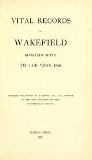
Search results from Open Library.
Recent natural events nearby
Ground air-quality sensors
Recently spotted species
Nearest stream gauge
Events
Gallery
Sources
- • Wikipedia
- • US Census Bureau (ACS 5-year estimates)
- • NOAA National Weather Service
- • Wikidata
- • CDC PLACES
- • Open-Elevation
- • Open-Meteo / sunrise-sunset.org
- • Wikipedia Pageviews API
- • Open Library
- • Wikidata SPARQL (CC0) — population, area, elevation, inception, head of government, Commons image