Browse / United States / Massachusetts / Waltham
Waltham
Massachusettscity

Waltham
Total population
64,902
Median home value
$748,700
Bachelor's+
Median income
$120,216
Founded
1634
Demographic figures from US Census Bureau · ACS 5-year estimates. Overview below cites Wikipedia and may reference a different year.
City facts
Facts from Wikidata (CC0).
Overview
Waltham is a city in Middlesex County, Massachusetts, United States, and was an early center for the labor movement as well as a major contributor to the American Industrial Revolution. The original home of the Boston Manufacturing Company, the city was a prototype for 19th century industrial city planning, spawning what became known as the Waltham-Lowell system of labor and production. The city is now a center for research and higher education as home to Brandeis University and Bentley University. The population was 65,218 at the 2020 United States census. Waltham is part of the Greater Boston area and lies 9 miles (14 km) west of Downtown Boston.
Read more on WikipediaHistory & geography
History
Waltham was first settled by the English in 1634 as part of Watertown, and was officially incorporated as a separate town in 1738, but the area was inhabited for thousands of years prior to English colonization. At the time of European arrival, Waltham was in a border zone between the territories of the Pawtucket confederation and the Massachusett, with nearby native settlements at Nonantum and Pequosset (Watertown). Early settlers recorded the presence of an "Indian Stockade" near today's Cambridge Reservoir, and an "Indian Hollow" in today's Calvary Cemetery. A native trail through Waltham, the "Old Connecticut Path" saw continued use after colonization and became the basis for present day Route 20. The first record of the name is from the articles of incorporation, dated January 15, 1738. In the early 19th century, Francis Cabot Lowell and his friends and colleagues established in Waltham the Boston Manufacturing Company—the first integrated textile mill in the United States—with the goal of eliminating the problems of co-ordination, quality control, and shipping inherent in the subcontracting based textile industry. The Waltham–Lowell system of production derives its name from the city and the founder of the mill. The city is home to a number of large estates, including Gore Place, a mansion built in 1806 for former Massachusetts governor Christopher Gore, the Robert Treat Paine Estate, a residence designed by architect Henry Hobson Richardson and landscape architect Frederick Law Olmsted for philanthropist Robert Treat Paine, Jr. (1810–1905), and the Lyman Estate, a estate built in 1793 by Boston merchant Theodore Lyman I. In 1857, the Waltham Model 1857 watch was produced by the American Watch Company in the city of Waltham, Massachusetts. In the late 19th…
Geography
Waltham is located at (42.380596, −71.235005), about north-west of downtown Boston, Massachusetts, and approximately northwest of Boston's Brighton neighborhood. The heart of the city is Waltham Common, which is home to Waltham City Hall and various memorial statues. The Common is on Main Street, which is home to several churches, the Waltham Public Library, and Post Office. The city stretches along the Charles River and contains several dams. The dams were used to power textile mills and other endeavors in the early years of the industrial activity. According to the United States Census Bureau, the city has a total area of , of which is land and (6.69%) is water. Waltham has several neighborhoods or villages, including: * Angleside * Banks Square * The Bleachery (named after the former Waltham Bleachery and Dye Works) * Cedarwood * The Chemistry (named after the former Newton Chemical Company) * Ellison Park * Gardencrest * Headyland * The Highlands * The Island (formerly Morse Meadow Island) * Kendal Green (mostly in Weston) * Kendall Park * Lakeview * The Lanes * Northeast * The North Side * Piety Corner * Prospectville (defunct in 1894, now under Cambridge Reservoir) * Rangeley Acres * Ravenswood * Roberts * Rock Alley * The South Side * Warrendale * West End * Wildwood Acres It is bordered to the west by Weston and Lincoln, to the south by Newton, to the east by Belmont and Watertown, and to the north by Lexington.
Excerpted from the corresponding Wikipedia article (CC BY-SA).
Demographics & economy
Race & ethnicity
Source: US Census Bureau — American Community Survey, 5-year estimates.
Geography
Coordinates & boundaries from the US Census TIGER/Line shapefiles.
Climate
Current forecast
Forecast for Waltham, MA from NOAA NWS API.
Air quality
Industrial & pollution facilities
Natural hazard risk
Health (adults)
Age-adjusted prevalence estimates from CDC PLACES (latest release).
Walkability
Amenities nearby
Wildlife & biodiversity
Most-observed species
- American RobinTurdus migratorius Linnaeus, 1766 · Aves171,944
- Blue JayCyanocitta cristata (Linnaeus, 1758) · Aves165,889
- Northern CardinalCardinalis cardinalis (Linnaeus, 1758) · Aves145,409
- Black-capped ChickadeePoecile atricapillus (Linnaeus, 1766) · Aves141,709
- Mourning DoveZenaida macroura (Linnaeus, 1758) · Aves127,702
- House SparrowPasser domesticus (Linnaeus, 1758) · Aves124,823
- Song SparrowMelospiza melodia (A.Wilson, 1810) · Aves123,681
- Downy WoodpeckerDryobates pubescens (Linnaeus, 1766) · Aves117,489
Citizen-science & research observations from the Global Biodiversity Information Facility (GBIF).
Schools
Largest nearby schools
- Framingham High SchoolHigh · Framingham · 2,566 students · 14.7:1 ratio
- Lexington HighHigh · Lexington · 2,303 students · 12.3:1 ratio
- Newton North HighHigh · Newtonville · 2,099 students · 10.9:1 ratio
- Cambridge Rindge and LatinHigh · Cambridge · 1,867 students · 8.7:1 ratio
- Malden HighHigh · Malden · 1,856 students · 16:1 ratio
- Newton South HighHigh · Newton Centre · 1,837 students · 11.8:1 ratio
- Waltham Sr HighHigh · Waltham · 1,751 students · 10.9:1 ratio
- Natick HighHigh · Natick · 1,727 students · 12.2:1 ratio
Public K–12 schools within ~10 mi from Urban Institute Education Data Portal (NCES Common Core of Data, 2022).
Earthquake history
Most recent
- M 3.8 — 2025-01-279 km SE of York Harbor, Maine
- M 2.7 — 2023-12-235 km SW of Chichester, New Hampshire
- M 3.6 — 2020-11-0810 km S of Bliss Corner, Massachusetts
- M 2.7 — 2018-02-150 km SE of East Kingston, New Hampshire
- M 2.6 — 2015-01-132 km E of Wauregan, Connecticut
- M 3.3 — 2015-01-120 km NE of Wauregan, Connecticut
Events from the USGS Earthquake Catalog (global) (FDSN Event Web Service).
Photos
Sights & places nearby
Notable people from here


People born within ~10 km, from Wikidata (CC0). Click any name for their Wikipedia article.
Nearby places in Massachusetts
- Cochituate7 mi away
- West Concord9.3 mi away · pop. 6,320
- Cordaville16.4 mi away
- Peabody17.2 mi away · pop. 54,695
- Randolph Town17.4 mi away
- Braintree Town17.6 mi away
- Danvers19.6 mi away
- Devens21.7 mi away
- Boxford23.1 mi away · pop. 2,284
- Methuen Town24.7 mi away
- East Pepperell25 mi away · pop. 2,120
- Amesbury Town35.1 mi away
Geography & sun
Elevation, sunrise/sunset and daylight from Open-Meteo. Solar climatology from NASA POWER.
Nearby airports
Public attention
Pageview totals from the Wikimedia Pageviews API.
Books about Waltham
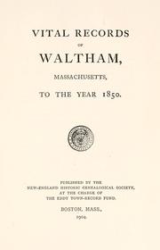


Search results from Open Library.
Recent natural events nearby
Ground air-quality sensors
Recently spotted species
Nearest stream gauge
Events
Gallery
Sources
- • Wikipedia
- • US Census Bureau (ACS 5-year estimates)
- • NOAA National Weather Service
- • Wikidata
- • USGS Earthquake Catalog (global feed)
- • NCES via Urban Institute Education Data Portal
- • GBIF (Global Biodiversity Information Facility)
- • CDC PLACES
- • Open-Meteo / sunrise-sunset.org
- • Wikipedia Pageviews API
- • Open Library
- • Wikidata SPARQL (CC0) — population, area, elevation, inception, head of government, Commons image