Browse / United States / Maryland / Chesapeake Beach
Chesapeake Beach
Marylandtown

Chesapeake Beach
Total population
6,456
Founded
1886
Demographic figures from US Census Bureau · ACS 5-year estimates. Overview below cites Wikipedia and may reference a different year.
City facts
Facts from Wikidata (CC0).
Overview
Chesapeake Beach is a town in Calvert County, Maryland, United States. Its major attractions include the Chesapeake Beach Railway Station, the Chesapeake Beach Rail Trail, a water park, marinas, piers, and charter boat fishing. As of the 2020 census, Chesapeake Beach had a population of 6,356.
Read more on WikipediaHistory & geography
History
Chesapeake Beach was established as a resort community at the end of the Chesapeake Beach Railway, a short line railroad from Washington, DC. It was the site of many slot machines in the early twentieth century (despite efforts to prohibit them) as part of the "Little Nevada" area of southern Maryland. Between steamer ships from Baltimore and trains from Washington, the weekend population of Chesapeake Beach reached into the 10,000s during the 1920s, until economic depression, and a bad hotel fire, brought an end to the railroad. The construction of the Bay Bridge to the Eastern Shore of Maryland in the 1950s enabled many of the visitors who used to spend their summers in Chesapeake Beach to now spend their time in Ocean City, Maryland instead. A museum at the old railroad station still exists today in Chesapeake Beach with many historic photos and an old passenger car from the railroad. It was listed on the National Register of Historic Places in 1980. In the new millennium a boardwalk and pier, and a new condominium development have risen in Chesapeake Beach. There is also a recreational water park with water slides, a newly opened resort spa hotel, and a seafood restaurant right on the bay. The Herrington Harbour (Rose Haven) marina resort, which was voted by Marina Dock Age magazine as the best marina in the United States, is a few miles north. Until the 1950s and early 1960s, Chesapeake Beach was segregated by race, as were many other beaches along the Chesapeake Bay at the time. The resort's amenities and amusement parks remained segregated until the passage of the Civil Rights Act of 1964, which prohibited racial segregation in public spaces. African-Americans frequented the nearby beaches of Carr's Beach and Sparrow's Beach. While discriminated against as…
Geography
Chesapeake Beach is located at (38.695070, -76.536125). According to the United States Census Bureau, the town has a total area of , of which is land and is water. The city has grown out from the intersection of Fishing Creek and the Chesapeake Bay. The creek has been dredged to allow pleasure craft, commercial fisherman and a few small US Navy vessels to dock in the city. Fishing Creek is a breeding sanctuary for Crassostrea virginica, as well as Chrysaora chesapeakei. The southern end of the city remains heavily wooded and is distinguished by the large sandstone cliffs called the Randle Cliffs. These cliffs tower as high as 110 feet above the water and are constantly eroding due to freeze/thaw and wave action. The debris from these cliffs has formed a number of shallow sand bars which makes navigation by boat near the cliffs very difficult and the water very shallow for hundreds of yards into the bay. Located at the center of town is the Chesapeake Beach Veterans' Memorial Park. It features a very large American flag and a waterfall fountain. A boardwalk along the Bay spans from 17th Street, down to the southern terminus of B Street and the northern entrance to Brownies Beach/Bayfront Park.
Excerpted from the corresponding Wikipedia article (CC BY-SA).
Demographics & economy
Geography
Coordinates & boundaries from the US Census TIGER/Line shapefiles.
Climate
Air quality
Industrial & pollution facilities
Natural hazard risk
Health (adults)
Walkability
Amenities nearby
Wildlife & biodiversity
Schools
Earthquake history
Photos
Sights & places nearby
Notable people from here


People born within ~10 km, from Wikidata (CC0). Click any name for their Wikipedia article.
Nearby places in Maryland
- Friendship3.7 mi away
- Huntingtown6.4 mi away · pop. 2,689
- Shady Side9.8 mi away
- Prince Frederick10.2 mi away
- Aquasco10.3 mi away · pop. 719
- Galesville10.5 mi away
- Eagle Harbor11.1 mi away · pop. 72
- Tilghman Island11.8 mi away
- Marlboro Meadows13.5 mi away
- Upper Marlboro13.9 mi away
- Queensland14.9 mi away
- Marlboro Village15.3 mi away · pop. 9,382
Geography & sun
Elevation, sunrise/sunset and daylight from Open-Meteo. Solar climatology from NASA POWER.
Nearby airports
Public attention
Pageview totals from the Wikimedia Pageviews API.
Books about Chesapeake Beach

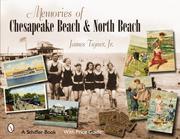
Search results from Open Library.
Recent natural events nearby
Ground air-quality sensors
Recently spotted species
Nearest stream gauge
Events
Gallery
Sources
- • Wikipedia
- • Wikidata
- • Open-Meteo / sunrise-sunset.org
- • Wikipedia Pageviews API
- • Open Library