Browse / United States / Maryland / Langley Park
Langley Park
MarylandCDP

Langley Park
Total population
21,508
Median home value
$357,200
Bachelor's+
Median income
$85,321
Demographic figures from US Census Bureau · ACS 5-year estimates. Overview below cites Wikipedia and may reference a different year.
City facts
Overview
Langley Park is an unincorporated area and census-designated place (CDP) in Prince George's County, Maryland, United States. It is located inside the Capital Beltway, on the northwest edge of Prince George's County, bordering Montgomery County. Per the 2020 census, the population was 20,126.
Read more on WikipediaHistory & geography
History
"Langley Park" refers to the Langley Park estate established in 1923 by the McCormick-Goodhart family in the Chillum District of Prince George's County. The name McCormick-Goodhart represented the linking of one of Chicago's oldest families, that of Cyrus McCormick, with that of British barrister Frederick E. McCormick-Goodhart. Frederick's wife Henrietta (Nettie) was the daughter of Leander J. McCormick, a brother of Cyrus. They named the estate "Langley Park" after the Goodharts' ancestral home in Kent, England. In 1924, they erected an , 28-room Georgian Revival mansion, designed by architect George Oakley Totten Jr., at a cost of $100,000. It remains a community landmark at 8151 15th Ave. CASA of Maryland purchased the property in 2009, making the site its home base, This property was listed on the National Register of Historic Places on August 29, 2008. During the late 1930s-early 1940s, Leander McCormick-Goodhart, son of Frederick and Nettie, served as personal assistant to Ambassador Lord Lothian and supervisor of American Relief to Great Britain through the British embassy. As a result, the Langley Park estate became a regular site of social activities related to the British embassy including hosting the regular games of the Washington Cricket Club and, in June 1941, a British Relief Country Fair. The estate was first subdivided during and immediately after World War II, and was developed as a planned community by Pierre Ghent & Associates of Washington, D.C. The last major section would be developed in 1963. Because of the wartime and immediate postwar demand for housing, the estate was quickly developed for low-rise apartment homes, semi-detached, and single family homes. Starting in 1949, a 1,542 garden apartment complex, Langley Park Apartments, now…
Geography
Langley Park is located at (38.994060, −76.981759), with a total area of , all land. The community is bordered by University Boulevard to the south, the Northwest Branch Anacostia River to the north, Phelps Road to the east, and the Prince George's County–Montgomery County line to the west. An extremely small stretch of Piney Branch Road (MD 320) which goes into Prince George's County, goes into the Langley Park neighborhood as well, just before it crosses the Northwest Branch Anacostia River and intersects New Hampshire Avenue (MD 650). While most of the Langley Park neighborhood contains the Hyattsville ZIP Code of 20783, there is a small portion of Langley Park located west of New Hampshire Avenue (MD 650), but east of the Prince George's County–Montgomery County line, which contains the Silver Spring ZIP Code of 20903. Langley Park is surrounded by the communities of Adelphi, Silver Spring, Takoma Park, Carole Highlands, and Lewisdale.
Excerpted from the corresponding Wikipedia article (CC BY-SA).
Demographics & economy
Race & ethnicity
Source: US Census Bureau — American Community Survey, 5-year estimates.
Geography
Coordinates & boundaries from the US Census TIGER/Line shapefiles.
Climate
Current forecast
Forecast for Langley Park, MD from NOAA NWS API.
Air quality
Industrial & pollution facilities
Natural hazard risk
Health (adults)
Walkability
Amenities nearby
Wildlife & biodiversity
Schools
Earthquake history
Photos
Sights & places nearby
Notable people from here
Nearby places in Maryland
- Adelphi0.9 mi away · pop. 17,395
- Chillum1.6 mi away · pop. 34,871
- Hyattsville2.4 mi away · pop. 20,966
- College Park2.5 mi away · pop. 34,540
- Hillandale2.6 mi away · pop. 5,060
- Riverdale Park3.3 mi away
- Mount Rainier3.4 mi away
- North Brentwood3.5 mi away · pop. 624
- Berwyn Heights3.6 mi away · pop. 3,318
- Forest Glen4 mi away
- Kemp Mill4.2 mi away · pop. 13,042
- East Riverdale4.3 mi away · pop. 18,336
Geography & sun
Elevation, sunrise/sunset and daylight from Open-Meteo. Solar climatology from NASA POWER.
Nearby airports
Public attention
Pageview totals from the Wikimedia Pageviews API.
Books about Langley Park



Search results from Open Library.
Recent natural events nearby
Ground air-quality sensors
Recently spotted species
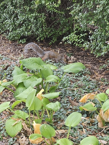



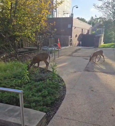



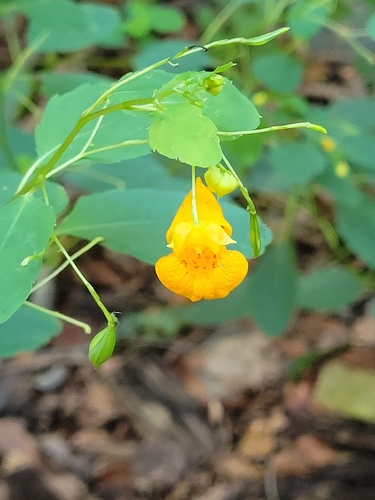
Research-grade observations from iNaturalist (within ~15 mi).
Nearest stream gauge
Events
Gallery
Sources
- • Wikipedia
- • US Census Bureau (ACS 5-year estimates)
- • NOAA National Weather Service
- • iNaturalist
- • Open-Meteo / sunrise-sunset.org
- • Wikipedia Pageviews API
- • Open Library