Browse / United States / Michigan / Dearborn Heights
Dearborn Heights
Michigancity

Dearborn Heights
Total population
61,771
Median home value
$185,100
Bachelor's+
Median income
$60,391
Demographic figures from US Census Bureau · ACS 5-year estimates. Overview below cites Wikipedia and may reference a different year.
- Frost Advisory · MinorFrost Advisory issued October 16 at 1:59PM EDT until October 17 at 8:00AM EDT by NWS Detroit/Pontiac MI
Source: NOAA National Weather Service.
City facts
Facts from Wikidata (CC0).
Overview
Dearborn Heights is a city in Wayne County in the U.S. state of Michigan. An inner-ring suburb of Detroit, Dearborn Heights is located about 12 miles (19 km) west of downtown Detroit. The city shares a small border with Detroit, and is considered a bedroom community. As of the 2020 census, the city had a population of 63,292.
Read more on WikipediaHistory & geography
History
Dearborn Heights was incorporated from the two discontinuous sections of Dearborn Township and a quarter-mile connecting strip of land from the village of Inkster. Incorporation petitions were filed on Friday, March 4, 1960, while Inkster officials delivered their petitions for incorporation on Monday, March 7, 1960. The residents approved Dearborn Heights' incorporation on an election held June 20, 1960, which is the official date of incorporation. Inkster, a predominantly black community, filed a lawsuit, claiming that the shape of Dearborn Heights reflected a racial gerrymander. The Michigan Supreme Court held that Inkster had failed to demonstrate any legally cognizable harm and dismissed the lawsuit.
Geography
According to the United States Census Bureau, the city has a total area of , of which is land and (0.09%) is water. The southern portion of the city is in the watershed of the north branch of the Ecorse Creek (also known as Ecorse River). The area surrounding the Ecorse is subject to flooding. The northern portion of the city is in the Rouge River watershed.
Excerpted from the corresponding Wikipedia article (CC BY-SA).
Demographics & economy
Race & ethnicity
Source: US Census Bureau — American Community Survey, 5-year estimates.
Geography
Coordinates & boundaries from the US Census TIGER/Line shapefiles.
Climate
Current forecast
Forecast for Dearborn Heights, MI from NOAA NWS API.
Air quality
Industrial & pollution facilities
Natural hazard risk
Health (adults)
Age-adjusted prevalence estimates from CDC PLACES (latest release).
Walkability
Amenities nearby
Wildlife & biodiversity
Most-observed species
- American RobinTurdus migratorius Linnaeus, 1766 · Aves26,985
- Northern CardinalCardinalis cardinalis (Linnaeus, 1758) · Aves26,313
- House SparrowPasser domesticus (Linnaeus, 1758) · Aves26,081
- Blue JayCyanocitta cristata (Linnaeus, 1758) · Aves25,630
- Mourning DoveZenaida macroura (Linnaeus, 1758) · Aves23,079
- Black-capped ChickadeePoecile atricapillus (Linnaeus, 1766) · Aves18,803
- Downy WoodpeckerDryobates pubescens (Linnaeus, 1766) · Aves18,468
- European StarlingSturnus vulgaris Linnaeus, 1758 · Aves17,850
Citizen-science & research observations from the Global Biodiversity Information Facility (GBIF).
Schools
Largest nearby schools
- Fordson High SchoolHigh · DEARBORN · 2,339 students · 19.7:1 ratio
- Dearborn High SchoolHigh · DEARBORN · 1,969 students · 20.7:1 ratio
- Star International AcademyOther · DEARBORN HEIGHTS · 1,698 students · 20:1 ratio
- Edsel Ford High SchoolHigh · DEARBORN · 1,639 students · 19.1:1 ratio
- Stevenson High SchoolHigh · LIVONIA · 1,636 students · 22.7:1 ratio
- John Glenn High SchoolHigh · WESTLAND · 1,542 students · 21.7:1 ratio
- Taylor High SchoolHigh · TAYLOR · 1,394 students · 18.6:1 ratio
- Lincoln Park High SchoolHigh · LINCOLN PARK · 1,367 students · 21.7:1 ratio
Public K–12 schools within ~10 mi from Urban Institute Education Data Portal (NCES Common Core of Data, 2022).
Earthquake history
Most recent
- M 2.7 — 2026-05-048 km N of Maybee, Michigan
- M 3 — 2026-04-267 km SSE of Amherstburg, Canada
- M 2.5 — 2024-03-184 km WSW of Millbury, Ohio
- M 2.6 — 2023-05-203 km SSE of Walbridge, Ohio
- M 2.5 — 2022-05-232 km NNW of Corunna, Canada
- M 3.2 — 2020-08-212 km SSE of Detroit Beach, Michigan
Events from the USGS Earthquake Catalog (global) (FDSN Event Web Service).
Photos
Sights & places nearby
Notable people from here


People born within ~10 km, from Wikidata (CC0). Click any name for their Wikipedia article.
Nearby places in Michigan
- Inkster3.3 mi away · pop. 25,428
- Dearborn4.2 mi away · pop. 106,383
- Wayne6.5 mi away · pop. 17,310
- Allen Park6.6 mi away · pop. 27,925
- Melvindale6.7 mi away · pop. 12,554
- Taylor7.7 mi away · pop. 62,081
- Lincoln Park8.4 mi away · pop. 39,257
- River Rouge9.4 mi away · pop. 7,008
- Detroit10.1 mi away · pop. 645,702
- Wyandotte10.9 mi away · pop. 24,489
- Lathrup Village11.3 mi away · pop. 4,059
- Farmington Hills11.3 mi away · pop. 84,160
Geography & sun
Elevation, sunrise/sunset and daylight from Open-Meteo. Solar climatology from NASA POWER.
Nearby airports
Public attention
Pageview totals from the Wikimedia Pageviews API.
Books about Dearborn Heights


Search results from Open Library.
Recent natural events nearby
Ground air-quality sensors
Recently spotted species
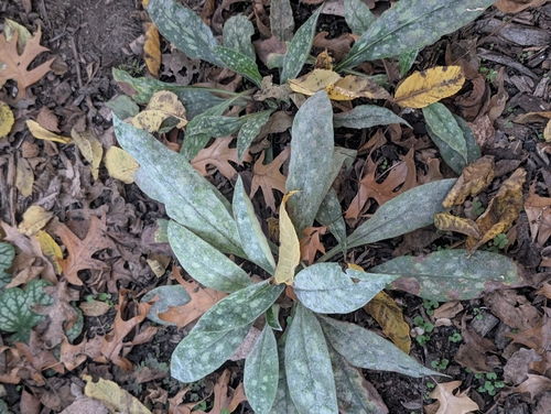


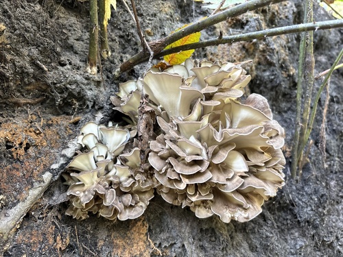

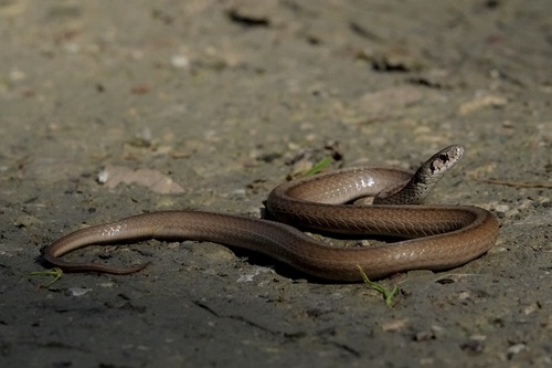


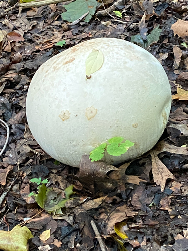
Research-grade observations from iNaturalist (within ~15 mi).
Nearest stream gauge
Live readings from USGS NWIS · measured 2026-10-13 11:15 UTC.
Events
Gallery
Sources
- • Wikipedia
- • US Census Bureau (ACS 5-year estimates)
- • NOAA National Weather Service
- • Wikidata
- • USGS Earthquake Catalog (global feed)
- • USGS NWIS (water data)
- • NCES via Urban Institute Education Data Portal
- • GBIF (Global Biodiversity Information Facility)
- • iNaturalist
- • CDC PLACES
- • Open-Meteo / sunrise-sunset.org
- • Wikipedia Pageviews API
- • Open Library