Browse / United States / Michigan / Dowagiac
Dowagiac
Michigancity

Dowagiac
Total population
5,732
Median home value
$130,800
Bachelor's+
Median income
$48,166
Founded
1848
Demographic figures from US Census Bureau · ACS 5-year estimates. Overview below cites Wikipedia and may reference a different year.
City facts
Facts from Wikidata (CC0).
Overview
Dowagiac is a city in Cass County in the U.S. state of Michigan. The population was 5,721 at the 2020 census. It is part of the South Bend-Mishawaka metropolitan area.
Read more on WikipediaHistory & geography
History
Dowagiac was first platted in 1848. It was incorporated as a village in 1863 and as a city in 1877. Dowagiac gained national attention in June 1964 after police began investigating multiple reports of what became known as the Dewey Lake Monster. In 1854, Dowagiac was the final destination for the first group of orphans brought to the Midwest from New York City on the Orphan Train.
Geography
According to the United States Census Bureau, the city has a total area of , of which is land and is water. Dowagiac Woods Nature Sanctuary, commonly referred to as Dowagiac Woods, a woods located in Cass, is a non-profit organization dedicated to protecting Michigan's exceptional natural habitats and extraordinary and endangered plants and animals. The Dowagiac River flows from the stream which rises as the "Dowagiac Drain" in central Decatur Township in southern Van Buren County, Michigan. It is joined first by the "Red Run" and then by the "Lake of the Woods Drain" near the southern edge of Hamilton Township, it becomes the "Dowagiac River" before entering Wayne Township in Cass County. North of the city of Dowagiac, the river passes through the "Dowagiac Swamp". Just west of Dowagiac, the river is joined by its principal tributary, the "Dowagiac Creek".
Excerpted from the corresponding Wikipedia article (CC BY-SA).
Demographics & economy
Race & ethnicity
Source: US Census Bureau — American Community Survey, 5-year estimates.
Geography
Coordinates & boundaries from the US Census TIGER/Line shapefiles.
Climate
Air quality
Industrial & pollution facilities
Natural hazard risk
Health (adults)
Walkability
Amenities nearby
Wildlife & biodiversity
Schools
Earthquake history
Photos
Sights & places nearby
Notable people from here


People born within ~10 km, from Wikidata (CC0). Click any name for their Wikipedia article.
Nearby places in Michigan
Geography & sun
Elevation, sunrise/sunset and daylight from Open-Meteo. Solar climatology from NASA POWER.
Nearby airports
Public attention
Pageview totals from the Wikimedia Pageviews API.
Books about Dowagiac


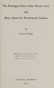
Search results from Open Library.
Recent natural events nearby
Ground air-quality sensors
Recently spotted species
Nearest stream gauge
Events
Gallery
Sources
- • Wikipedia
- • US Census Bureau (ACS 5-year estimates)
- • Wikidata
- • Open-Meteo / sunrise-sunset.org
- • Wikipedia Pageviews API
- • Open Library