Browse / United States / Minnesota / Dayton
Dayton
Minnesotacity

Dayton
Total population
9,095
Median home value
$511,300
Bachelor's+
Median income
$148,947
Founded
1855
Demographic figures from US Census Bureau · ACS 5-year estimates. Overview below cites Wikipedia and may reference a different year.
City facts
Facts from Wikidata (CC0).
Overview
Dayton is a city in Hennepin and Wright counties in the U.S. state of Minnesota. The population was 7,262 at the 2020 census. According to 2025 census estimates, the city is estimated to have a population of 11,402. Dayton is mainly located within Hennepin County, but a part of the city extends into Wright County as well. It is the northernmost city in Hennepin County and is a suburb of the Minneapolis–St. Paul "Twin Cities" metropolitan area.
Read more on WikipediaHistory & geography
Geography
According to the United States Census Bureau, the city has a total area of , of which is land and is water. On January 15, 2003, the city's most recent geographical expanse extended its boundaries. Fernbrook Lane (County 121); North Diamond Lake Road (County 144); South Diamond Lake Road; and Dayton River Road (County 12) are four of the main routes in Dayton. Interstate 94 and County Road 81 pass briefly through the southwest corner of Dayton. Brockton Lane (County 13) runs north-south along Dayton's western boundary line with adjacent city of Rogers. The neighboring cities are Champlin, Rogers, Maple Grove, Anoka, Ramsey, Elk River, and Otsego. Corcoran is nearby, but does not border Dayton. Dayton is located at the confluence of the Mississippi and Crow Rivers.
Excerpted from the corresponding Wikipedia article (CC BY-SA).
Demographics & economy
Race & ethnicity
Source: US Census Bureau — American Community Survey, 5-year estimates.
Geography
Coordinates & boundaries from the US Census TIGER/Line shapefiles.
Climate
Current forecast
Forecast for Dayton, MN from NOAA NWS API.
Air quality
Industrial & pollution facilities
Natural hazard risk
Health (adults)
Age-adjusted prevalence estimates from CDC PLACES (latest release).
Walkability
Amenities nearby
Wildlife & biodiversity
Schools
Largest nearby schools
- Champlin Park High SchoolHigh · CHAMPLIN · 2,983 students · 20.7:1 ratio
- MAPLE GROVE SENIOR HIGHHigh · MAPLE GROVE · 2,324 students · 23.5:1 ratio
- OSSEO SENIOR HIGHHigh · OSSEO · 2,280 students · 21.9:1 ratio
- JACKSON MIDDLEMiddle · CHAMPLIN · 1,981 students · 17.5:1 ratio
- PARK CENTER IB WORLD SCHOOLHigh · BROOKLYN PARK · 1,908 students · 17.2:1 ratio
- ROGERS SENIOR HIGHHigh · ROGERS · 1,740 students · 37:1 ratio
- Maple Grove Middle SchoolMiddle · MAPLE GROVE · 1,598 students · 21.6:1 ratio
- Osseo Middle SchoolMiddle · OSSEO · 1,155 students · 18.9:1 ratio
Public K–12 schools within ~10 mi from Urban Institute Education Data Portal (NCES Common Core of Data, 2022).
Earthquake history
Photos
Sights & places nearby
Notable people from here


People born within ~10 km, from Wikidata (CC0). Click any name for their Wikipedia article.
Nearby places in Minnesota
Geography & sun
Elevation, sunrise/sunset and daylight from Open-Meteo. Solar climatology from NASA POWER.
Nearby airports
Public attention
Pageview totals from the Wikimedia Pageviews API.
Books about Dayton
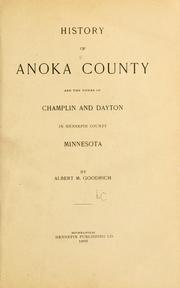

Search results from Open Library.
Recent natural events nearby
Ground air-quality sensors
Recently spotted species
Nearest stream gauge
Events
Gallery
Sources
- • Wikipedia
- • US Census Bureau (ACS 5-year estimates)
- • NOAA National Weather Service
- • Wikidata
- • NCES via Urban Institute Education Data Portal
- • CDC PLACES
- • Open-Meteo / sunrise-sunset.org
- • Wikipedia Pageviews API
- • Open Library