Browse / United States / Minnesota / Elk River
Elk River
Minnesotacity

Elk River
Total population
26,793
Median home value
$370,100
Bachelor's+
Median income
$108,741
Demographic figures from US Census Bureau · ACS 5-year estimates. Overview below cites Wikipedia and may reference a different year.
City facts
Facts from Wikidata (CC0).
Overview
Elk River is a city and the county seat of Sherburne County, Minnesota, United States, about 34 miles northwest of Minneapolis. It is at the confluence of the Mississippi and Elk Rivers. The population was 25,835 at the 2020 census, making Elk River the second-largest city in the Central Minnesota region after St. Cloud. U.S. Highways 10 and 169 and State Highway 101 are three of the main routes in Elk River. Elk River is 33.2 miles northwest of Minneapolis and 37.4 miles southeast of St. Cloud.
Read more on WikipediaHistory & geography
History
The last glacier to traverse Minnesota is responsible for the creation of the hardwood-forested hills where Elk River is nestled. These hills are made up of coarse materials, which is why gravel mining is so prevalent in Elk River, and also why much of the area is not considered good farmland for culture and agriculture use. To the south of Elk River lies the prairie. This natural boundary between the prairie and woods was also a boundary between Indian nations. Two battles between the Dakota and Ojibwe took place where the Elk River meets the Mississippi in 1772 and 1773. Zebulon Pike passed through the area on his 1805 exploration of the Upper Mississippi River and named the Elk River after the herds of elk he saw in the area. David Frederic Faribault, son of French-Canadian fur trader Jean-Baptiste Faribault, built a trading post near the confluence of the Elk and Mississippi Rivers in 1846, which he sold in 1848 to H. M. Rice and S. P. Folsom. Folsom moved his family to the place and built a log cabin. French fur trader and guide Pierre Bottineau bought the post and cabin from Folsom. The trading post stood on a bluff just north of the present-day bridge across the Elk River on Main Street. In 1850, Bottineau built a hotel on the bank of the Mississippi about half a mile below the mouth of the Elk. The two rivers and the Red River Trail, which passed nearby, made this area a good location for commerce. Silas Lane opened a farm near the old trading post site, making his claim in section 33 in 1850. Many early settlers came from Maine and nearly all of them were experts in lumbering. In 1851, Ard Godfrey and John C. Jamieson, a native of Orono, Maine, saw the potential of the water power of the Elk River and purchased the claim from Lane. They built a dam and a…
Geography
According to the United States Census Bureau, the city has an area of , of which is land and (3.39%) is water. Elk River is bordered to the south by the Mississippi River. The Elk River meanders through Sherburne County to its terminus at the Mississippi River through the western side of Elk River, pausing at Lake Orono, created by a dam not far from its conjunction with the Mississippi River.
Excerpted from the corresponding Wikipedia article (CC BY-SA).
Demographics & economy
Race & ethnicity
Source: US Census Bureau — American Community Survey, 5-year estimates.
Geography
Coordinates & boundaries from the US Census TIGER/Line shapefiles.
Climate
Air quality
Industrial & pollution facilities
Natural hazard risk
Health (adults)
Age-adjusted prevalence estimates from CDC PLACES (latest release).
Walkability
Amenities nearby
Wildlife & biodiversity
Schools
Largest nearby schools
- ELK RIVER SENIOR HIGHHigh · ELK RIVER · 1,637 students · 32.1:1 ratio
- BIG LAKE SENIOR HIGHHigh · BIG LAKE · 899 students · 30:1 ratio
- LIBERTY ELEMENTARYElementary · BIG LAKE · 806 students · 14.9:1 ratio
- ZIMMERMAN HIGH SCHOOLHigh · ZIMMERMAN · 707 students · 32.1:1 ratio
- TWIN LAKES ELEMENTARYElementary · ELK RIVER · 705 students · 19.6:1 ratio
- BIG LAKE MIDDLE SCHOOLMiddle · BIG LAKE · 686 students · 28.6:1 ratio
- INDEPENDENCE ELEMENTARYElementary · BIG LAKE · 660 students · 15.7:1 ratio
- SALK MIDDLE SCHOOLMiddle · ELK RIVER · 657 students · 41.1:1 ratio
Public K–12 schools within ~10 mi from Urban Institute Education Data Portal (NCES Common Core of Data, 2022).
Earthquake history
Photos
Sights & places nearby
Notable people from here
Nearby places in Minnesota
- Otsego5.4 mi away
- St. Francis9.4 mi away
- Dayton10.9 mi away · pop. 9,095
- St. Michael11 mi away
- Osseo16.9 mi away
- East Bethel17 mi away · pop. 12,115
- Rockford18.8 mi away
- Loretto19.5 mi away
- Silver Creek20.5 mi away
- Spring Lake Park21.6 mi away
- Brooklyn Center21.9 mi away · pop. 32,479
- Maple Lake22.6 mi away · pop. 2,042
Geography & sun
Elevation, sunrise/sunset and daylight from Open-Meteo. Solar climatology from NASA POWER.
Nearby airports
Public attention
Pageview totals from the Wikimedia Pageviews API.
Books about Elk River

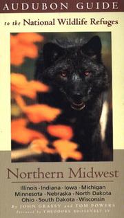
Search results from Open Library.
Recent natural events nearby
Ground air-quality sensors
Recently spotted species
Nearest stream gauge
Events
Gallery
Sources
- • Wikipedia
- • US Census Bureau (ACS 5-year estimates)
- • Wikidata
- • NCES via Urban Institute Education Data Portal
- • CDC PLACES
- • Open-Meteo / sunrise-sunset.org
- • Wikipedia Pageviews API
- • Open Library