Browse / United States / Missouri / Mountain Grove
Mountain Grove
Missouricity

Mountain Grove
Total population
4,491
Median home value
$87,200
Bachelor's+
Median income
$37,415
Demographic figures from US Census Bureau · ACS 5-year estimates. Overview below cites Wikipedia and may reference a different year.
City facts
Facts from Wikidata (CC0).
Overview
Mountain Grove is a city in Wright County and Texas County in Missouri, United States. It lies within the Ozarks in the south-central part of the state. The population was 4,313 at the 2020 census.
Read more on WikipediaHistory & geography
History
A post office called Mountain Grove has been in operation since 1875. The community owes its present name to a stand of trees near the original elevated town site. In 1841 a settlement was built on land east of Mountain Grove near a spring in a grove of hickory timber. A post office was established in Hickory Spring, the original name of Mountain Grove, in 1851, but was removed in 1861. On March 9, 1862, there was a skirmish in the town during the American Civil War. Company "B" of Phelps' Regiment of the Missouri Volunteers under command of Captain Josephus G. Rich was notified via a scout of a Confederate party located at Fox Creek "some 10 or 15 miles from the Mountain Store." Rich, one Lieutenant Flint, and 30 federal troops marched from Marshfield. The company was reinforced with around 30 troops from the Missouri Home Guard at "Lick Skillet". Later on, the company "Formed a junction on the head of Clark's Creek, at Todd's...", being bolstered by around 50 cavalry men of the 4th Regiment from Lebanon. On Sunday, March 9th, they would march from Todd's to the Mountain Grove Seminary, and encounter a Confederate force amounting somewhere between 35 and 40. In a later report from Rich to Colonel Phelps, he stated that the Confederate force suffered 13 killed, 7 wounded, and the rest taken prisoner, excluding two who may have fled. Among the prisoners were Colonel Campbell and Captain Holt, the latter of which was described in Rich's report as "badly wounded." Rich reported that his forces suffered no casualties, though it is likely that the Union forces suffered 10 killed, and 2 wounded. Captain Rich would later, on March 12th, draft a report to Colonel John S. Phelps of the events mentioned. A new post office was named for Judge Robert W. Fyan, a prominent figure…
Geography
Mountain Grove is located in the Ozarks, along the south edge of the Salem Plateau. The community is served by US Route 60 and Missouri Route 95. The community is mostly within Wright County, Missouri, with the eastern portion extending into Texas County, Missouri. The town sits on the drainage divide between the White River tributaries to the south and the Missouri River tributaries to the north. According to the United States Census Bureau, the city has a total area of , of which is land and is water. The city of Mountain Grove is also directly on the border with neighboring Texas County.
Excerpted from the corresponding Wikipedia article (CC BY-SA).
Demographics & economy
Race & ethnicity
Source: US Census Bureau — American Community Survey, 5-year estimates.
Geography
Coordinates & boundaries from the US Census TIGER/Line shapefiles.
Climate
Current forecast
Forecast for Mountain Grove, MO from NOAA NWS API.
Air quality
Industrial & pollution facilities
Natural hazard risk
Health (adults)
Age-adjusted prevalence estimates from CDC PLACES (latest release).
Walkability
Amenities nearby
Wildlife & biodiversity
Schools
Largest nearby schools
- MOUNTAIN GROVE ELEM.Elementary · MOUNTAIN GROVE · 688 students · 14.6:1 ratio
- MOUNTAIN GROVE MIDDLEMiddle · MOUNTAIN GROVE · 476 students · 14.9:1 ratio
- MOUNTAIN GROVE HIGHHigh · MOUNTAIN GROVE · 444 students · 17.1:1 ratio
- NORWOOD HIGHHigh · NORWOOD · 187 students · 11:1 ratio
- NORWOOD ELEM.Elementary · NORWOOD · 140 students · 9.3:1 ratio
- SKYVIEW SCHOOLOther · MOUNTAIN GROVE · 4 students · 4:1 ratio
- OZARK REGIONAL JUVENILE DET CTOther · MOUNTAIN GROVE · 3 students
- OZARK MOUNTAIN TECHNICAL CTR.High · MOUNTAIN GROVE
Public K–12 schools within ~10 mi from Urban Institute Education Data Portal (NCES Common Core of Data, 2022).
Earthquake history
Photos
Sights & places nearby
Notable people from here
Nearby places in Missouri
Geography & sun
Elevation, sunrise/sunset and daylight from Open-Meteo. Solar climatology from NASA POWER.
Nearby airports
Public attention
Pageview totals from the Wikimedia Pageviews API.
Books about Mountain Grove
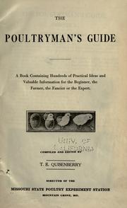


Search results from Open Library.
Recent natural events nearby
- Wildfire BISON, Osage, OklahomaWildfires · 2026-08-21 · 225 mi
- Wildfire B.B, Osage, OklahomaWildfires · 2026-08-06 · 232 mi
- Wildfire Snake Mountain, Pushmataha, OklahomaWildfires · 2026-08-14 · 245 mi
- Wildfire Bunker Fire, Calhoun, ArkansasWildfires · 2026-09-15 · 247 mi
- Wildfire Bunker Fire, Calhoun, ArkansasWildfires · 2026-09-14 · 247 mi
Wildfires, storms and other events from NASA EONET (last 12 months, within 250 mi).
Ground air-quality sensors
Recently spotted species
Nearest stream gauge
Events
Gallery
Sources
- • Wikipedia
- • US Census Bureau (ACS 5-year estimates)
- • NOAA National Weather Service
- • Wikidata
- • NCES via Urban Institute Education Data Portal
- • CDC PLACES
- • Open-Meteo / sunrise-sunset.org
- • Wikipedia Pageviews API
- • Open Library
- • NASA EONET