Browse / United States / Missouri / Old Monroe
Old Monroe
Missouricity

Old Monroe
Total population
236
Demographic figures from US Census Bureau · ACS 5-year estimates. Overview below cites Wikipedia and may reference a different year.
City facts
Facts from Wikidata (CC0).
Overview
Old Monroe is a city in Lincoln County, Missouri, United States. The population was 249 at the 2020 census.
Read more on WikipediaHistory & geography
History
Old Monroe was the site of Fort Howard. It was laid out in 1819, and named after President James Monroe. The name was prefixed with "Old" in order to avoid postal conflict with Monroe City. The Battle of the Sink Hole was fought on May 24, 1815, after the official end of the War of 1812, between Missouri Rangers and Sauk Indians led by Black Hawk. The Sauk were unaware, or did not care, that their British patrons had signed the Treaty of Ghent with the U.S. The battle was fought in a low spot near the mouth of the Cuivre River near the current day city of Old Monroe. After the battle, in 1816, Black Hawk reaffirmed the Treaty of St. Louis after re-negotiation with the United States government. The city was originally named "Monroe" and it served as the county seat from 1819 until 1823. The name would change to its current form circa 1857 when Monroe County and its county seat, Monroe City, were established. The postal office then labeled the older town as Old Monroe.
Geography
Old Monroe is located at (38.931993, -90.748049). According to the United States Census Bureau, the city has a total area of , of which is land and is water.
Excerpted from the corresponding Wikipedia article (CC BY-SA).
Demographics & economy
Geography
Coordinates & boundaries from the US Census TIGER/Line shapefiles.
Climate
Air quality
Industrial & pollution facilities
Natural hazard risk
Health (adults)
Walkability
Amenities nearby
Wildlife & biodiversity
Schools
Earthquake history
Photos
Sights & places nearby
Notable people from here
Nearby places in Missouri
Geography & sun
Elevation, sunrise/sunset and daylight from Open-Meteo. Solar climatology from NASA POWER.
Nearby airports
Public attention
Pageview totals from the Wikimedia Pageviews API.
Books about Old Monroe

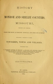


Search results from Open Library.
Recent natural events nearby
Ground air-quality sensors
Recently spotted species
Nearest stream gauge
Events
Gallery
Sources
- • Wikipedia
- • Wikidata
- • Open-Meteo / sunrise-sunset.org
- • Wikipedia Pageviews API
- • Open Library