Browse / United States / Mississippi / Purvis
Purvis
Mississippicity

Purvis
Total population
1,914
Median home value
$168,100
Bachelor's+
Median income
$45,667
Demographic figures from US Census Bureau · ACS 5-year estimates. Overview below cites Wikipedia and may reference a different year.
City facts
Facts from Wikidata (CC0).
Overview
Purvis is a U.S. city in and the county seat of Lamar County, Mississippi. It is part of the Hattiesburg, Mississippi Metropolitan Statistical Area. As of the 2020 census, Purvis had a population of 1,909. The Town of Purvis was incorporated on February 25, 1888 and was founded by and named after Thomas Melville Purves, originally of Marion County, Alabama. Purves, born March 8, 1820, was a second generation Scottish-American; his grandfather emigrated to Charleston, South Carolina in 1765.
Read more on WikipediaHistory & geography
History
Purves acquired a land grant in 1870 for a parcel of real estate which was located, at that time, in Marion County, Mississippi. In 1871, Purves moved from his home in Greene County and homesteaded the , along with his wife, Dorothy Abney, born May 14, 1826, in Hinds County, and their five surviving children, to the rural property. Dorothy, also known as Dollie or Dolly, was a doctor who tended the sick of the area and delivered babies. Purves built a two-room log cabin for his family with an open fireplace in one room used for cooking and heating. John, Thomas Purves' third surviving child, was the town's first Mayor. In 1884, the New Orleans and Northeastern Railroad gained right-of-way on Purves' property and a depot was erected, along with a marker, reading "Purvis". Lamar became a county on February 19, 1904, in House Bill 166 and was formed from the second Judicial District of Marion County. The county was named after Lucius Quintus Cincinnatus Lamar II, who was elected to Mississippi Congress in 1872 and has one county each in Mississippi, Alabama and Georgia named after him. The town of Purvis was designated as the county seat of the county Lamar with the depot of the New Orleans and Northeastern Railroad listed as the town's center and the lines to run with the cardinal points of the compass. Purvis began as a sawmill town and is noted to be located on the highest point on the Southern Railroad between Meridian and New Orleans by James Bounds, land surveyor, MS REG # L.S.1021. Lamar County Administrator Chuck Bennett stated on December 30, 2008, that the courthouse is slated for a complete renovation that could cost up to $44,000,000 and could take up to four years to complete. Preliminary work began in 2006 and some items have already been paid in full,…
Geography
According to the United States Census Bureau, the city has a total area of , of which is land and 0.25% is water. Because of a well-known system of aquifers and sand mines, this area was selected for "project dribble" to be the site of nuclear tests by the US government during 1961 to 1968 to measure seismic activity. Purvis is part of the area known as the Pine Belt due to the overwhelming number of longleaf pine trees that populate the forests. Purvis is located in the Deep South, in a humid subtropical area of the country with hot summers and mild winters. Located in USDA Hardiness Zone 8, the climate supports a large variety of foliage and plants. Purvis receives about 62 inches of rain annually, January being the wettest month averaging , which provides for the lush growth of native plants and trees. January is also the coldest month of the year with an average temperature of 60 degrees during the daytime and 36 degrees at night. Summers are long, with 80 degree temperatures beginning in May or sometimes sooner, and lasting normally until the first weeks of October. Night temperatures do not usually vary greatly from daytime temperatures, usually dropping only 21 -24 degrees. Heat indexes can soar during the summer months, due to high humidity and long hours of sunshine, causing a 93 degree day to feel as if it were 101 degrees. Afternoon showers and thunderstorms are to be expected during summer months but are often short lived. July is, on average, the hottest month of the year at 92 degrees, without counting the varying heat index. Snowfall is rare, and when it does occur it usually is only or less. Purvis averages freezing temperatures only a few times a winter. The record high was in 1951 at 106 degrees and the record low in 1985 at 4 degrees. On…
Excerpted from the corresponding Wikipedia article (CC BY-SA).
Demographics & economy
Race & ethnicity
Source: US Census Bureau — American Community Survey, 5-year estimates.
Geography
Coordinates & boundaries from the US Census TIGER/Line shapefiles.
Climate
Current forecast
Forecast for Purvis, MS from NOAA NWS API.
Air quality
Industrial & pollution facilities
Natural hazard risk
Health (adults)
Age-adjusted prevalence estimates from CDC PLACES (latest release).
Walkability
Amenities nearby
Wildlife & biodiversity
Schools
Largest nearby schools
- OAK GROVE MIDDLE SCHOOLMiddle · Hattiesburg · 1,294 students · 14.1:1 ratio
- OAK GROVE ELEMENTARYElementary · Hattiesburg · 764 students · 11.6:1 ratio
- PURVIS HIGH SCHOOLHigh · Purvis · 620 students · 14.1:1 ratio
- PURVIS LOWER ELEMENTARYElementary · Purvis · 454 students · 12.3:1 ratio
- PURVIS MIDDLE SCHOOLMiddle · Purvis · 383 students · 12.8:1 ratio
- PURVIS UPPER ELEMENTARYElementary · Purvis · 373 students · 12.9:1 ratio
- JEFFERSON/TODD ALTERNATIVE PROGRAMOther · Purvis
- LAMAR CO VOC TECH CENTERHigh · Purvis
Public K–12 schools within ~10 mi from Urban Institute Education Data Portal (NCES Common Core of Data, 2022).
Earthquake history
Photos
Sights & places nearby
Notable people from here

People born within ~10 km, from Wikidata (CC0). Click any name for their Wikipedia article.
Nearby places in Mississippi
- Lumberton10.2 mi away · pop. 1,320
- West Hattiesburg11.4 mi away
- Hattiesburg12.3 mi away · pop. 48,619
- Eastabuchie20.7 mi away · pop. 82
- Poplarville22.4 mi away
- New Augusta22.6 mi away · pop. 590
- Runnelstown23.5 mi away
- Wiggins25.6 mi away
- Columbia25.9 mi away · pop. 6,632
- Collins36 mi away · pop. 2,455
- Saucier39.5 mi away
- Hide-A-Way Lake41.6 mi away · pop. 2,569
Geography & sun
Elevation, sunrise/sunset and daylight from Open-Meteo. Solar climatology from NASA POWER.
Nearby airports
Public attention
Pageview totals from the Wikimedia Pageviews API.
Books about Purvis
Search results from Open Library.
Recent natural events nearby
- Wildfire RAY COAKER, Washington, AlabamaWildfires · 2026-09-09 · 66 mi
- Wildfire Jackson - Hwy 90, Jackson, MississippiWildfires · 2026-08-16 · 75 mi
- Wildfire Round Prarie, Morehouse, LouisianaWildfires · 2026-09-20 · 192 mi
- Prescribed Fire RX CALV BU 104-108, Vernon, LouisianaWildfires · 2026-09-16 · 223 mi
- Wildfire Pine Tree Rd, Union, ArkansasWildfires · 2026-08-20 · 228 mi
Wildfires, storms and other events from NASA EONET (last 12 months, within 250 mi).
Ground air-quality sensors
Recently spotted species
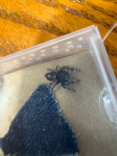

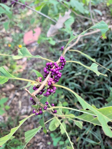




Research-grade observations from iNaturalist (within ~15 mi).
Nearest stream gauge
Live readings from USGS NWIS · measured 2026-09-21 23:45 UTC.
Events
Gallery
Sources
- • Wikipedia
- • US Census Bureau (ACS 5-year estimates)
- • NOAA National Weather Service
- • Wikidata
- • USGS NWIS (water data)
- • NCES via Urban Institute Education Data Portal
- • iNaturalist
- • CDC PLACES
- • Open-Meteo / sunrise-sunset.org
- • Wikipedia Pageviews API
- • Open Library
- • NASA EONET