Browse / United States / Montana / Hinsdale
Hinsdale
MontanaCDP

Hinsdale
Total population
233
Median home value
$109,500
Bachelor's+
Median income
$47,500
Demographic figures from US Census Bureau · ACS 5-year estimates. Overview below cites Wikipedia and may reference a different year.
- Lake Wind Advisory · ModerateLake Wind Advisory issued September 17 at 1:42AM MDT until September 18 at 12:00AM MDT by NWS Glasgow MT
Source: NOAA National Weather Service.
City facts
Facts from Wikidata (CC0).
Overview
Hinsdale is an unincorporated community and census-designated place in Valley County, Montana, United States. As of the 2020 census, Hinsdale had a population of 193. The community is located on the Milk River and U.S. Route 2, with Montana Highway 537 headed north out of town and South Bench Road crossing the railroad tracks and running south of town. Hinsdale has a post office with ZIP code 59241.
Read more on WikipediaHistory & geography
History
Native American tribes lived in the local area for thousands of years before European colonization. This colonization brought horses which greatly improved life on the prairie. The steady eastward march of settlers pushed new tribes into the area. The Corps of Discovery reached the head of the Milk River in May 1805. There, the river received its name, for "the water of this river possesses a peculiar whiteness, being about the colour of a cup of tea with the admixture of a tablespoonfull of milk." After the Corps of Discovery, the next major event in the area was the arrival of Texas cattle coming to fatten up on the local grass after their long cattle drives. The cattle drives lasted from 1866 until the late 1880s. The area was used and claimed by various Native American Tribes. The Act of May 1, 1888 ceded a large area of land, including Hinsdale, from the tribes and opened the area up to homesteading The summer of 2014 was unusually wet. After several weeks of small, scattered rainstorms, a larger system rolled through in late August. The storm dropped several inches of rain as it made its way across Montana. Hinsdale received seven inches rain over a three-day period. This induced the third hundred‑year‑flood that Hinsdale had experienced in three years.
Geography
Hinsdale is located on the Milk River just above the flood plain. A cut bank separates the town from the county park on the river's edge. U.S. Highway 2 runs east and west on the south side of town, with the railroad tracks running parallel south of the highway. Just south of town is the south bench, with marks the edge of the terrace than makes up the majority of south Valley County. The terrace is a raised area that was not cut down as far by erosion compared to the Milk River Valley. Numerous soil horizons, including multiple layers of sandstone, are visible in the bench. Hinsdale was once on the edge of the inland sea of North America. As the Rocky Mountains began to rise, they were eroded and sediment filled in the sea. as the Rocky Mountain Front continued to gain elevation and increase the slope of the land, water began to erode away the sediment that had been deposited. At this point, the Missouri River flowed north past Big Sandy, entered what is now the Milk River Valley, and flowed along its course past Hinsdale. Around what is now Poplar, the Missouri turned north and eventually flowed into the Hudson Bay. During the last series of ice ages, the flow of the Missouri was diverted to its current riverbed. The Milk River now flows through part of the Missouri's ancient riverbed. The continental glaciers also deposited large amounts of rocks and sediment on the landscape. According to the U.S. Census Bureau, the CDP has an area of , of which is land and is water. According to the Köppen Climate Classification system, Hinsdale has a semi-arid climate, abbreviated "BSk" on climate maps.
Excerpted from the corresponding Wikipedia article (CC BY-SA).
Demographics & economy
Race & ethnicity
Source: US Census Bureau — American Community Survey, 5-year estimates.
Geography
Coordinates & boundaries from the US Census TIGER/Line shapefiles.
Climate
Current forecast
Forecast for Hinsdale, MT from NOAA NWS API.
Air quality
Industrial & pollution facilities
Natural hazard risk
Health (adults)
Walkability
Amenities nearby
Wildlife & biodiversity
Schools
Earthquake history
Photos
Sights & places nearby
Notable people from here
Nearby places in Montana
Geography & sun
Elevation, sunrise/sunset and daylight from Open-Meteo. Solar climatology from NASA POWER.
Nearby airports
Public attention
Pageview totals from the Wikimedia Pageviews API.
Books about Hinsdale
Search results from Open Library.
Recent natural events nearby
- Wildfire Snow, Custer, MontanaWildfires · 2026-09-02 · 160 mi
- Incident Complex Rattlesnake Complex, Prairie, MontanaWildfires · 2026-09-04 · 161 mi
- Wildfire Ayers Pond, Prairie, MontanaWildfires · 2026-09-03 · 161 mi
- Wildfire Sarpy, Big Horn, MontanaWildfires · 2026-08-17 · 186 mi
- Wildfire Middle Coulee, Chouteau, MontanaWildfires · 2026-08-02 · 186 mi
- Wildfire Ant Park, Meagher, MontanaWildfires · 2026-07-31 · 202 mi
- Wildfire Windmill, Stillwater, MontanaWildfires · 2026-08-19 · 211 mi
- Wildfire Harris, Rosebud, MontanaWildfires · 2026-08-09 · 223 mi
Wildfires, storms and other events from NASA EONET (last 12 months, within 250 mi).
Ground air-quality sensors
Recently spotted species

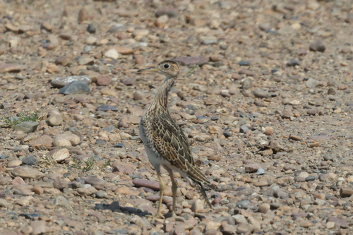
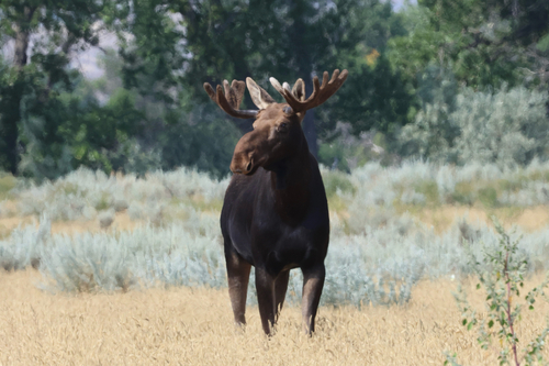

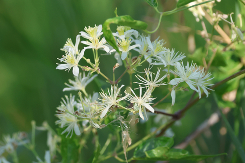

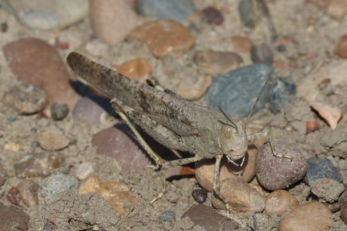


Research-grade observations from iNaturalist (within ~15 mi).
Nearest stream gauge
Live readings from USGS NWIS · measured 2026-09-17 10:30 UTC.
Events
Gallery
Sources
- • Wikipedia
- • US Census Bureau (ACS 5-year estimates)
- • NOAA National Weather Service
- • Wikidata
- • USGS NWIS (water data)
- • iNaturalist
- • Open-Meteo / sunrise-sunset.org
- • Wikipedia Pageviews API
- • Open Library
- • NASA EONET