Browse / United States / North Carolina / Albemarle
Albemarle
North Carolinacity

Albemarle
Total population
16,762
Median home value
$204,800
Bachelor's+
Median income
$46,881
Founded
1826
Demographic figures from US Census Bureau · ACS 5-year estimates. Overview below cites Wikipedia and may reference a different year.
City facts
Facts from Wikidata (CC0).
Overview
Albemarle is a city in and the county seat of Stanly County, North Carolina, United States. The population was 16,432 in the 2020 census.
Read more on WikipediaHistory & geography
History
This place-name is derived from the English surname Albemarle. According to a 1905 publication by the United States Geologic Survey, based on research by University of North Carolina - Chapel Hill history professor Kemp P. Battle, it was named specifically for General George Monck, the first Duke of Albemarle and one of the original proprietors of the colony of Carolina, which included the town. The site of modern-day Albemarle was originally peopled by small tribes of hunter-gatherers and mound builders whose artifacts and settlements have been dated back nearly 10,000 years. Large-scale European settlement of the region came in the mid-18th century via two primary waves: immigrants of Dutch, Scots-Irish and German descent moved from Pennsylvania and New Jersey seeking enhanced religious and political tolerance, while immigrants of English backgrounds came to the region from Virginia and the Cape Fear River Basin in Eastern North Carolina. In early English colonial times, the Albemarle area was politically part of the New Hanover Precinct, out of which the Bladen Precinct was created in 1734. The renamed Bladen County was subdivided to create Anson County in 1750, which in turn spawned Montgomery County in 1779. The Albemarle region's first post office was established in 1826; it was then known as Smith's Store. The nearby crossroads of the Old Turnpike Road from Fayetteville to Salisbury and the Old Stage Road connecting Charlotte and Raleigh emerged as an important hub for regional commerce and trade. The region remained part of Montgomery County until 1841, when after years of attempted separation, prominent residents of the increasingly populous areas west of the Yadkin/Pee Dee River system successfully petitioned the North Carolina General Assembly for the…
Geography
According to the United States Census Bureau, Albemarle has a total area of , of which is land and (0.44%) is water. The city is centered on the junction of U.S. Route 52 and the duplexed NC-24/27 in the Piedmont Region of North Carolina. Its topography is characterized by rolling, eroded hills, deciduous forests, and fast-running, narrow, shallow streams that feed the Yadkin/Pee Dee River Basin. Little Long Creek and Town Creek are the major non-seasonal streams through Albemarle; both flow generally southward into the Long and Big Bear Creek Sub-basin. Albemarle is located in the Floyd Church Formation of the Carolina Slate Belt. Thickly bedded, axially cleaved meta-mudstone and meta-argillite are common in this formation, interbedded with meta-sandstone, meta-conglomerate and meta-volcanic rock. Biotite is the most prevalent Paleozoic metamorphic rock in the region. Albemarle has a humid subtropical climate (Köppen climate classification Cfa), with cool to mild winters and hot, humid summers.
Excerpted from the corresponding Wikipedia article (CC BY-SA).
Demographics & economy
Race & ethnicity
Source: US Census Bureau — American Community Survey, 5-year estimates.
Geography
Coordinates & boundaries from the US Census TIGER/Line shapefiles.
Climate
Air quality
Industrial & pollution facilities
Natural hazard risk
Health (adults)
Walkability
Amenities nearby
Wildlife & biodiversity
Schools
Earthquake history
Photos
Sights & places nearby
Notable people from here


People born within ~10 km, from Wikidata (CC0). Click any name for their Wikipedia article.
Nearby places in North Carolina
Geography & sun
Elevation, sunrise/sunset and daylight from Open-Meteo. Solar climatology from NASA POWER.
Nearby airports
Public attention
Pageview totals from the Wikimedia Pageviews API.
Books about Albemarle
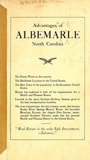


Search results from Open Library.
Recent natural events nearby
Ground air-quality sensors
Recently spotted species
Nearest stream gauge
Events
Gallery
Sources
- • Wikipedia
- • US Census Bureau (ACS 5-year estimates)
- • Wikidata
- • Open-Meteo / sunrise-sunset.org
- • Wikipedia Pageviews API
- • Open Library