Browse / United States / North Carolina / Beaufort
Beaufort
North Carolinatown

Beaufort
Total population
4,689
Median home value
$354,900
Bachelor's+
Median income
$53,321
Founded
1709
Demographic figures from US Census Bureau · ACS 5-year estimates. Overview below cites Wikipedia and may reference a different year.
City facts
Facts from Wikidata (CC0).
Overview
Beaufort is a town in and the county seat of Carteret County, North Carolina, United States. Founded in 1709, Established in 1713 and incorporated in 1723, Beaufort is the third oldest town in North Carolina. The population was 4,464 at the 2020 census.
Read more on WikipediaHistory & geography
History
The Beaufort Historic District, Carteret County Home, Duncan House, Gibbs House, Jacob Henry House, and Old Burying Ground are listed on the National Register of Historic Places. In June 1718, Blackbeard the pirate ran his flagship, the Queen Anne's Revenge and his sloop Adventure, aground near present-day Beaufort Inlet, NC. The Queen Anne's Revenge was added to the National Register of Historic Places in 2004 with the reference number 04000148. Thirty-two years later, in August 1750, at least three Spanish merchantmen ran aground in North Carolina during a hurricane. One of the three, the El Salvador, sank near Cape Lookout. Beaufort was established by European settlers in about 1709 on the site of a former Coree Native American village, Cwarioc. The town was surveyed and laid out in 1713 following the end of the Tuscarora War. Subordinates of the lords proprietors of the Province of Carolina designated Beaufort a port for unloading ships on April 4, 1722. In the colonial period, Port Beaufort exported tar, pitch, turpentine, crafts of wood, and corn, especially to the West Indies. The town was incorporated on November 23, 1723. Its boundaries were expanded and new lots sold in 1728, but its population remained small. It was briefly occupied by Spanish privateers in 1747. Beaufort continued to develop slowly during the antebellum period, but by the mid-19th century it had become a vacation destination and was home to several successful merchants and hotelkeepers. During the Secession Crisis in April 1861, Beaufort locals formed a militia and seized nearby Fort Macon. The State of North Carolina seceded from the United States in May and joined the Confederate States of America and thus becoming involved in the American Civil War. Federal troops recaptured Beaufort…
Geography
Beaufort is located south of the center of Carteret County. It is located near Beaufort Inlet, a channel leading south to the Atlantic Ocean. To the west is the tidal Newport River, separating the town from Morehead City. To the east is the unincorporated neighborhood of Lenoxville, extending to the North River, another tidal river. U.S. Route 70 passes through Beaufort, leading west across the Newport River to Morehead City and northeast to its end in the town of Atlantic. According to the United States Census Bureau, Beaufort has a total area of , of which is land and , or 17.75%, is water.
Excerpted from the corresponding Wikipedia article (CC BY-SA).
Demographics & economy
Race & ethnicity
Source: US Census Bureau — American Community Survey, 5-year estimates.
Geography
Coordinates & boundaries from the US Census TIGER/Line shapefiles.
Climate
Current forecast
Forecast for Beaufort, NC from NOAA NWS API.
Air quality
Industrial & pollution facilities
Natural hazard risk
Health (adults)
Age-adjusted prevalence estimates from CDC PLACES (latest release).
Walkability
Amenities nearby
Wildlife & biodiversity
Most-observed species
- Laughing GullLeucophaeus atricilla (Linnaeus, 1758) · Aves6,766
- Mourning DoveZenaida macroura (Linnaeus, 1758) · Aves6,509
- Northern CardinalCardinalis cardinalis (Linnaeus, 1758) · Aves6,285
- Northern MockingbirdMimus polyglottos (Linnaeus, 1758) · Aves5,778
- Carolina WrenThryothorus ludovicianus (Latham, 1790) · Aves5,539
- Great EgretArdea alba Linnaeus, 1758 · Aves4,795
- Carolina ChickadeePoecile carolinensis (Audubon, 1834) · Aves4,767
- Brown PelicanPelecanus occidentalis Linnaeus, 1766 · Aves4,529
Citizen-science & research observations from the Global Biodiversity Information Facility (GBIF).
Schools
Largest nearby schools
- West Carteret HighHigh · Morehead City · 1,146 students · 16.1:1 ratio
- Morehead City PrimaryElementary · Morehead City · 545 students · 11.4:1 ratio
- East Carteret HighHigh · Beaufort · 530 students · 13.9:1 ratio
- Morehead City MiddleMiddle · Morehead City · 482 students · 14.2:1 ratio
- Beaufort ElementaryElementary · Beaufort · 378 students · 11.8:1 ratio
- Morehead Elem at Camp GlennElementary · Morehead City · 285 students · 14.3:1 ratio
- Beaufort MiddleMiddle · Beaufort · 258 students · 12.3:1 ratio
- Down East Middle and Smyrna ElementaryElementary · Smyrna · 249 students · 10.8:1 ratio
Public K–12 schools within ~10 mi from Urban Institute Education Data Portal (NCES Common Core of Data, 2022).
Earthquake history
Most recent
- M 2.9 — 2014-02-117 km NW of Hobucken, North Carolina
Events from the USGS Earthquake Catalog (global) (FDSN Event Web Service).
Photos
Sights & places nearby
Notable people from here


People born within ~10 km, from Wikidata (CC0). Click any name for their Wikipedia article.
Nearby places in North Carolina
Geography & sun
Elevation, sunrise/sunset and daylight from Open-Meteo. Solar climatology from NASA POWER.
Nearby airports
Public attention
Pageview totals from the Wikimedia Pageviews API.
Books about Beaufort
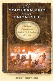


Search results from Open Library.
Recent natural events nearby
Ground air-quality sensors
Recently spotted species
Nearest stream gauge
Events
Gallery
Sources
- • Wikipedia
- • US Census Bureau (ACS 5-year estimates)
- • NOAA National Weather Service
- • Wikidata
- • USGS Earthquake Catalog (global feed)
- • NCES via Urban Institute Education Data Portal
- • GBIF (Global Biodiversity Information Facility)
- • CDC PLACES
- • Open-Meteo / sunrise-sunset.org
- • Wikipedia Pageviews API
- • Open Library