Browse / United States / North Carolina / Kinston
Kinston
North Carolinacity

Kinston
Total population
19,505
Median home value
$119,300
Bachelor's+
Median income
$36,878
Founded
1762
Demographic figures from US Census Bureau · ACS 5-year estimates. Overview below cites Wikipedia and may reference a different year.
City facts
Facts from Wikidata (CC0).
Overview
Kinston is a city in Lenoir County, North Carolina, United States, with a population of 19,900 as of the 2020 census. It has been the county seat of Lenoir County since its formation in 1791. Kinston is located in the coastal plains region of eastern North Carolina.
Read more on WikipediaHistory & geography
History
At the time of English settlement, the area was inhabited by the Neusiok people. Preceding the historic tribe, indigenous peoples of a variety of cultures had lived in the area for thousands of years. Before the English colonists established the city, the area was called "Atkins Bank", referring to a bluff once owned by Robert Atkins just above the Neuse River; it was the site of farms, a tobacco warehouse, and a Church of England mission. Kinston was created by an act of the North Carolina General Assembly in December 1762 as "Kingston", in honor of King George III, who had just recently ascended to the throne. The bill to incorporate it was introduced by Richard Caswell, who made his home there and later served as the first governor of the state of North Carolina from 1776 to 1780. After victory in the American Revolution, the citizens renamed the city "Kinston" in 1784 to show the population's disavowal of royalty. In 1833, Kinston briefly became "Caswell", in honor of Governor Caswell, but the name Kinston was restored the following year. Commissioners appointed to design the town began to accept "subscriptions" for numbered lots. To keep a lot, subscribers were required to build brick homes of specific dimensions within three years or lose their rights to the property. The town was laid out with border streets named East, North, and South, with the western border the Neuse River. The two principal roads within these borders were named for King George and Queen Charlotte. They remain King and Queen Streets to this day. Other streets were named in honor of Governor Arthur Dobbs (later renamed Independence Street) and the commissioners. In December 1791, an act was passed in the General Assembly to abolish Dobbs County and form Lenoir and Glasgow (now Greene)…
Geography
Kinston is in the Atlantic coastal plain region of North Carolina. It is mainly on the northeast side of the Neuse River, and is northeast of the center of Lenoir County. It is east of Goldsboro, south of Greenville, and west of New Bern. The Atlantic Ocean at Emerald Isle is to the southeast, and Raleigh, the state capital, is to the northwest. According to the U.S. Census Bureau, the city of Kinston has a total area of , of which , or 0.95%, is covered by water. According to the Köppen climate classification, Kinston has a humid subtropical climate, Cfa on climate maps. The hottest temperature recorded in Kinston was on July 20, 1977, and August 20–22, 1983, while the coldest temperature recorded was on January 21, 1985. |source 2 = National Weather Service }}
Excerpted from the corresponding Wikipedia article (CC BY-SA).
Demographics & economy
Race & ethnicity
Source: US Census Bureau — American Community Survey, 5-year estimates.
Geography
Coordinates & boundaries from the US Census TIGER/Line shapefiles.
Climate
Current forecast
Forecast for Kinston, NC from NOAA NWS API.
Air quality
Industrial & pollution facilities
Natural hazard risk
Health (adults)
Age-adjusted prevalence estimates from CDC PLACES (latest release).
Walkability
Amenities nearby
Wildlife & biodiversity
Most-observed species
- Northern CardinalCardinalis cardinalis (Linnaeus, 1758) · Aves1,905
- Carolina WrenThryothorus ludovicianus (Latham, 1790) · Aves1,808
- Mourning DoveZenaida macroura (Linnaeus, 1758) · Aves1,711
- American CrowCorvus brachyrhynchos C.L.Brehm, 1822 · Aves1,591
- Northern MockingbirdMimus polyglottos (Linnaeus, 1758) · Aves1,581
- Tufted TitmouseBaeolophus bicolor (Linnaeus, 1766) · Aves1,425
- Eastern BluebirdSialia sialis (Linnaeus, 1758) · Aves1,284
- Red-bellied WoodpeckerMelanerpes carolinus (Linnaeus, 1758) · Aves1,239
Citizen-science & research observations from the Global Biodiversity Information Facility (GBIF).
Schools
Largest nearby schools
- North Lenoir HighHigh · La Grange · 975 students · 18.1:1 ratio
- Contentnea-Savannah SchoolElementary · Kinston · 859 students · 15.1:1 ratio
- Kinston HighHigh · Kinston · 713 students · 17.4:1 ratio
- Woodington MiddleMiddle · Kinston · 577 students · 15.2:1 ratio
- Northwest ElementaryElementary · Kinston · 478 students · 17.1:1 ratio
- Rochelle MiddleMiddle · Kinston · 466 students · 16.6:1 ratio
- Banks ElementaryElementary · Kinston · 462 students · 14:1 ratio
- Northeast ElementaryElementary · Kinston · 442 students · 14.3:1 ratio
Public K–12 schools within ~10 mi from Urban Institute Education Data Portal (NCES Common Core of Data, 2022).
Earthquake history
Most recent
- M 2.9 — 2014-02-117 km NW of Hobucken, North Carolina
Events from the USGS Earthquake Catalog (global) (FDSN Event Web Service).
Photos
Sights & places nearby
Notable people from here


People born within ~10 km, from Wikidata (CC0). Click any name for their Wikipedia article.
Nearby places in North Carolina
- Jackson Heights4.2 mi away · pop. 794
- Graingers5.7 mi away · pop. 27
- Dover9.9 mi away · pop. 404
- Hookerton10.2 mi away · pop. 573
- Snow Hill13 mi away · pop. 2,438
- Seven Springs14.6 mi away · pop. 32
- Walnut Creek16 mi away · pop. 1,422
- Winterville20.6 mi away · pop. 10,725
- Farmville22.1 mi away · pop. 4,514
- Bell Arthur22.3 mi away · pop. 374
- Goldsboro22.5 mi away · pop. 34,383
- Eureka24.3 mi away · pop. 224
Geography & sun
Elevation, sunrise/sunset and daylight from Open-Meteo. Solar climatology from NASA POWER.
Nearby airports
Public attention
Pageview totals from the Wikimedia Pageviews API.
Books about Kinston
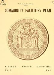


Search results from Open Library.
Recent natural events nearby
Ground air-quality sensors
Recently spotted species
Nearest stream gauge
Events
Gallery
Sources
- • Wikipedia
- • US Census Bureau (ACS 5-year estimates)
- • NOAA National Weather Service
- • Wikidata
- • USGS Earthquake Catalog (global feed)
- • NCES via Urban Institute Education Data Portal
- • GBIF (Global Biodiversity Information Facility)
- • CDC PLACES
- • Open-Meteo / sunrise-sunset.org
- • Wikipedia Pageviews API
- • Open Library