Browse / United States / North Carolina / Montreat
Montreat
North Carolinatown

Montreat
Total population
630
Median home value
$606,400
Bachelor's+
Median income
$115,568
Demographic figures from US Census Bureau · ACS 5-year estimates. Overview below cites Wikipedia and may reference a different year.
City facts
Facts from Wikidata (CC0).
Overview
Montreat is a town in Buncombe County, North Carolina, United States. As of the 2020 census, Montreat had a population of 901. It is part of the Asheville metropolitan area. The town is best known for Montreat Conference Center and Montreat College, and for having been the home of the evangelist Billy Graham and his wife Ruth Bell Graham.
Read more on WikipediaHistory & geography
History
The town of Montreat was incorporated in 1967. Much of the property in the area is still owned by the Mountain Retreat Association, formed in 1897 by John Collins, a Congregationalist minister from Connecticut. Funding for the retreat's creation was secured from candy manufacturer and philanthropist John S. Huyler, founder of Huyler's. The name of Montreat is a portmanteau of the words "Mountain" and "Retreat". In 1907, control of the Mountain Retreat Association (MRA) passed to the Presbyterian Church in the US, and for many years Montreat has been host to religious conferences, mainly Presbyterian, organized through the MRA. Woman's Auxiliary of the Presbyterian Church, U.S. was established in Montreat in 1912. Significant organizations in the contemporary town of Montreat, in addition to the Mountain Retreat Association, include Montreat Presbyterian Church: PC(USA), Montreat College (founded in 1916), and Christ Community Church, EPC (formerly Montreat Presbyterian Church). In 2024, the town was severely damaged by Hurricane Helene.
Geography
Montreat is located in eastern Buncombe County. Its eastern border is the county line, with McDowell County to the east. The town is located in the valley of Flat Creek and is surrounded by mountains on three sides. The only road access is via North Carolina Highway 9, which leads southwest to the town of Black Mountain. According to the United States Census Bureau, Montreat has a total area of .
Excerpted from the corresponding Wikipedia article (CC BY-SA).
Demographics & economy
Race & ethnicity
Source: US Census Bureau — American Community Survey, 5-year estimates.
Geography
Coordinates & boundaries from the US Census TIGER/Line shapefiles.
Climate
Current forecast
Forecast for Montreat, NC from NOAA NWS API.
Air quality
Industrial & pollution facilities
Natural hazard risk
Health (adults)
Walkability
Amenities nearby
Wildlife & biodiversity
Schools
Earthquake history
Photos
Sights & places nearby
Notable people from here


People born within ~10 km, from Wikidata (CC0). Click any name for their Wikipedia article.
Nearby places in North Carolina
- Black Mountain2.8 mi away
- Fairview10.4 mi away · pop. 2,298
- Gerton12.2 mi away · pop. 110
- Barnardsville12.7 mi away
- Chimney Rock Village13.9 mi away · pop. 122
- Biltmore Forest15.5 mi away · pop. 1,587
- Royal Pines16.3 mi away · pop. 4,325
- Marion16.8 mi away · pop. 7,579
- Glenwood17.9 mi away · pop. 226
- Burnsville18.5 mi away · pop. 2,082
- Mars Hill18.7 mi away · pop. 3,025
- Avery Creek19.9 mi away
Geography & sun
Elevation, sunrise/sunset and daylight from Open-Meteo. Solar climatology from NASA POWER.
Nearby airports
Public attention
Pageview totals from the Wikimedia Pageviews API.
Books about Montreat

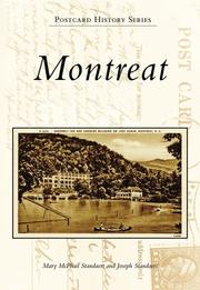


Search results from Open Library.
Recent natural events nearby
Ground air-quality sensors
Recently spotted species
Nearest stream gauge
Events
Gallery
Sources
- • Wikipedia
- • US Census Bureau (ACS 5-year estimates)
- • NOAA National Weather Service
- • Wikidata
- • Open-Meteo / sunrise-sunset.org
- • Wikipedia Pageviews API
- • Open Library