Browse / United States / New Jersey / Netcong
Netcong
New Jerseyborough

Netcong
Total population
3,659
Median home value
$346,100
Bachelor's+
Median income
$83,958
Founded
1894
Demographic figures from US Census Bureau · ACS 5-year estimates. Overview below cites Wikipedia and may reference a different year.
- Special Weather Statement · ModerateSpecial Weather Statement issued September 18 at 5:05AM EDT by NWS Mount Holly NJ
Source: NOAA National Weather Service.
City facts
Facts from Wikidata (CC0).
Overview
Netcong is a borough in southwestern Morris County, in the U.S. state of New Jersey. As of the 2020 United States census, the borough's population was 3,375, an increase of 143 (+4.4%) from the 2010 census count of 3,232, which in turn reflected an increase of 652 (+25.3%) from the 2,580 counted in the 2000 census. Netcong lies on the shores of Lake Musconetcong.
Read more on WikipediaHistory & geography
History
Netcong received its name from the Musconetcong River, named by the Lenape Native Americans and meaning "grass creek", "swamp stream", "rapid stream" or "clear stream place". Along with the river, the proximity of the old Morris and Sussex Turnpike, which passed through the region shortly after 1801, and the coming of the Morris Canal, in 1831, made the site a favorable one for development. After becoming a borough, the residents had to elect the first governing body. The first mayor was Abraham J. Drake, elected November 14, 1894. A census of Netcong taken July 1895 showed a population of 877 people. In 1968, AT&T announced that the company would be building a two-story building in the borough at the bottom of a hole underground. The facility, designed to connect a cable running between Boston and Miami, was designed to withstand a nuclear attack and continue 24-hour operations for as long as three weeks using supplies and generating capacity on the site.
Geography
According to the United States Census Bureau, the borough had a total area of 0.96 square miles (2.49 km2), including 0.83 square miles (2.16 km2) of land and 0.13 square miles (0.33 km2) of water (13.33%).
Excerpted from the corresponding Wikipedia article (CC BY-SA).
Demographics & economy
Race & ethnicity
Source: US Census Bureau — American Community Survey, 5-year estimates.
Geography
Coordinates & boundaries from the US Census TIGER/Line shapefiles.
Climate
Current forecast
Forecast for Netcong, NJ from NOAA NWS API.
Air quality
Industrial & pollution facilities
Natural hazard risk
Health (adults)
Age-adjusted prevalence estimates from CDC PLACES (latest release).
Walkability
Amenities nearby
Wildlife & biodiversity
Schools
Largest nearby schools
- Mount Olive High SchoolHigh · FLANDERS · 1,493 students · 12.7:1 ratio
- Randolph High SchoolHigh · RANDOLPH · 1,349 students · 11.1:1 ratio
- Roxbury High SchoolHigh · SUCCASUNNA · 1,192 students · 9.8:1 ratio
- Morris Hills High SchoolHigh · ROCKAWAY · 1,187 students · 10.1:1 ratio
- Dover High SchoolHigh · DOVER · 1,159 students · 13.3:1 ratio
- Mount Olive Middle SchoolMiddle · BUDD LAKE · 1,109 students · 10.8:1 ratio
- West Morris Central High SchoolHigh · CHESTER · 994 students · 11.8:1 ratio
- Randolph Middle SchoolMiddle · RANDOLPH · 922 students · 10.6:1 ratio
Public K–12 schools within ~10 mi from Urban Institute Education Data Portal (NCES Common Core of Data, 2022).
Earthquake history
Photos
Sights & places nearby
Notable people from here


People born within ~10 km, from Wikidata (CC0). Click any name for their Wikipedia article.
Nearby places in New Jersey
Geography & sun
Elevation, sunrise/sunset and daylight from Open-Meteo. Solar climatology from NASA POWER.
Nearby airports
Public attention
Pageview totals from the Wikimedia Pageviews API.
Books about Netcong
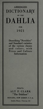

Search results from Open Library.
Recent natural events nearby
Ground air-quality sensors
Recently spotted species
Nearest stream gauge
Events
Gallery
Sources
- • Wikipedia
- • US Census Bureau (ACS 5-year estimates)
- • NOAA National Weather Service
- • Wikidata
- • NCES via Urban Institute Education Data Portal
- • CDC PLACES
- • Open-Meteo / sunrise-sunset.org
- • Wikipedia Pageviews API
- • Open Library