Browse / United States / New Jersey / South Amboy
South Amboy
New Jerseycity

South Amboy
Total population
9,989
Median home value
$379,700
Bachelor's+
Median income
$91,997
Demographic figures from US Census Bureau · ACS 5-year estimates. Overview below cites Wikipedia and may reference a different year.
City facts
Facts from Wikidata (CC0).
Overview
South Amboy is a city in Middlesex County, in the U.S. state of New Jersey, located on Raritan Bay. As of the 2020 United States census, the city's population was 9,411, an increase of 780 (+9.0%) from the 2010 census count of 8,631, which in turn reflected an increase of 718 (+9.1%) from the 7,913 counted in the 2000 census.
Read more on WikipediaHistory & geography
History
First settled by the Lenape Native Americans, who called the area around Perth Amboy by the name "Ompoge" (meaning "level ground"), the settlement ultimately became a key port for commerce between Lower New York Bay and Philadelphia, connected first by stagecoach and eventually by railroad. The city was initially founded as a village by Dutch fishermen known as Radford's Ferry, but later become a key city to safeguard New Amsterdam from the British. When settled by Europeans in 1684, the city was named New Perth in honor of James Drummond, Earl of Perth, one of the associates of a company of Scottish proprietaries. The Algonquian language name was corrupted to Ambo, or Point Amboy, and eventually a combination of the native and colonial names was used. South Amboy is mentioned during the Revolutionary War in letters to and from George Washington referring to an "officer stationed on the South Amboy shore" and by General Washington himself writing that he was "now in Jersey" and suggesting the enemy "may proceed to South Amboy". Once known as Radford's Ferry, as well as the South Ward of Perth Amboy, South Amboy became one of the earliest townships around 1685 as well as one of the largest at 18 miles long and six miles wide. In 1808, the first store was opened by Samuel Gordon. In 1831, Robert L. Stevens brought the steam engine "John Bull" to the Camden & Amboy Railroad. In 1832, Charles Moore became the town's first lawyer. In 1844, the first post office was established in the town. In 1852, the Swan Hill Pottery was established. Most of the town's churches were established between the 1850s-1880s. In 1880, the Great Beds Lighthouse is built offshore. In 1882, local newspaper "The Citizen" was established. In 1888, Amboy National Bank was established. In 1889, the…
Geography
According to the United States Census Bureau, the city had a total area of 2.68 square miles (6.95 km2), including 1.54 square miles (3.98 km2) of land and 1.15 square miles (2.97 km2) of water (42.76%). South Amboy is bordered by land with Sayreville to the south and west, by Perth Amboy to the north (across the Raritan River), and Staten Island to the east (across the Raritan Bay in New York City). Area codes 732 and 848 are used in South Amboy. The city had been in area code 908, until January 1, 1997, when 908 was split forming area code 732. South Amboy has an enclave of apartments near Kohl's in Sayreville, whose residents use a South Amboy mailing address. The Melrose and Morgan sections of Sayreville and the Laurence Harbor section of Old Bridge also use the South Amboy Zip Code of 08879. Mechanicsville, White's Dock, and Thomas J. Dohany Homes are neighborhoods in the city.
Excerpted from the corresponding Wikipedia article (CC BY-SA).
Demographics & economy
Race & ethnicity
Source: US Census Bureau — American Community Survey, 5-year estimates.
Geography
Coordinates & boundaries from the US Census TIGER/Line shapefiles.
Climate
Current forecast
Forecast for South Amboy, NJ from NOAA NWS API.
Air quality
Industrial & pollution facilities
Natural hazard risk
Health (adults)
Age-adjusted prevalence estimates from CDC PLACES (latest release).
Walkability
Amenities nearby
Wildlife & biodiversity
Schools
Earthquake history
Photos
Sights & places nearby
Notable people from here
Nearby places in New Jersey
- Perth Amboy2.4 mi away · pop. 55,436
- Sayreville2.6 mi away
- Keasbey2.6 mi away · pop. 2,252
- Laurence Harbor2.9 mi away · pop. 6,191
- Madison Park2.9 mi away · pop. 9,124
- Hopelawn3 mi away · pop. 3,496
- Fords3.9 mi away · pop. 12,771
- Cliffwood Beach4.4 mi away · pop. 3,056
- Sewaren4.5 mi away · pop. 3,248
- Woodbridge4.6 mi away
- Menlo Park Terrace5.2 mi away
- Metuchen5.9 mi away
Geography & sun
Elevation, sunrise/sunset and daylight from Open-Meteo. Solar climatology from NASA POWER.
Nearby airports
Public attention
Pageview totals from the Wikimedia Pageviews API.
Books about South Amboy

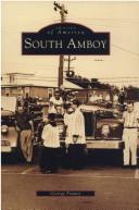


Search results from Open Library.
Recent natural events nearby
Ground air-quality sensors
Recently spotted species
Nearest stream gauge
Events
Gallery
Sources
- • Wikipedia
- • US Census Bureau (ACS 5-year estimates)
- • NOAA National Weather Service
- • Wikidata
- • CDC PLACES
- • Open-Meteo / sunrise-sunset.org
- • Wikipedia Pageviews API
- • Open Library