Browse / United States / New Mexico / Continental Divide
Continental Divide
New MexicoCDP

Continental Divide
Total population
231
Median home value
$0
Bachelor's+
Median income
$61,284
Demographic figures from US Census Bureau · ACS 5-year estimates. Overview below cites Wikipedia and may reference a different year.
City facts
Facts from Wikidata (CC0).
Overview
Continental Divide is an unincorporated community and census-designated place (CDP) in McKinley County, New Mexico, United States. It has a post office with ZIP code 87312. As of the 2020 census, it had a population of 187.
Read more on WikipediaHistory & geography
Geography
The community is located in central McKinley County along Interstate 40, east-southeast of Gallup, at Campbell Pass, a low point along the Continental Divide of the Americas. The center of the community sits at an elevation of , just west of the height of land. According to the U.S. Census Bureau, the CDP has an area of , all land. The area west of the Continental Divide is drained by the South Fork of the Puerco River, a tributary of the Little Colorado River, while the area east of the divide drains through Mitchell Draw toward the Rio San Jose, part of the Rio Puerco watershed leading to the Rio Grande.
Excerpted from the corresponding Wikipedia article (CC BY-SA).
Demographics & economy
Race & ethnicity
Source: US Census Bureau — American Community Survey, 5-year estimates.
Geography
Coordinates & boundaries from the US Census TIGER/Line shapefiles.
Climate
Air quality
Industrial & pollution facilities
Natural hazard risk
Health (adults)
Age-adjusted prevalence estimates from CDC PLACES (latest release).
Walkability
Amenities nearby
Wildlife & biodiversity
Most-observed species
- Common RavenCorvus corax Linnaeus, 1758 · Aves478
- Western BluebirdSialia mexicana Swainson, 1832 · Aves213
- Northern FlickerColaptes auratus (Linnaeus, 1758) · Aves174
- American RobinTurdus migratorius Linnaeus, 1766 · Aves171
- MallardAnas platyrhynchos Linnaeus, 1758 · Aves170
- Dark-eyed JuncoJunco hyemalis (Linnaeus, 1758) · Aves169
- American CrowCorvus brachyrhynchos C.L.Brehm, 1822 · Aves157
- Mountain BluebirdSialia currucoides (Bechstein, 1798) · Aves154
Citizen-science & research observations from the Global Biodiversity Information Facility (GBIF).
Schools
Largest nearby schools
- THOREAU HIGHHigh · THOREAU · 475 students · 19:1 ratio
- THOREAU ELEMENTARYElementary · THOREAU · 400 students · 18.2:1 ratio
- THOREAU MIDDLEMiddle · THOREAU · 284 students · 18.9:1 ratio
Public K–12 schools within ~10 mi from Urban Institute Education Data Portal (NCES Common Core of Data, 2022).
Earthquake history
Most recent
- M 2.8 — 2026-08-2921 km SW of Pinehill, New Mexico
- M 3.4 — 2026-08-2920 km SW of Pinehill, New Mexico
- M 2.7 — 2026-08-2411 km SE of San Mateo, New Mexico
- M 4 — 2026-08-228 km SSE of San Mateo, New Mexico
- M 2.9 — 2026-08-2020 km NNE of Fence Lake, New Mexico
- M 2.8 — 2026-02-263 km NNW of Sawmill, Arizona
Events from the USGS Earthquake Catalog (global) (FDSN Event Web Service).
Photos
Sights & places nearby
Notable people from here
Nearby places in New Mexico
Geography & sun
Elevation, sunrise/sunset and daylight from Open-Meteo. Solar climatology from NASA POWER.
Nearby airports
Public attention
Pageview totals from the Wikimedia Pageviews API.
Books about Continental Divide
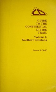
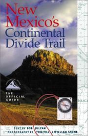
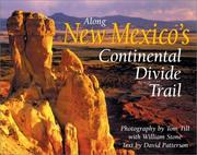


Search results from Open Library.
Recent natural events nearby
Ground air-quality sensors
Recently spotted species
Nearest stream gauge
Events
Gallery
Sources
- • Wikipedia
- • US Census Bureau (ACS 5-year estimates)
- • Wikidata
- • USGS Earthquake Catalog (global feed)
- • NCES via Urban Institute Education Data Portal
- • GBIF (Global Biodiversity Information Facility)
- • CDC PLACES
- • Open-Meteo / sunrise-sunset.org
- • Wikipedia Pageviews API
- • Open Library