Browse / United States / New Mexico / La Luz
La Luz
New MexicoCDP

La Luz
Total population
1,797
Median home value
$68,100
Bachelor's+
Median income
$46,655
Demographic figures from US Census Bureau · ACS 5-year estimates. Overview below cites Wikipedia and may reference a different year.
- Flood Watch · SevereFlood Watch issued September 24 at 12:18PM MDT until September 25 at 6:00AM MDT by NWS El Paso Tx/Santa Teresa NM
Source: NOAA National Weather Service.
City facts
Facts from Wikidata (CC0).
Overview
La Luz is a census-designated place (CDP) in Otero County, New Mexico, United States. As of the 2020 census, La Luz had a population of 1,578. It is located immediately north of Alamogordo and lies in the eastern edge of the Tularosa Basin and on the western flank of the Sacramento Mountains. Until 1848, La Luz was a part of Mexico. The CDP gets its name from the Spanish word for "light".
Read more on WikipediaHistory & geography
History
Native Americans lived in the area for thousands of years prior to the arrival of the Spanish in the late 16th Century. The Mescalero Apache homelands covered an area of south-central New Mexico including the Sacramento Mountains and the Tularosa Basin. Today, the ancestral homelands of the Apache have been reduced to those lands contained in the Mescalero Apache Reservation, approximately 30 miles northeast of La Luz. There is some dispute over the founding of La Luz. By some accounts, it was founded by Franciscan friars as early as the 18th Century and called Nuestra Señora De La Luz (Our Lady of the Light). Early maps of the area include this notation and La Luz Canyon may have served as an early pass over the Sacramento Mountains connecting with the Peñasco river, which eventually flows into the Pecos River near present-day Artesia, New Mexico. The Sacramento Mountains reach a height of 9,000 feet. It is well documented that a large group of Hispanic settlers came to the area around 1864 leaving villages along the Rio Grande in the vicinity of present-day Socorro, New Mexico, after devastating floods had occurred. These settlers founded the Village of Tularosa along the banks of Tularosa Creek and established a large acequia system and agricultural area. Anglo settlers arrived in increasing numbers in the area especially after the Civil War with some establishing large ranches in the Tularosa Basin and nearby areas to supply beef to nearby Fort Stanton. Increasing rivalries between various competing factions would result in the Lincoln County War. The arrival of the railroad in the area brought rapid change to the area. The railroad reached El Paso, ninety miles to the south, in 1882. Charles B. Eddy and partners constructed a branch line from El Paso northward…
Geography
According to the United States Census Bureau, the CDP has a total area of , all land. La Luz sits at the opening of La Luz Canyon Creek, whose headwaters are high in the Sacramento Mountains. The waters of La Luz and Fresnal creeks are used by both the much larger city of Alamogordo, just to the south of La Luz and by La Luz in a ditch or acequia system. The City of Alamogordo has constructed a large reservoir to the south of La Luz to impound these waters.
Excerpted from the corresponding Wikipedia article (CC BY-SA).
Demographics & economy
Race & ethnicity
Source: US Census Bureau — American Community Survey, 5-year estimates.
Geography
Coordinates & boundaries from the US Census TIGER/Line shapefiles.
Climate
Current forecast
Forecast for La Luz, NM from NOAA NWS API.
Air quality
Industrial & pollution facilities
Natural hazard risk
Health (adults)
Age-adjusted prevalence estimates from CDC PLACES (latest release).
Walkability
Amenities nearby
Wildlife & biodiversity
Most-observed species
- White-winged DoveZenaida asiatica (Linnaeus, 1758) · Aves2,118
- Larrea tridentata (DC.) Coult.Larrea tridentata (DC.) Coult. · Magnoliopsida1,938
- House FinchHaemorhous mexicanus (P.L.Statius Müller, 1776) · Aves1,762
- House SparrowPasser domesticus (Linnaeus, 1758) · Aves1,333
- Common RavenCorvus corax Linnaeus, 1758 · Aves1,144
- Dark-eyed JuncoJunco hyemalis (Linnaeus, 1758) · Aves1,131
- eagle-claw cactusEchinocactus horizonthalonius Lem. · Magnoliopsida1,109
- American RobinTurdus migratorius Linnaeus, 1766 · Aves1,029
Citizen-science & research observations from the Global Biodiversity Information Facility (GBIF).
Schools
Largest nearby schools
- ALAMOGORDO HIGHHigh · ALAMOGORDO · 1,579 students · 18.8:1 ratio
- CHAPARRAL MIDDLEMiddle · ALAMOGORDO · 627 students · 17.9:1 ratio
- MOUNTAIN VIEW MIDDLEMiddle · ALAMOGORDO · 502 students · 16.2:1 ratio
- SUNSET HILLS ELEMENTARYElementary · ALAMOGORDO · 466 students · 16.6:1 ratio
- DESERT STAR ELEMENTARYElementary · ALAMOGORDO · 464 students · 19.3:1 ratio
- SIERRA ELEMENTARYElementary · ALAMOGORDO · 301 students · 17.7:1 ratio
- TULAROSA HIGHHigh · TULAROSA · 272 students · 12.4:1 ratio
- TULAROSA INTERMEDIATEElementary · TULAROSA · 268 students · 14.1:1 ratio
Public K–12 schools within ~10 mi from Urban Institute Education Data Portal (NCES Common Core of Data, 2022).
Earthquake history
Most recent
- M 2.7 — 2025-05-066 km W of Nogal, New Mexico
- M 2.8 — 2025-01-0350 km NW of Tularosa, New Mexico
- M 3 — 2022-10-252 km NNE of La Luz, New Mexico
- M 2.7 — 2008-04-1617 km W of Carrizozo, New Mexico
- M 3.5 — 2004-11-1426 km NW of Tularosa, New Mexico
Events from the USGS Earthquake Catalog (global) (FDSN Event Web Service).
Photos
Sights & places nearby
Notable people from here


People born within ~10 km, from Wikidata (CC0). Click any name for their Wikipedia article.
Nearby places in New Mexico
- Tularosa8.4 mi away · pop. 2,597
- Boles Acres10.7 mi away · pop. 1,848
- Cloudcroft12.1 mi away · pop. 630
- Holloman AFB12.6 mi away
- Sacramento25.3 mi away
- Nogal41.3 mi away · pop. 80
- White Sands51.5 mi away · pop. 1,609
- Organ54 mi away · pop. 152
- University Park67.1 mi away · pop. 2,782
- Tortugas67.8 mi away · pop. 381
- Chaparral69.6 mi away · pop. 18,186
- Picacho Hills71 mi away · pop. 2,002
Geography & sun
Elevation, sunrise/sunset and daylight from Open-Meteo. Solar climatology from NASA POWER.
Nearby airports
Public attention
Pageview totals from the Wikimedia Pageviews API.
Books about La Luz

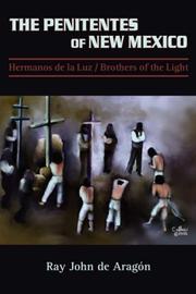



Search results from Open Library.
Recent natural events nearby
Ground air-quality sensors
Recently spotted species
Nearest stream gauge
Events
Gallery
Sources
- • Wikipedia
- • US Census Bureau (ACS 5-year estimates)
- • NOAA National Weather Service
- • Wikidata
- • USGS Earthquake Catalog (global feed)
- • NCES via Urban Institute Education Data Portal
- • GBIF (Global Biodiversity Information Facility)
- • CDC PLACES
- • Open-Meteo / sunrise-sunset.org
- • Wikipedia Pageviews API
- • Open Library