Browse / United States / Nevada / Fallon
Fallon
Nevadacity

Fallon
Total population
9,463
Median home value
$282,700
Bachelor's+
Median income
$73,389
Demographic figures from US Census Bureau · ACS 5-year estimates. Overview below cites Wikipedia and may reference a different year.
- Fire Weather Watch · SevereFire Weather Watch issued September 23 at 12:47PM PDT until September 25 at 10:00PM PDT by NWS Reno NV
Source: NOAA National Weather Service.
City facts
Sister cities
Facts from Wikidata (CC0).
Overview
Fallon is a city in Churchill County in the U.S. state of Nevada. The population was 9,327 at the time of the 2020 census. Fallon is the county seat of Churchill County and is located in the Lahontan Valley. Fallon is known for being home to Naval Air Station Fallon, located southeast of the city.
Read more on WikipediaHistory & geography
History
The community was first populated during the California Gold Rush, because multiple would-be Forty-niners stopped after crossing the Carson River. The town and post office were established on July 24, 1896, in a little shack belonging to Michael Fallon and Eliza Fallon, who operated a ranch at the site. Shortly afterwards, Jim Richards later operated a store near the post office. The town was officially incorporated in 1908.
Geography
Fallon is located in western Churchill County at the geographic coordinates (39.472792, −118.778826). It is in the Lahontan Valley, a former lakebed into which flows the Carson River, which passes north of the city. According to the United States Census Bureau, Fallon has a total area of , of which is land and , or 0.49%, is water. Fallon experiences a cool arid climate (Köppen BWk), with hot summers and cold winters. Due to Fallon's elevation and aridity, the diurnal temperature variation is quite substantial, especially in the summer months. Summer days can be hot, but temperatures are cooler than in deserts such as the Mojave, Sonoran, and Chihuahuan, due to Fallon's altitude and higher latitude. In the winter, daytime temperatures top freezing on all but eight afternoons, but nights can be bitterly cold, with 2.9 mornings falling to and a record low of on February 6, 1989. Fallon's climate is quite dry, due to its location in the rain shadow of the Sierra Nevada, with only half as much precipitation as Minden marginally further west, and only one-eleventh as much as Grass Valley on the other side of the Sierra. The wettest "rain year" was from July 1976 to June 1977 with and the driest from July 1949 to June 1950 with . The most precipitation in one month has been in May 1995, and the most in one day , which occurred twice on January 1, 1910 and May 28, 1913. Snowfall is extremely light because of the aridity: the most in one season is only between July 1988 and June 1989 and numerous seasons have passed without measurable snow. The most snow in one month has been in January 1916. Fallon can experience heavy fog in winter, known as pogonip.
Excerpted from the corresponding Wikipedia article (CC BY-SA).
Demographics & economy
Race & ethnicity
Source: US Census Bureau — American Community Survey, 5-year estimates.
Geography
Coordinates & boundaries from the US Census TIGER/Line shapefiles.
Climate
Current forecast
Forecast for Fallon, NV from NOAA NWS API.
Air quality
Industrial & pollution facilities
Natural hazard risk
Health (adults)
Age-adjusted prevalence estimates from CDC PLACES (latest release).
Walkability
Amenities nearby
Wildlife & biodiversity
Schools
Largest nearby schools
- Churchill County High SchoolHigh · Fallon · 1,054 students · 31:1 ratio
- Churchill County Middle SchoolMiddle · Fallon · 741 students · 20:1 ratio
- Oasis AcademyOther · Fallon · 735 students · 25.3:1 ratio
- Lahontan Elementary SchoolElementary · Fallon · 474 students · 16.3:1 ratio
- Numa Elementary SchoolElementary · Fallon · 469 students · 18:1 ratio
- E C Best ElementaryElementary · Fallon · 445 students · 16.5:1 ratio
- Northside Early Learning CenterOther · Fallon · 159 students · 15.9:1 ratio
- Churchill County Adult EdOther · Fallon · 52 students
Public K–12 schools within ~10 mi from Urban Institute Education Data Portal (NCES Common Core of Data, 2022).
Earthquake history
Photos
Sights & places nearby
Notable people from here


People born within ~10 km, from Wikidata (CC0). Click any name for their Wikipedia article.
Nearby places in Nevada
- Fallon Station5.2 mi away · pop. 1,399
- Fernley22.8 mi away · pop. 24,225
- Silver Springs24.1 mi away
- Wadsworth29.4 mi away · pop. 705
- Stagecoach33.2 mi away
- Schurz34.3 mi away
- Nixon39.4 mi away · pop. 305
- Yerington40 mi away · pop. 3,150
- Dayton43.3 mi away · pop. 15,781
- Virginia City47.9 mi away · pop. 644
- Silver City48.1 mi away · pop. 118
- Spanish Springs49.1 mi away · pop. 17,980
Geography & sun
Elevation, sunrise/sunset and daylight from Open-Meteo. Solar climatology from NASA POWER.
Nearby airports
Public attention
Pageview totals from the Wikimedia Pageviews API.
Books about Fallon
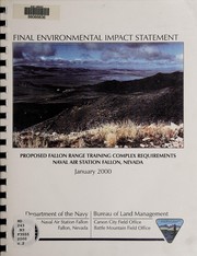


Search results from Open Library.
Recent natural events nearby
Ground air-quality sensors
Recently spotted species
Nearest stream gauge
Events
Gallery
Sources
- • Wikipedia
- • US Census Bureau (ACS 5-year estimates)
- • NOAA National Weather Service
- • Wikidata
- • NCES via Urban Institute Education Data Portal
- • CDC PLACES
- • Open-Elevation
- • Open-Meteo / sunrise-sunset.org
- • Wikipedia Pageviews API
- • Open Library