Browse / United States / New York / Hoosick Falls
Hoosick Falls
New Yorkvillage

Hoosick Falls
Total population
3,177
Median home value
$154,600
Bachelor's+
Median income
$48,214
Founded
1827
Demographic figures from US Census Bureau · ACS 5-year estimates. Overview below cites Wikipedia and may reference a different year.
City facts
Facts from Wikidata (CC0).
Overview
Hoosick Falls is a village in Rensselaer County, New York, United States. As of the 2020 census, Hoosick Falls had a population of 3,216. During its peak, in 1900, the village had a population of approximately 7,000.
Read more on WikipediaHistory & geography
History
Although this has been an issue of considerable debate, it's believed the first documented settlers came to Hoosick Falls, on the Hoosic River, around 1746. The French drove the settlers out in 1754 and most of the settlement was burned, but they returned and rebuilt after the French & Indian War ended. Hoosick Falls was incorporated as a village in 1827. In 1852, a blacksmith named Walter A. Wood began manufacturing a reaper in Hoosick Falls. By the 1890s, the Walter A. Wood Mowing & Reaping Company was the largest farm machinery manufacturer in the world, taking up 85 acres (340,000 m2) on the west bank of the river. The Wood Company closed in 1924, mainly due to the introduction of John Deere's revolutionary self propelled farm equipment. Most of these facilities were used by the Colasta Corporation, a radio parts manufacturer, from the mid-1920s until the late 1950s. Later, parts of this site were used as a lumber yard/hardware store. A rash of arson fires in the mid and late 1970s consumed the entire complex. The only buildings still in use today are outside of the main complex, the Interface Solutions Plant (formerly the Wood-Flong Paper Mill), which was Walter A Wood's steel foundry. The original Office Building is still present also. Along with the Walter Wood plant, Hoosick Falls was a boomtown in the 19th century. Many other businesses came to town, creating growth and prosperity. Hoosick Falls once had factories that made paper, small numbers of appliances, glass, and some nominal soda and beer bottling plants. A large number of rich Victorian homes were built during this period and are still there today, most in good shape. Hoosick Falls also served as a regional center of trade and export. Local farmers and manufacturers would come to town to sell their…
Geography
According to the United States Census Bureau, the village has a total area of , all land. The village is divided by the Hoosic River. Hoosick Falls is bisected by NY Route 22. Public transportation to and from the village is provided between Albany and Bennington, Vermont by Yankee Trails World Travel's weekday-running Albany-Bennington Shuttle bus.
Excerpted from the corresponding Wikipedia article (CC BY-SA).
Demographics & economy
Race & ethnicity
Source: US Census Bureau — American Community Survey, 5-year estimates.
Geography
Coordinates & boundaries from the US Census TIGER/Line shapefiles.
Climate
Current forecast
Forecast for Hoosick Falls, NY from NOAA NWS API.
Air quality
Industrial & pollution facilities
Natural hazard risk
Health (adults)
Walkability
Amenities nearby
Wildlife & biodiversity
Schools
Earthquake history
Photos
Sights & places nearby
Notable people from here


People born within ~10 km, from Wikidata (CC0). Click any name for their Wikipedia article.
Nearby places in New York
- Cambridge8.9 mi away · pop. 2,262
- Poestenkill17.6 mi away
- Green Island20.3 mi away · pop. 2,970
- Loudonville24.8 mi away
- East Nassau26.2 mi away
- North Ballston Spa26.7 mi away
- East Greenbush27.8 mi away
- Niskayuna28 mi away
- Nassau Lake28.3 mi away
- Nassau29.8 mi away
- Hudson Falls30.2 mi away · pop. 7,395
- Niverville34.7 mi away
Geography & sun
Elevation, sunrise/sunset and daylight from Open-Meteo. Solar climatology from NASA POWER.
Nearby airports
Public attention
Pageview totals from the Wikimedia Pageviews API.
Books about Hoosick Falls
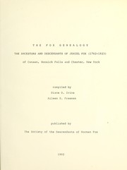


Search results from Open Library.
Recent natural events nearby
Ground air-quality sensors
Recently spotted species
Nearest stream gauge
Events
Gallery
Sources
- • Wikipedia
- • US Census Bureau (ACS 5-year estimates)
- • NOAA National Weather Service
- • Wikidata
- • Open-Meteo / sunrise-sunset.org
- • Wikipedia Pageviews API
- • Open Library