Browse / United States / New York / Jericho
Jericho
New YorkCDP

Jericho
Total population
13,759
Median home value
$948,400
Bachelor's+
Median income
$167,935
Demographic figures from US Census Bureau · ACS 5-year estimates. Overview below cites Wikipedia and may reference a different year.
City facts
Facts from Wikidata (CC0).
Overview
Jericho is a hamlet and census-designated place (CDP) located within the Town of Oyster Bay in Nassau County, on the North Shore of Long Island, in New York, United States, approximately 29 miles (47 km) east of Midtown Manhattan. The population was 14,808 at the time of the 2020 census.
Read more on WikipediaHistory & geography
History
Located in the Town of Oyster Bay, Jericho was part of the Robert Williams Plantation in 1648. The English families who settled in Jericho were, or soon became, Quakers, members of the Society of Friends. Many fled from persecution in England and in the New England Colonies. They sought a peaceful existence as farmers. The name of the area was changed in 1692 from Lusum to Jericho after the town in the Middle East near the Jordan River mentioned in the Bible as part of the Promised Land. The [https://upload.wikimedia.org/wikipedia/commons/3/32/Census_of_slaves%2C_1755._%28IA_censusofslaves1700ocal%29.pdf Census of slaves], conducted in the Province of New York in 1755, contains a long list of enslaved individuals in Oyster Bay, including the hamlets of Jericho and what is now North Hempstead. It is followed by a remarkable additional list of "free Negroes Melattoes [people of Afro-European ancestry] and Mustees [people of Afro-Indigenous ancestry] Resideing within ye Township of Oysterbay that may probably Be Likely In case of Insurrections To be as Mischevious as ye Slaves." (Free individuals were not supposed to be reported for the Census; a local militia captain supplied it on his own initiative, with the expectation "that ye Other Captains in Oysterbay will acquaint Your Honour [governor of New York] of those Resideing in ye Other parts of ye Township.") Slavery was abolished locally in 1817, with the help of Elias Hicks. (A Hempstead carpenter, Hicks had moved to his wife’s family's farm in Jericho in 1771, where he became a noted preacher of Quaker doctrine.) A post office was established in 1802, a cider mill in the mid-19th century, and the first public elementary school (known as the Cedar Swamp School) in 1905. Improvements to infrastructure were made with…
Geography
According to the United States Census Bureau, the CDP has a total area of , all land. There is another community known as Jericho in New York, located in the extreme northern corner of the state, in the Town of Altona, Clinton County. The main entrance to SUNY Old Westbury is located within Jericho. The local hardiness zone is 7a. Jericho consists of three villages and one unincorporated hamlet: * Jericho * Brookville * Upper Brookville * Old Brookville (part, with Greater Glen Cove).
Excerpted from the corresponding Wikipedia article (CC BY-SA).
Demographics & economy
Race & ethnicity
Source: US Census Bureau — American Community Survey, 5-year estimates.
Geography
Coordinates & boundaries from the US Census TIGER/Line shapefiles.
Climate
Air quality
Industrial & pollution facilities
Natural hazard risk
Health (adults)
Age-adjusted prevalence estimates from CDC PLACES (latest release).
Walkability
Amenities nearby
Wildlife & biodiversity
Schools
Largest nearby schools
- SYOSSET SENIOR HIGH SCHOOLHigh · SYOSSET · 2,266 students · 10.1:1 ratio
- FREEPORT HIGH SCHOOLHigh · FREEPORT · 2,264 students · 13.5:1 ratio
- UNIONDALE HIGH SCHOOLHigh · UNIONDALE · 2,080 students · 11.6:1 ratio
- ACADEMY CHARTER SCHOOLOther · HEMPSTEAD · 1,880 students · 17.1:1 ratio
- HEMPSTEAD HIGH SCHOOLHigh · HEMPSTEAD · 1,866 students · 23.6:1 ratio
- HICKSVILLE HIGH SCHOOLHigh · HICKSVILLE · 1,852 students · 13:1 ratio
- NEW HYDE PARK MEMORIAL HIGH SCHOOLHigh · NEW HYDE PARK · 1,727 students · 13.7:1 ratio
- NASSAU BOCESOther · GARDEN CITY · 1,712 students · 4.4:1 ratio
Public K–12 schools within ~10 mi from Urban Institute Education Data Portal (NCES Common Core of Data, 2022).
Earthquake history
Photos
Sights & places nearby
Notable people from here
Nearby places in New York
- Muttontown2.6 mi away
- Old Westbury2.9 mi away
- Plainview3.6 mi away
- Bethpage3.9 mi away · pop. 17,123
- East Norwich4.3 mi away · pop. 2,697
- Carle Place4.5 mi away · pop. 5,188
- Levittown4.6 mi away · pop. 51,904
- East Meadow4.7 mi away · pop. 36,821
- Greenvale4.7 mi away · pop. 1,113
- Old Brookville4.7 mi away
- Old Bethpage5 mi away
- Matinecock5.4 mi away
Geography & sun
Elevation, sunrise/sunset and daylight from Open-Meteo. Solar climatology from NASA POWER.
Nearby airports
Public attention
Pageview totals from the Wikimedia Pageviews API.
Books about Jericho
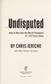

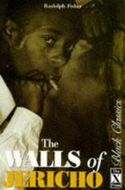
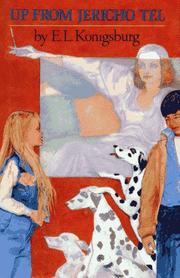
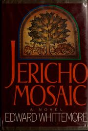

Search results from Open Library.
Recent natural events nearby
Ground air-quality sensors
Recently spotted species
Nearest stream gauge
Events
Gallery
Sources
- • Wikipedia
- • US Census Bureau (ACS 5-year estimates)
- • Wikidata
- • NCES via Urban Institute Education Data Portal
- • CDC PLACES
- • Open-Meteo / sunrise-sunset.org
- • Wikipedia Pageviews API
- • Open Library