Browse / United States / Ohio / Lakewood
Lakewood
Ohiocity

Lakewood
Total population
50,007
Median home value
$262,200
Bachelor's+
Median income
$68,954
Founded
1889
Demographic figures from US Census Bureau · ACS 5-year estimates. Overview below cites Wikipedia and may reference a different year.
- Beach Hazards Statement · ModerateBeach Hazards Statement issued September 22 at 1:27PM EDT until September 23 at 10:00PM EDT by NWS Cleveland OH
Source: NOAA National Weather Service.
City facts
Facts from Wikidata (CC0).
Overview
Lakewood is a city in Cuyahoga County, Ohio, United States, on the southern shore of Lake Erie. Established in 1889, it is one of Cleveland's historical streetcar suburbs and part of the Cleveland metropolitan area. The population was 50,942 at the 2020 census, making it the third largest city in Cuyahoga County, behind Cleveland and Parma.
Read more on WikipediaHistory & geography
History
The area now called Lakewood was populated by the Ottawa, Potawatomi, Chippewa, Wyandot, Munsee, Delaware and Shawnee tribes until the Treaty of Ft. Industry pushed them west in 1805. Prior to the treaty, American settlers were prohibited from moving west of the Cuyahoga River. The treaty ceded 500,000 acres of some of the tribes' land to the United States for about $18,000 or 3.5 cents/acre. The Shawnee and Seneca, living with the Wyandot, were to get $1000 "...every year forever hereafter." In 1806, the area was formally surveyed as Rockport Township, Township 7, Range 14, of the Connecticut Western Reserve. It was purchased from the Connecticut Land Company by a syndicate of six men headed by Judson Canfield on April 4, 1807, for $26,084. In 1818, permanent settlement began with the arrival from Connecticut of James Nicholson. Other early pioneers included Jared Kirtland and Mars Wagar. Settlements were mostly along Detroit Avenue, a toll road operated by the Rockport Plank Company from 1848 to 1901, with large farms and properties extending north to Lake Erie. Making bricks and planting orchards were among the most prolific occupations until natural gas and crude oil wells were developed in the early 1880s. Current street names reflect this history such as Orchard Grove and Blossom Park. The most common occupations in Lakewood were farming and the building trades. A toll road was established from Cleveland to Lakewood by the Rockport Plank Road Company, operating from 1848 to 1901. Lakewood was incorporated as a village in 1889, and named for its lakefront location. In 1893, streetcars came from Cleveland to Lakewood with the construction of the Detroit Avenue line, followed by the Clifton Boulevard line in 1903 and the Madison Avenue line in 1916. Under the…
Geography
Lakewood is located about west of Downtown Cleveland. The city borders Lake Erie to the north, the Cleveland neighborhoods of Edgewater and Cudell to the east, and the neighborhoods of Jefferson and Kamm's Corners to the south. It borders the suburb of Rocky River to the west at the Rocky River valley. According to the United States Census Bureau, the city has a total area of , of which is land and is water. Historical housing throughout the city and an active historical society are the norm in Lakewood. The "Make Lakewood Beautiful" program involves contests in which residents compete to make their homes look and resemble their original design and architecture, and awards are given to several homeowners each year. The city offers tours of the most famous homes in the spring, summer, and fall. * Arts District - Centered around the Beck Center for the Arts, on the west side of Lakewood. * Birdtown - Southeastern corner of Lakewood, a well-known 8-street residential district on the southeast side of the city that was built specifically for the workers of the nearby National Carbon Company in the 1890s. The houses are distinctive and most of the streets are named after birds. Birdtown was designated a National Register Historic District in 2006. It is adjacent to Madison Park, the former Union Carbide factory, and the W. 117th St. Rapid Transit Station. Birdtown achieved National Historic Register status in 2006. * Clifton Boulevard - Lined with big trees and multi-family homes, apartment complexes, and 4×4 brick structures, and turn of the century single family colonials, the seven-lane Clifton Boulevard is one of the busiest streets in greater Cleveland. * Clifton Park - The wealthiest neighborhood of Lakewood is situated in the northwestern corner of the city, and…
Excerpted from the corresponding Wikipedia article (CC BY-SA).
Demographics & economy
Race & ethnicity
Source: US Census Bureau — American Community Survey, 5-year estimates.
Geography
Coordinates & boundaries from the US Census TIGER/Line shapefiles.
Climate
Current forecast
Forecast for Lakewood, OH from NOAA NWS API.
Air quality
Industrial & pollution facilities
Natural hazard risk
Health (adults)
Age-adjusted prevalence estimates from CDC PLACES (latest release).
Walkability
Amenities nearby
Wildlife & biodiversity
Most-observed species
- American RobinTurdus migratorius Linnaeus, 1766 · Aves48,037
- Northern CardinalCardinalis cardinalis (Linnaeus, 1758) · Aves42,937
- Blue JayCyanocitta cristata (Linnaeus, 1758) · Aves41,810
- Ring-billed GullLarus delawarensis Ord, 1815 · Aves34,469
- Canada Goose (canadensis Group)Branta canadensis (Linnaeus, 1758) · Aves33,373
- American GoldfinchSpinus tristis (Linnaeus, 1758) · Aves32,997
- Red-winged BlackbirdAgelaius phoeniceus (Linnaeus, 1766) · Aves32,693
- MallardAnas platyrhynchos Linnaeus, 1758 · Aves32,525
Citizen-science & research observations from the Global Biodiversity Information Facility (GBIF).
Schools
Earthquake history
Most recent
- M 2.9 — 2026-03-053 km SW of Madison, Ohio
- M 2.7 — 2026-01-064 km ENE of North Madison, Ohio
- M 2.5 — 2025-05-124 km ESE of Madison, Ohio
- M 2.6 — 2024-06-011 km E of Madison, Ohio
- M 3 — 2024-03-302 km SSW of Maple Ridge, Ohio
- M 2.6 — 2024-01-053 km SE of Madison, Ohio
Events from the USGS Earthquake Catalog (global) (FDSN Event Web Service).
Photos
Sights & places nearby
Notable people from here


People born within ~10 km, from Wikidata (CC0). Click any name for their Wikipedia article.
Nearby places in Ohio
- Fairview Park3.9 mi away · pop. 17,018
- Middleburg Heights7.9 mi away
- Lyndhurst16 mi away
- Euclid16.4 mi away · pop. 48,823
- Northfield17.4 mi away
- Oakwood17.4 mi away · pop. 3,518
- Pepper Pike17.7 mi away
- Macedonia19.4 mi away
- Mayfield19.5 mi away
- Gates Mills20.4 mi away · pop. 2,207
- Bentleyville20.7 mi away
- Peninsula21.5 mi away
Geography & sun
Elevation, sunrise/sunset and daylight from Open-Meteo. Solar climatology from NASA POWER.
Nearby airports
Public attention
Pageview totals from the Wikimedia Pageviews API.
Books about Lakewood

Search results from Open Library.
Recent natural events nearby
Ground air-quality sensors
Recently spotted species



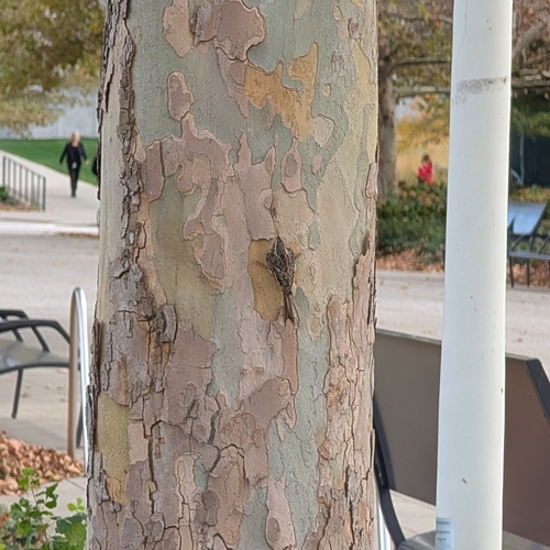





Research-grade observations from iNaturalist (within ~15 mi).
Nearest stream gauge
Live readings from USGS NWIS · measured 2026-10-16 12:00 UTC.
Events
Gallery
Sources
- • Wikipedia
- • US Census Bureau (ACS 5-year estimates)
- • NOAA National Weather Service
- • Wikidata
- • USGS Earthquake Catalog (global feed)
- • USGS NWIS (water data)
- • GBIF (Global Biodiversity Information Facility)
- • iNaturalist
- • CDC PLACES
- • Open-Meteo / sunrise-sunset.org
- • Wikipedia Pageviews API
- • Open Library