Browse / United States / Ohio / Mansfield
Mansfield
Ohiocity

Mansfield
Total population
47,663
Median home value
$119,600
Bachelor's+
Median income
$44,540
Founded
1808
Demographic figures from US Census Bureau · ACS 5-year estimates. Overview below cites Wikipedia and may reference a different year.
- Freeze Watch · SevereFreeze Watch issued October 16 at 12:36PM EDT until October 18 at 9:00AM EDT by NWS Cleveland OH
Source: NOAA National Weather Service.
City facts
Sister cities
Facts from Wikidata (CC0).
Overview
Mansfield is a city in Richland County, Ohio, United States, and its county seat. The population was 47,534 at the 2020 census. Located approximately halfway between Cleveland and Columbus via Interstate 71, it is part of the Northeast Ohio region in the western foothills of the Allegheny Plateau.
Read more on WikipediaHistory & geography
History
Mansfield was laid out and founded by James Hedges, Joseph Larwell, and Jacob Newman, and was platted in June 1808 as a settlement. It was named for Colonel Jared Mansfield, the United States Surveyor General who directed its planning. It was originally platted as a square, known today as the public square or Central Park. At that time, there were less than a dozen settlers in Richland County and Ohio was still largely wilderness. The blockhouse was later used as a school with Eliza Wolf being its teacher. Between 1846 and 1863, the railroads came to the city with the Sandusky, Mansfield and Newark Railroad being the first railroad to reach Mansfield in 1846, the Pittsburgh, Fort Wayne and Chicago Railway in 1849, and the Atlantic and Great Western Railroad in 1863. The city was a center of manufacturing and trade in the late 1880s thanks to the four railroads that passed through the community. Dozens of manufacturing businesses operated in the city, producing goods like brass objects, doors, linseed oil, paper boxes, suspenders, and numerous other items. Mansfield's largest employer in 1888 was a cigar maker, Hautzenroeder & Company, that had 285 workers employed. In 1888, Frank B. Black borrowed $5,000 from relatives to start Ohio Brass Company, a foundry specializing in brass and bronze castings, stem brass goods, electric railway supplies and more. By 1890, 13,473 people lived in the city. By 1908, the blockhouse became a symbol of Mansfield's heritage during its 100th birthday celebration, and in 1929, the blockhouse was relocated to its present location at South Park. During the 1920s and 1930s, the Mansfield tire brand stood shoulder to shoulder with Goodyear, Goodrich, Firestone and Uniroyal, the "Big Four" tire name brands in the industry at the time. In…
Geography
Mansfield is located at (40.754856, −82.522855), directly between Columbus and Cleveland, however, the city lies in the western foothills of the Allegheny Plateau, and its elevation is among the highest of Ohio cities. The highest point in the city above sea level is located at the Woodland Reservoir, an underground water storage (service reservoir) along Woodland Road in southwest Mansfield. The elevation in downtown Mansfield, which is located at Central Park is above sea level, and at Mansfield Lahm Airport, the elevation is above sea level. The highest point in Richland County, second highest point in Ohio (after Campbell Hill) is between and above sea level is located southwest of the city, just off Lexington-Ontario Road at Apple Hill Orchards in Springfield Township. According to the United States Census Bureau, the city has a total area of , of which, is land and is water. Mansfield is bordered by Madison Township to the east, northwest and southwest, Franklin Township to the north, Weller Township to the northeast, Washington Township to the south, Troy Township to the southwest, Springfield Township and the suburban city of Ontario to the west. Mansfield has a humid continental climate (Köppen Dfa), typical of the Midwest, with four distinct seasons. Winters are cold and dry but typically bring a mix of rain, sleet, and snow with occasional heavy snowfall and icing. January is the coldest month with an average mean temperature of , Another notable snowstorm to impact the region was the Great Blizzard of 1978. The snowiest month on record was in February 2010, while winter snowfall amounts have ranged from in 1995–96 to in 1932–33. Springs are short with rapid transition from hard winter to sometimes very warm, and humid conditions. Summers are…
Excerpted from the corresponding Wikipedia article (CC BY-SA).
Demographics & economy
Race & ethnicity
Source: US Census Bureau — American Community Survey, 5-year estimates.
Geography
Coordinates & boundaries from the US Census TIGER/Line shapefiles.
Climate
Current forecast
Forecast for Mansfield, OH from NOAA NWS API.
Air quality
Industrial & pollution facilities
Natural hazard risk
Health (adults)
Walkability
Amenities nearby
Wildlife & biodiversity
Most-observed species
- American CrowCorvus brachyrhynchos C.L.Brehm, 1822 · Aves10,229
- Northern CardinalCardinalis cardinalis (Linnaeus, 1758) · Aves9,058
- Blue JayCyanocitta cristata (Linnaeus, 1758) · Aves8,099
- Song SparrowMelospiza melodia (A.Wilson, 1810) · Aves7,018
- Canada Goose (canadensis Group)Branta canadensis (Linnaeus, 1758) · Aves6,981
- American RobinTurdus migratorius Linnaeus, 1766 · Aves6,891
- Red-bellied WoodpeckerMelanerpes carolinus (Linnaeus, 1758) · Aves6,607
- Tufted TitmouseBaeolophus bicolor (Linnaeus, 1766) · Aves6,117
Citizen-science & research observations from the Global Biodiversity Information Facility (GBIF).
Schools
Earthquake history
Most recent
- M 3 — 2011-06-055 km W of Lodi, Ohio
- M 2.7 — 2010-05-141 km ENE of Gibsonburg, Ohio
Events from the USGS Earthquake Catalog (global) (FDSN Event Web Service).
Photos
Sights & places nearby
Notable people from here


People born within ~10 km, from Wikidata (CC0). Click any name for their Wikipedia article.
Nearby places in Ohio
- Roseland1.6 mi away
- Ontario4.4 mi away
- Lucas7.2 mi away · pop. 593
- Bellville10.3 mi away · pop. 2,086
- Ashland13.2 mi away · pop. 18,911
- Butler13.5 mi away · pop. 1,146
- Perrysville13.6 mi away · pop. 822
- Candlewood Lake16.2 mi away
- Jeromesville17.7 mi away
- Loudonville18.1 mi away · pop. 3,230
- Hidden Lakes19.4 mi away
- Fredericktown19.9 mi away
Geography & sun
Elevation, sunrise/sunset and daylight from Open-Meteo. Solar climatology from NASA POWER.
Nearby airports
Public attention
Pageview totals from the Wikimedia Pageviews API.
Books about Mansfield

Search results from Open Library.
Recent natural events nearby
Ground air-quality sensors
Recently spotted species




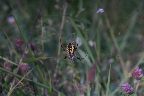

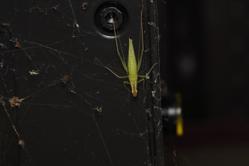
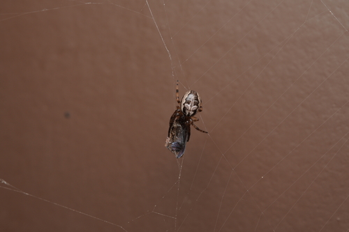
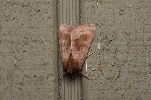
Research-grade observations from iNaturalist (within ~15 mi).
Nearest stream gauge
Events
Gallery
Sources
- • Wikipedia
- • US Census Bureau (ACS 5-year estimates)
- • NOAA National Weather Service
- • Wikidata
- • USGS Earthquake Catalog (global feed)
- • GBIF (Global Biodiversity Information Facility)
- • iNaturalist
- • Open-Meteo / sunrise-sunset.org
- • Wikipedia Pageviews API
- • Open Library