Browse / United States / Ohio / Piqua
Piqua
Ohiocity

Piqua
Total population
20,646
Median home value
$138,600
Bachelor's+
Median income
$67,796
Founded
1807
Demographic figures from US Census Bureau · ACS 5-year estimates. Overview below cites Wikipedia and may reference a different year.
City facts
Facts from Wikidata (CC0).
Overview
Piqua is a city in Miami County, Ohio, United States, along the Great Miami River. The population was 20,354 at the 2020 census. Located 27 miles (43 km) north of Dayton, it is part of the Dayton metropolitan area.
Read more on WikipediaHistory & geography
History
The word 'Piqua' is believed to be derived from a Shawnee language phrase: Othath-He-Waugh-Pe-Qua, translated as "He has risen from the ashes," related to a legend of the people. It became associated with the Pekowi, one of the five divisions of the Shawnee people, who were eventually known as the Piqua. In 1749, Fort Pickawillany was constructed by the British to protect their trading post at a Miami village of the same name. It was located at the confluence of Loramie Creek and the Great Miami River. In 1752, Charles de Langlade, an Odawa war chief of partial French Canadian descent, attacked the fort. He led more than 240 Odawa and Ojibwe warriors allied with French forces against the British and the Miami village in the Battle of Pickawillany. The Miami chief and a British trader were killed in the conflict. After the battle, the British and Miami abandoned this site. The Miami rebuilt Pickawillany, and Piqua later developed near their village. The British soon took over the area after defeating the French in the French and Indian War. Until 1780, Piqua had been the capital town of the Shawnee located on the Mad River about 23 miles southeast of the modern town (near Springfield). That year, an expedition by Gen. George Rogers Clark culminated in the Battle of Piqua, after which the town and surrounding fields were burned. The Shawnee relocated north and west to the Great Miami River. Piqua was settled as two separate Shawnee villages late in 1780, known as Upper Piqua and Lower Piqua. In 1790, General Harmar found the site on the Great Miami River abandoned and in ruins, as did General Wayne in 1794. As Gen. Anthony Wayne's Legion was returning to Greenville via Loramie's trading post and Piqua at the termination of their Indian Country campaign in fall…
Geography
According to the United States Census Bureau, the city has a total area of , of which is land and is water. The Great Miami River runs through Piqua. The area at the south end of town on the east side of the river is known as Shawnee.
Excerpted from the corresponding Wikipedia article (CC BY-SA).
Demographics & economy
Race & ethnicity
Source: US Census Bureau — American Community Survey, 5-year estimates.
Geography
Coordinates & boundaries from the US Census TIGER/Line shapefiles.
Climate
Current forecast
Forecast for Piqua, OH from NOAA NWS API.
Air quality
Industrial & pollution facilities
Natural hazard risk
Health (adults)
Age-adjusted prevalence estimates from CDC PLACES (latest release).
Walkability
Amenities nearby
Wildlife & biodiversity
Most-observed species
- Northern CardinalCardinalis cardinalis (Linnaeus, 1758) · Aves4,549
- Red-bellied WoodpeckerMelanerpes carolinus (Linnaeus, 1758) · Aves3,656
- Carolina ChickadeePoecile carolinensis (Audubon, 1834) · Aves3,639
- Blue JayCyanocitta cristata (Linnaeus, 1758) · Aves3,480
- American GoldfinchSpinus tristis (Linnaeus, 1758) · Aves3,338
- American RobinTurdus migratorius Linnaeus, 1766 · Aves3,323
- White-breasted NuthatchSitta carolinensis Latham, 1790 · Aves3,150
- Downy WoodpeckerDryobates pubescens (Linnaeus, 1766) · Aves2,950
Citizen-science & research observations from the Global Biodiversity Information Facility (GBIF).
Schools
Earthquake history
Most recent
- M 2.9 — 2023-12-095 km W of Jackson Center, Ohio
- M 2.8 — 2008-09-305 km SW of Kettlersville, Ohio
- M 2.5 — 2006-08-153 km NE of Fort Shawnee, Ohio
- M 2.8 — 2006-05-122 km E of Lima, Ohio
- M 2.5 — 2004-01-302 km S of Rockford, Ohio
Events from the USGS Earthquake Catalog (global) (FDSN Event Web Service).
Photos
Sights & places nearby
Notable people from here
Nearby places in Ohio
Geography & sun
Elevation, sunrise/sunset and daylight from Open-Meteo. Solar climatology from NASA POWER.
Nearby airports
Public attention
Pageview totals from the Wikimedia Pageviews API.
Books about Piqua
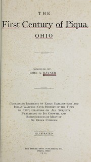
Search results from Open Library.
Recent natural events nearby
Ground air-quality sensors
Recently spotted species
Nearest stream gauge
Events
Gallery
Sources
- • Wikipedia
- • US Census Bureau (ACS 5-year estimates)
- • NOAA National Weather Service
- • Wikidata
- • USGS Earthquake Catalog (global feed)
- • GBIF (Global Biodiversity Information Facility)
- • CDC PLACES
- • Open-Meteo / sunrise-sunset.org
- • Wikipedia Pageviews API
- • Open Library