Browse / United States / Oklahoma / Vinita
Vinita
Oklahomacity

Vinita
Total population
5,300
Median home value
$96,200
Bachelor's+
Median income
$47,025
Founded
1871
Demographic figures from US Census Bureau · ACS 5-year estimates. Overview below cites Wikipedia and may reference a different year.
City facts
Facts from Wikidata (CC0).
Overview
Vinita is a city in and the county seat of Craig County, Oklahoma, United States. As of the 2020 census, the population was 5,193.
Read more on WikipediaHistory & geography
History
Vinita was founded in 1870 by Elias Cornelius Boudinot. In 1889, gunman and lawman Tom Threepersons was born there. It was the first city in the state with electricity. The city was first named "Downingville", and was a primarily Native American community. It was later renamed "Vinita" after Boudinot's friend, sculptor Vinnie Ream. The city was incorporated in Indian Territory in 1898. Vinita is along the path of the Texas Road cattle trail, and the later Jefferson Highway of the early National Trail System, both roughly along the route of U.S. Route 69 through Oklahoma today. The First National Bank opened in 1892, and the local Masonic Lodge was founded in 1894. Newspapers founded before the turn of the 20th Century included Vinita Indian Chieftain (1882), Vinita Leader (1885) and the Daily Indian Chieftain (1899). The Vinita Daily Journal began publication in 1907 and has continued into the 21st Century.
Geography
Vinita is located in northeastern Oklahoma, a region of the state known as Green Country. According to the Vinita Chamber of Commerce, the town is often called the "Crossroads to Green Country." It sits at the base of the Ozark Highlands topographical region in a mix of prairie and forest. It is located in southern Craig County. According to the United States Census Bureau, the city has a total area of , all land. Vinita is in a valley. Vinita is northeast of Tulsa and southwest of Joplin, Missouri, both via Interstate 44.
Excerpted from the corresponding Wikipedia article (CC BY-SA).
Demographics & economy
Race & ethnicity
Source: US Census Bureau — American Community Survey, 5-year estimates.
Geography
Coordinates & boundaries from the US Census TIGER/Line shapefiles.
Climate
Current forecast
Forecast for Vinita, OK from NOAA NWS API.
Air quality
Industrial & pollution facilities
Natural hazard risk
Health (adults)
Age-adjusted prevalence estimates from CDC PLACES (latest release).
Walkability
Amenities nearby
Wildlife & biodiversity
Schools
Largest nearby schools
- VINITA ESElementary · Vinita · 595 students · 15.7:1 ratio
- VINITA HSHigh · Vinita · 419 students · 18.2:1 ratio
- EWING HALSELL MSMiddle · Vinita · 307 students · 17.1:1 ratio
- WHITE OAK PUBLIC SCHOOLElementary · Vinita · 51 students · 12.8:1 ratio
Public K–12 schools within ~10 mi from Urban Institute Education Data Portal (NCES Common Core of Data, 2022).
Earthquake history
Photos
Sights & places nearby
Notable people from here


People born within ~10 km, from Wikidata (CC0). Click any name for their Wikipedia article.
Nearby places in Oklahoma
- White Oak6.9 mi away
- Big Cabin8.1 mi away · pop. 195
- Bluejacket11.5 mi away · pop. 237
- Pensacola13.2 mi away
- Sportmans Shores13.5 mi away
- Disney14.4 mi away · pop. 182
- Narcissa16.7 mi away
- Chelsea17.2 mi away · pop. 1,880
- Dennis17.2 mi away
- Copeland18.5 mi away · pop. 1,401
- Spavinaw18.7 mi away
- Zena19.9 mi away
Geography & sun
Elevation, sunrise/sunset and daylight from Open-Meteo. Solar climatology from NASA POWER.
Nearby airports
Public attention
Pageview totals from the Wikimedia Pageviews API.
Books about Vinita

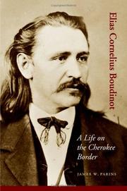


Search results from Open Library.
Recent natural events nearby
Ground air-quality sensors
Recently spotted species
Nearest stream gauge
Events
Gallery
Sources
- • Wikipedia
- • US Census Bureau (ACS 5-year estimates)
- • NOAA National Weather Service
- • Wikidata
- • NCES via Urban Institute Education Data Portal
- • CDC PLACES
- • Open-Meteo / sunrise-sunset.org
- • Wikipedia Pageviews API
- • Open Library