Browse / United States / Pennsylvania / Summit Hill
Summit Hill
Pennsylvaniaborough

Summit Hill
Total population
3,137
Median home value
$99,700
Bachelor's+
Median income
$65,268
Demographic figures from US Census Bureau · ACS 5-year estimates. Overview below cites Wikipedia and may reference a different year.
City facts
Overview
Summit Hill is a borough in Carbon County, Pennsylvania, United States. It is part of Northeastern Pennsylvania. As of the 2020 census, Summit Hill had a population of 3,120.
Read more on WikipediaHistory & geography
History
Anthracite coal was discovered on the ridgeline of Sharpe Mountain (now known as Pisgah Mountain) in 1791 by a hunter. along the northeast-to-southwest-running ridgeline of Pisgah Mountain lying several hundred feet below the ridge on the north slope in an area that became the boroughs of Summit Hill and Lansford. Summit Hill High School was added to the National Register of Historic Places in 2001.
Geography
Summit Hill is located in western Carbon County at (40.827420, -75.865892). The main development of the borough is on the crest of Pisgah Mountain, but the borough limits extend north to the ridgecrest of Nesquehoning Mountain, south to the far side of Mauch Chunk Mountain, and east to cover most of Mauch Chunk Lake. Also on the northern border is the borough of Lansford, while Tamaqua in Schuylkill County is on the western border. According to the U.S. Census Bureau, Summit Hill borough has a total area of , of which is land and , or 4.54%, is water. Summit Hill is located southwest of Jim Thorpe and 1 mile south of Lansford. Summit Hill's elevation varies from above sea level in the borough center to at the highest point on Pisgah Mountain to at Mauch Chunk Lake.
Excerpted from the corresponding Wikipedia article (CC BY-SA).
Demographics & economy
Race & ethnicity
Source: US Census Bureau — American Community Survey, 5-year estimates.
Geography
Coordinates & boundaries from the US Census TIGER/Line shapefiles.
Climate
Current forecast
Forecast for Summit Hill, PA from NOAA NWS API.
Air quality
Industrial & pollution facilities
Natural hazard risk
Health (adults)
Walkability
Amenities nearby
Wildlife & biodiversity
Schools
Largest nearby schools
- Lehighton Area Elementary CenterElementary · Lehighton · 998 students · 13.7:1 ratio
- Panther Valley JSHSHigh · Lansford · 771 students · 18.4:1 ratio
- Lehighton Area HSHigh · Lehighton · 660 students · 10.3:1 ratio
- L B Morris El SchElementary · Jim Thorpe · 624 students · 12.5:1 ratio
- Panther Valley El SchElementary · Nesquehoning · 622 students · 15.6:1 ratio
- Jim Thorpe Area HSHigh · Jim Thorpe · 565 students · 14.1:1 ratio
- Lehighton Area MSMiddle · Lehighton · 513 students · 10.3:1 ratio
- Panther Valley Intermediate SchMiddle · Lansford · 417 students · 17.4:1 ratio
Public K–12 schools within ~10 mi from Urban Institute Education Data Portal (NCES Common Core of Data, 2022).
Earthquake history
Photos
Sights & places nearby
Notable people from here
Nearby places in Pennsylvania
- Lansford2.1 mi away · pop. 4,156
- Beaver Meadows8 mi away
- Hazleton10.9 mi away · pop. 30,111
- Delano11.6 mi away
- Maryd11.9 mi away · pop. 164
- Harleigh12.9 mi away · pop. 1,389
- Freeland13.8 mi away
- Mahanoy City15.3 mi away
- East Side17 mi away · pop. 457
- Cherryville17.1 mi away
- Albrightsville18 mi away
- Holiday Pocono18.8 mi away
Geography & sun
Elevation, sunrise/sunset and daylight from Open-Meteo. Solar climatology from NASA POWER.
Nearby airports
Public attention
Pageview totals from the Wikimedia Pageviews API.
Books about Summit Hill
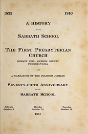

Search results from Open Library.
Recent natural events nearby
Ground air-quality sensors
Recently spotted species
Nearest stream gauge
Events
Gallery
Sources
- • Wikipedia
- • US Census Bureau (ACS 5-year estimates)
- • NOAA National Weather Service
- • NCES via Urban Institute Education Data Portal
- • Open-Meteo / sunrise-sunset.org
- • Wikipedia Pageviews API
- • Open Library