Browse / Portugal / Faro / Olhão
Olhão
Farocity

Olhão
Total population
29,556
Demographic figures from INE Portugal. Overview below cites Wikipedia and may reference a different year.
City facts
Sister cities
Facts from Wikidata (CC0).
Overview
Olhão, officially the City of Olhão da Restauração, is a city and municipality in the Algarve region of southern Portugal. The population of the municipality in 2011 was 45,396, in an area of 130.86 km2 (50.53 sq mi). Located near the regional capital Faro and forming a single urban agglomeration, it is a fishing port and tourist center. Along with Faro, Loulé and Tavira, Olhão forms a conurbation from the eastern and central Algarve.
Read more on WikipediaHistory & geography
History
Since pre-history, Olhão has had vestiges of human occupation, although the oldest written record dates only from 1378, referring to a place called Olham. The estuary and abundance of water were decisive factors that influenced fishermen, at the beginning of the 17th century, to congregate along the beach of Olhão. The settlement developed even as officials in Faro discouraged concentration along this coast. Yet, after the middle of the 17th century, growth was driven by the protection offered by the Fort of São Lourenço do Bugio, which guarded the coast and entrance to the estuary, discouraging attacks from corsairs. The incremental growth of the fishery along the coast and sea, and commercial enterprises associated their growth, provoked a leap in population. As a result, in 1695, the residents requested from the Bishop of Faro, that Olhão should be de-annexed from the parish of Quelfes: resulting in the formation of the parish of Nossa Senhora do Rosário de Olhão. During the French occupation of the Algarve, during the Peninsular Wars, Olhão was notable for one of the few public uprisings against the occupiers, occurring on 16 June 1808. This revolt culminated in the expulsion of the French from Olhão and, as a result, from the rest of the Algarve. It was during this period, that a month later, a small group of 17 men embarked to Brazil, a Portuguese territory in South America where the king was living due to the French invasion, on a caique (a small sailing vessel) named Bom Sucesso, in the hope of promoting the Algarvean success to the Portuguese Court. The crew brought an ex-official statement describing the audacious attitude of the Olhanese revolt. A replica of the boat is moored at Olhão's waterfront. In recompense, a regal charter (with the force of law)…
Geography
The municipality is confronted on the east and north by the municipality of Tavira, to the west by the municipality of Faro and in the south by the Atlantic Ocean. It is located within the morphological sub-regions of the Barrocal and coast. In the Barrocal, the municipality is limited in the north by the old massif and south with the sand-stones of the Mesozoic. * Moncarapacho e Fuseta * Olhão * Pechão * Quelfes
Excerpted from the corresponding Wikipedia article (CC BY-SA).
Geography
Coordinates & boundaries from the US Census TIGER/Line shapefiles.
Climate
Air quality
Walkability
Amenities nearby
Wildlife & biodiversity
Earthquake history
Photos
Sights & places nearby
Notable people from here


People born within ~10 km, from Wikidata (CC0). Click any name for their Wikipedia article.
Nearby places in Faro
- Quelfes2.4 mi away
- Conceição4.8 mi away · pop. 636
- Moncarapacho4.9 mi away · pop. 1,192
- Santo Estêvão9.8 mi away
- Querença14.3 mi away · pop. 35
- Cabanas de Tavira15.3 mi away
- Vale Judeu15.4 mi away · pop. 716
- Monte Poço16 mi away · pop. 147
- Vaqueiros25.5 mi away · pop. 58
- Algoz27.1 mi away · pop. 1,987
- Azinhal27.4 mi away · pop. 271
- Pera28.3 mi away · pop. 1,379
Geography & sun
Elevation, sunrise/sunset and daylight from Open-Meteo. Solar climatology from NASA POWER.
Nearby airports
Public attention
Pageview totals from the Wikimedia Pageviews API.
Books about Olhão
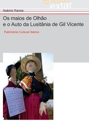
Search results from Open Library.
Recent natural events nearby
Ground air-quality sensors
Recently spotted species
Events
Gallery
Sources
- • Wikipedia
- • Wikidata
- • Open-Meteo / sunrise-sunset.org
- • Wikipedia Pageviews API
- • Open Library
- • Wikidata SPARQL (CC0) — population, area, elevation, inception, head of government, Commons image