Browse / United States / Rhode Island / Providence
Providence
Rhode Islandcity
Total population
194,710
Median home value
$413,800
Bachelor's+
Median income
$61,797
Founded
1636
Demographic figures from US Census Bureau · ACS 5-year estimates. Overview below cites Wikipedia and may reference a different year.
City facts
Sister cities
Facts from Wikidata (CC0).
Overview
Providence is the capital and most populous city of the U.S. state of Rhode Island. It is the third-most populous city in New England, with a population of 190,934 at the 2020 census. The Providence metropolitan area extends into Massachusetts and has approximately 1.7 million residents, making it the 39th-largest metropolitan area in the U.S. It is the county seat of Providence County.
Read more on WikipediaHistory & geography
History
Providence was settled in June 1636 by Puritan theologian Roger Williams and grew into one of the original Thirteen Colonies. As a minister in the Massachusetts Bay Colony, Williams had advocated the separation of church and state and condemned colonists' confiscation of land from the Indians. For these and other "diverse, new, and dangerous opinions," he was convicted of sedition and heresy and banished from the colony. Williams and others established a settlement in Rumford, Rhode Island. The group later moved down the Seekonk River, around Fox Point and up the Providence River to the confluence of the Moshassuck and Woonasquatucket Rivers. The settlement was named after "God's merciful Providence". Providence lacked a royal charter, unlike Salem and Boston. The settlers thus organized themselves, allotting tracts on the eastern side of the Providence River in 1638 allowing roughly six acres each. These home lots extended from Towne Street (now South Main Street) to Hope Street. Over the following two decades, Providence Plantations grew into a self-sufficient agricultural and fishing settlement, though its lands were difficult to farm and its borders were disputed with Connecticut and Massachusetts. However, the Rhode Island General Assembly legalized African and Native American slavery throughout the colony in 1703, and Providence merchants' participation in the slave trade helped turn the city into a major port. By 1755, enslaved people made up 8% of Providence's population, below the 10% average for colonial Rhode Island, but above the 5% average for the northern colonies. In 1770, Brown University moved to Providence from nearby Warren. At the time, the college was known as Rhode Island College and occupied a single building on College Hill. The college's…
Geography
The Providence city limits enclose a small geographical region with a total area of ; of it is land and the remaining is water (roughly 10%). Providence is located at the head of Narragansett Bay, with the Providence River running into the bay through the center of the city, formed by the confluence of the Moshassuck and Woonasquatucket Rivers. The Waterplace Park amphitheater and riverwalks line the river's banks through Downtown. Providence is one of many cities claimed to be founded on seven hills like Rome. As with many cities worldwide, the Northeastern megacity has a large population of feral pigeons (Columba livia). Providence has 25 official neighborhoods, though these neighborhoods are often grouped together and referred to collectively: * The East Side is a region comprising the neighborhoods of Blackstone, Hope (aka Summit), Mount Hope, College Hill, Wayland, and Fox Point. * The North End is formed by the concatenation of the neighborhoods of Charles, Wanskuck, Smith Hill, Elmhurst, and Mount Pleasant. Geographically, Providence is compact—characteristic of eastern seaboard cities that developed prior to use of the automobile. The street layout of the city is irregular; more than one thousand streets run haphazardly, connecting and radiating from traditionally bustling places such as Market Square. Downtown Providence has numerous 19th-century mercantile buildings in the Federal and Victorian architectural styles, as well as several postmodern and modernist buildings. In particular, a fairly clear spatial separation appears between the areas of pre-1980s development and post-1980s development; West Exchange Street and Exchange Terrace serve as rough boundaries between the two. includes the Providence Place Mall (1999), Omni Providence Hotel (1993) and…
Excerpted from the corresponding Wikipedia article (CC BY-SA).
Demographics & economy
Race & ethnicity
Source: US Census Bureau — American Community Survey, 5-year estimates.
Geography
Coordinates & boundaries from the US Census TIGER/Line shapefiles.
Climate
Current forecast
Forecast for Providence, RI from NOAA NWS API.
Air quality
Industrial & pollution facilities
Natural hazard risk
Health (adults)
Age-adjusted prevalence estimates from CDC PLACES (latest release).
Walkability
Amenities nearby
Wildlife & biodiversity
Most-observed species
- American RobinTurdus migratorius Linnaeus, 1766 · Aves26,299
- Song SparrowMelospiza melodia (A.Wilson, 1810) · Aves25,281
- Blue JayCyanocitta cristata (Linnaeus, 1758) · Aves24,609
- Northern CardinalCardinalis cardinalis (Linnaeus, 1758) · Aves23,094
- Black-capped ChickadeePoecile atricapillus (Linnaeus, 1766) · Aves21,974
- Mourning DoveZenaida macroura (Linnaeus, 1758) · Aves20,680
- Carolina WrenThryothorus ludovicianus (Latham, 1790) · Aves19,619
- Tufted TitmouseBaeolophus bicolor (Linnaeus, 1766) · Aves18,481
Citizen-science & research observations from the Global Biodiversity Information Facility (GBIF).
Schools
Largest nearby schools
- Cranston High School WestHigh · Cranston · 1,715 students · 15.9:1 ratio
- East Providence HighHigh · East Providence · 1,659 students · 15.8:1 ratio
- Cranston High School EastHigh · Cranston · 1,499 students · 12.5:1 ratio
- Cumberland High SchoolHigh · Cumberland · 1,446 students · 13.6:1 ratio
- Central High SchoolHigh · Providence · 1,302 students · 16.5:1 ratio
- Mount Pleasant HighHigh · Providence · 1,164 students · 15.3:1 ratio
- Classical High SchoolHigh · Providence · 1,113 students · 17.4:1 ratio
- North Providence HighHigh · North Providence · 1,090 students · 12.7:1 ratio
Public K–12 schools within ~10 mi from Urban Institute Education Data Portal (NCES Common Core of Data, 2022).
Earthquake history
Most recent
- M 3.6 — 2020-11-0810 km S of Bliss Corner, Massachusetts
- M 2.6 — 2015-01-132 km E of Wauregan, Connecticut
- M 3.3 — 2015-01-120 km NE of Wauregan, Connecticut
- M 2.5 — 2007-10-192 km WSW of Littleton Common, Massachusetts
- M 2.5 — 2005-11-174 km S of Plymouth, Massachusetts
- M 2.5 — 2002-06-073 km NNW of Hopedale, Massachusetts
Events from the USGS Earthquake Catalog (global) (FDSN Event Web Service).
Photos
Sights & places nearby
Notable people from here


People born within ~10 km, from Wikidata (CC0). Click any name for their Wikipedia article.
Nearby places in Rhode Island
- East Providence3.4 mi away · pop. 47,281
- Pawtucket4.3 mi away · pop. 75,604
- Central Falls4.8 mi away · pop. 22,701
- Cranston5 mi away · pop. 84,445
- Valley Falls7.1 mi away · pop. 12,657
- Greenville7.9 mi away
- Warwick8.3 mi away · pop. 83,554
- Cumberland Hill10.7 mi away · pop. 8,648
- Harmony11.1 mi away · pop. 1,006
- Woonsocket13 mi away · pop. 43,240
- Chepachet13.9 mi away
- Clayville14.6 mi away · pop. 296
Geography & sun
Elevation, sunrise/sunset and daylight from Open-Meteo. Solar climatology from NASA POWER.
Nearby airports
Public attention
Pageview totals from the Wikimedia Pageviews API.
Books about Providence
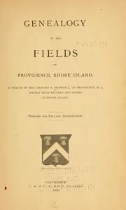



Search results from Open Library.
Recent natural events nearby
Ground air-quality sensors
Recently spotted species
Nearest stream gauge
Events
Notable, recurring, and historical events associated with Providence, sourced from Wikidata.
- 172nd National Puzzlers' League conventionJul 7, 2011recurring event edition
- NecronomiCon Providencerecurring event
biennial convention and academic conference held in Providence, Rhode Island
- 123rd National Puzzlers' League conventionSep 1, 1949recurring event edition
Source: Wikidata (CC0).
Gallery
Sources
- • Wikipedia
- • US Census Bureau (ACS 5-year estimates)
- • NOAA National Weather Service
- • Wikidata
- • USGS Earthquake Catalog (global feed)
- • NCES via Urban Institute Education Data Portal
- • GBIF (Global Biodiversity Information Facility)
- • CDC PLACES
- • Open-Meteo / sunrise-sunset.org
- • Wikipedia Pageviews API
- • Open Library