Browse / United States / South Carolina / Rock Hill
Rock Hill
South Carolinacity

Rock Hill
Total population
75,787
Median home value
$306,800
Bachelor's+
Median income
$71,309
Founded
1852
Air quality index
Demographic figures from US Census Bureau · ACS 5-year estimates. Overview below cites Wikipedia and may reference a different year.
City facts
Facts from Wikidata (CC0).
Overview
Rock Hill is the most populous city in York County, South Carolina, United States, and the 5th-most populous city in the state. It is also the 4th-most populous city of the Charlotte metropolitan area, behind Charlotte, Concord, and Gastonia. As of the 2020 census, the city's population was 74,372.
Read more on WikipediaHistory & geography
History
Although some European settlers had already arrived in the Rock Hill area in the 1830s and 1840s, Rock Hill did not become an actual town until the Charlotte and South Carolina Railroad Company made the decision to send a rail line through the area. Originally, the railroad had hoped to build a station in the nearby village of Ebenezerville which was squarely between Charlotte, North Carolina and Columbia, South Carolina. When approached, however, the locals in Ebenezerville refused to have the railroad run through their village since they considered it dirty and noisy. Instead, engineers and surveyors decided to run the line two miles away by a local landmark. According to some, the engineers marked the spot on the map and named it "rocky hill." Some of Rock Hill's early founding families—the White family, the Black family, and the Moores—believed that having a rail depot so close to them would be advantageous, so they decided to give the Columbia and Charlotte Railroad the right of way through their properties. As they were the three largest landowners in the area, this settled the matter. George Pendleton White contracted with the railroad to build a section of the line. Construction began in 1848. The first passenger train arrived on March 23, 1852. A few weeks later, on April 17, 1852, the first Rock Hill Post Office opened. As their actions gained widespread national news coverage, the tactic was adopted by other civil rights groups. The men became known as the Friendship Nine because eight of the nine men were students at Rock Hill's Friendship Junior College. Later in 1961, Rock Hill was the first stop in the Deep South for a group of 13 Freedom Riders, who boarded buses in Washington, DC, and headed South to test the 1960 ruling by the U.S. Supreme Court…
Geography
According to the United States Census Bureau, the city has a total area of , of which is land and (0.36%) is water. Sustained winds over across Rock Hill knocked out power, resulting in schools' closing for a week. It was the worst overall blizzard to hit the area. During the Tornado outbreak of November 14–16, 2011, a deadly EF-2 tornado struck about south and southwest of Rock Hill that travelled for after touchdown. The storm, which left a wide path of destruction and had wind speeds of up to , left 3 people dead, caused 5 injuries, and 7-8 damaged homes. This event caused the first ever tornado related deaths to be recorded in York Country history. Rock Hill has a humid subtropical climate with four distinct seasons, characterized by hot humid summers and cool dry winters. The city itself is part of the USDA hardiness zone 7b with yearly minimum low temperature extremes between , typically occurring in the month of January. Precipitation does not vary greatly between seasons, but is highly dependent on moisture supplied from the Gulf of Mexico. July is the hottest month, with an average high temperature of and an average low temperature of . The coldest month of the year is January, when the average high temperature is and the average low temperature is . }}
Excerpted from the corresponding Wikipedia article (CC BY-SA).
Demographics & economy
Race & ethnicity
Source: US Census Bureau — American Community Survey, 5-year estimates.
Geography
Coordinates & boundaries from the US Census TIGER/Line shapefiles.
Climate
Current forecast
Forecast for Rock Hill, SC from NOAA NWS API.
Air quality
Current readings from Open-Meteo Air Quality API (Copernicus CAMS European reanalysis).
Industrial & pollution facilities
Natural hazard risk
Health (adults)
Age-adjusted prevalence estimates from CDC PLACES (latest release).
Walkability
Amenities nearby
Wildlife & biodiversity
Most-observed species
- Northern CardinalCardinalis cardinalis (Linnaeus, 1758) · Aves10,964
- Carolina WrenThryothorus ludovicianus (Latham, 1790) · Aves9,392
- Carolina ChickadeePoecile carolinensis (Audubon, 1834) · Aves8,667
- Tufted TitmouseBaeolophus bicolor (Linnaeus, 1766) · Aves7,820
- House FinchHaemorhous mexicanus (P.L.Statius Müller, 1776) · Aves7,348
- Eastern BluebirdSialia sialis (Linnaeus, 1758) · Aves7,011
- Downy WoodpeckerDryobates pubescens (Linnaeus, 1766) · Aves6,897
- Red-bellied WoodpeckerMelanerpes carolinus (Linnaeus, 1758) · Aves6,379
Citizen-science & research observations from the Global Biodiversity Information Facility (GBIF).
Schools
Largest nearby schools
- Fort Mill HighHigh · Fort Mill · 2,036 students · 15.2:1 ratio
- Rock Hill HighHigh · Rock Hill · 1,945 students · 16.1:1 ratio
- Nation Ford HighHigh · Fort Mill · 1,877 students · 15:1 ratio
- Northwestern HighHigh · Rock Hill · 1,774 students · 16.3:1 ratio
- York Preparatory AcademyOther · Rock Hill · 1,673 students · 14.8:1 ratio
- Catawba Ridge High SchoolHigh · Fort Mill · 1,530 students · 15.6:1 ratio
- South Pointe HighHigh · Rock Hill · 1,196 students · 14.6:1 ratio
- Pleasant Knoll MiddleMiddle · Fort Mill · 961 students · 14.3:1 ratio
Public K–12 schools within ~10 mi from Urban Institute Education Data Portal (NCES Common Core of Data, 2022).
Earthquake history
Most recent
- M 3 — 2026-02-265 km WSW of Irmo, South Carolina
- M 2.84 — 2026-02-134 km WSW of Irmo, South Carolina
- M 2.72 — 2026-01-205 km ESE of Elgin, South Carolina
- M 2.57 — 2025-04-266 km E of Elgin, South Carolina
- M 2.5 — 2024-09-156 km E of Elgin, South Carolina
- M 2.65 — 2024-03-095 km E of Elgin, South Carolina
Events from the USGS Earthquake Catalog (global) (FDSN Event Web Service).
Photos
Sights & places nearby
Notable people from here


People born within ~10 km, from Wikidata (CC0). Click any name for their Wikipedia article.
Nearby places in South Carolina
Geography & sun
Elevation, sunrise/sunset and daylight from Open-Meteo. Solar climatology from NASA POWER.
Nearby airports
Public attention
Pageview totals from the Wikimedia Pageviews API.
Books about Rock Hill
Search results from Open Library.
Recent natural events nearby
- Wildfire Main Trail, Chatham, GeorgiaWildfires · 2026-08-14 · 212 mi
- Hurricane IsaiasSevere Storms · 2026-10-11 · 243 mi
Wildfires, storms and other events from NASA EONET (last 12 months, within 250 mi).
Ground air-quality sensors
Recently spotted species




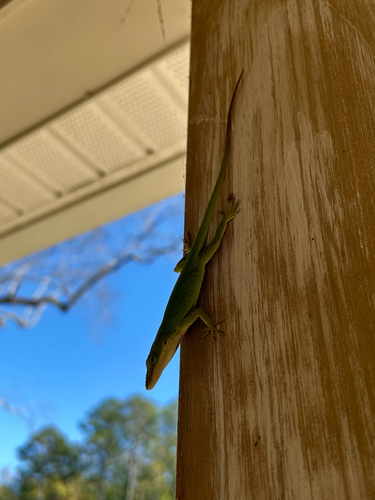

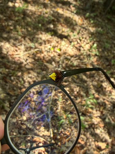
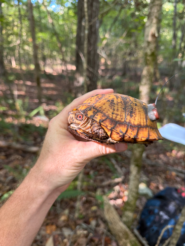
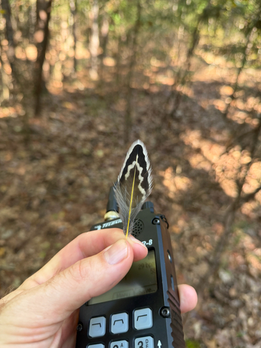
Research-grade observations from iNaturalist (within ~15 mi).
Nearest stream gauge
Events
Gallery
Sources
- • Wikipedia
- • US Census Bureau (ACS 5-year estimates)
- • NOAA National Weather Service
- • Wikidata
- • Open-Meteo Air Quality (CAMS)
- • USGS Earthquake Catalog (global feed)
- • NCES via Urban Institute Education Data Portal
- • GBIF (Global Biodiversity Information Facility)
- • iNaturalist
- • CDC PLACES
- • Open-Meteo / sunrise-sunset.org
- • Wikipedia Pageviews API
- • Open Library
- • NASA EONET