Browse / United States / South Dakota / Custer
Custer
South Dakotacity

Custer
Total population
2,341
Median home value
$235,600
Bachelor's+
Median income
$78,369
Founded
1875
Demographic figures from US Census Bureau · ACS 5-year estimates. Overview below cites Wikipedia and may reference a different year.
City facts
Facts from Wikidata (CC0).
Overview
Custer is a city in Custer County, South Dakota, United States. The population was 1,919 at the 2020 census. It is the county seat of Custer County.
Read more on WikipediaHistory & geography
History
Custer is the oldest town established by European Americans in the Black Hills. Gold was discovered east of Custer during the Black Hills Expedition, conducted by the 7th Cavalry led by Lt. Colonel George Armstrong Custer, a discovery which initiated the Black Hills Gold Rush. For thousands of years, the Black Hills had been part of the territory of varying tribes of indigenous peoples. They were within historical territory of the Oglala Sioux at the time of United States encounter, and within the Great Sioux Reservation established by the US Treaty of Fort Laramie (1868). Having established dominance in the area by the eighteenth century, the Oglala Sioux had long considered the Black Hills as sacred land. After increasing encroachment by Americans and violent confrontations, the U.S. government forced the Sioux to cede much of the Black Hills in 1877, and opened the land for individual purchase and settlement. In 1875 trespassing gold-boomers named their settlement Stonewall (after the Confederate general, Stonewall Jackson), but it was renamed for Custer. Almost abandoned in 1876 after word of the much larger gold strikes in Deadwood Gulch spread, Custer later became an established city. Custer has had a smaller population and been less wealthy than the Northern Hills cities of Deadwood and Lead. In addition to gold, Custer and other cities based their economies on the extraction of industrial minerals, which are still important to the regional economy. Custer annually observes a "Gold Discovery Days" celebration and festivities over the last full weekend of July. This heritage tourism event celebrates the embezzlement of gold by the Custer expedition in nearby French Creek and the subsequent founding of the town.
Geography
According to the United States Census Bureau, the city has a total area of , of which is land and is water. Custer has a humid continental climate (Köppen Dfb/Dwb) with summers featuring very warm afternoons and cool mornings, and cold, extremely variable winters. Winter weather is dominated by the conflict between cold Arctic air moving south from Canada, and very warm chinook winds which can produce exceptionally high winter temperatures for the latitude and altitude. For instance, January 19 of 1963 saw the coldest temperature ever of , yet in just over two weeks on February 5, Custer reached . The coldest month has been January 1957, which averaged and included twenty-two mornings reaching – in contrast only one morning fell below zero Fahrenheit in the winter of 2015–16. On average the first temperature of will occur around November 25, and the last around March 8, whilst the corresponding window for freezing temperatures is from September 6 to June 2, allowing a frost-free season of only ninety-five days. Snowfall averages , and has ranged from between July 1998 and June 1999, down to during the very mild and dry winter of 1933–34. The frequent chinooks limit snow cover: even in January the mean is only . The most snow on the ground in Custer has been on April 15, 1927. Custer's altitude makes summers much milder than in the Great Plains proper: only seven afternoons rise above and has been reached only once in 1954. The transitional spring season is similarly variable to the winter: as much as of snow fell in April 1920 – the snowiest month on record – but has been reached as early as March 15 of 2003 and as early as April 21, 1989. Most precipitation falls from spring and early summer thunderstorms: of the of precipitation expected each year,…
Excerpted from the corresponding Wikipedia article (CC BY-SA).
Demographics & economy
Race & ethnicity
Source: US Census Bureau — American Community Survey, 5-year estimates.
Geography
Coordinates & boundaries from the US Census TIGER/Line shapefiles.
Climate
Current forecast
Forecast for Custer, SD from NOAA NWS API.
Air quality
Industrial & pollution facilities
Natural hazard risk
Health (adults)
Age-adjusted prevalence estimates from CDC PLACES (latest release).
Walkability
Amenities nearby
Wildlife & biodiversity
Schools
Largest nearby schools
- Custer Elementary - 02Elementary · Custer · 304 students · 11.7:1 ratio
- Custer High School - 01High · Custer · 284 students · 12.9:1 ratio
- Custer Jr. High - 05Middle · Custer · 101 students · 14.4:1 ratio
Public K–12 schools within ~10 mi from Urban Institute Education Data Portal (NCES Common Core of Data, 2022).
Earthquake history
Photos
Sights & places nearby
Notable people from here

People born within ~10 km, from Wikidata (CC0). Click any name for their Wikipedia article.
Nearby places in South Dakota
Geography & sun
Elevation, sunrise/sunset and daylight from Open-Meteo. Solar climatology from NASA POWER.
Nearby airports
Public attention
Pageview totals from the Wikimedia Pageviews API.
Books about Custer
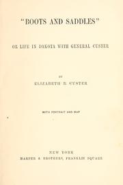
Search results from Open Library.
Recent natural events nearby
- Wildfire XU Hill, Oglala Lakota, South DakotaWildfires · 2026-08-11 · 60 mi
- Wildfire Rancher fire, Oglala Lakota, South DakotaWildfires · 2026-08-11 · 71 mi
- Wildfire Needles, Oglala Lakota, South DakotaWildfires · 2026-09-04 · 72 mi
- Wildfire Potato Creek, Jackson, South DakotaWildfires · 2026-08-01 · 78 mi
- Wildfire Potato Creek, Jackson, South DakotaWildfires · 2026-07-27 · 78 mi
- Wildfire Fairpoint, Meade, South DakotaWildfires · 2026-07-27 · 78 mi
- Wildfire Duhamel, Pennington, South DakotaWildfires · 2026-07-29 · 81 mi
- Wildfire Kohns, Campbell, WyomingWildfires · 2026-07-27 · 88 mi
Wildfires, storms and other events from NASA EONET (last 12 months, within 250 mi).
Ground air-quality sensors
Recently spotted species
Nearest stream gauge
Live readings from USGS NWIS · measured 2026-09-24 11:45 UTC.
Events
Gallery
Sources
- • Wikipedia
- • US Census Bureau (ACS 5-year estimates)
- • NOAA National Weather Service
- • Wikidata
- • USGS NWIS (water data)
- • NCES via Urban Institute Education Data Portal
- • CDC PLACES
- • Open-Elevation
- • Open-Meteo / sunrise-sunset.org
- • Wikipedia Pageviews API
- • Open Library
- • NASA EONET