Browse / United States / Tennessee / Dickson
Dickson
Tennesseecity

Dickson
Total population
16,424
Median home value
$292,600
Bachelor's+
Median income
$69,678
Demographic figures from US Census Bureau · ACS 5-year estimates. Overview below cites Wikipedia and may reference a different year.
City facts
Facts from Wikidata (CC0).
Overview
Dickson is a city in the U.S. state of Tennessee. Located in Dickson County. It is part of the Nashville metropolitan area. As of the 2020 census, Dickson's population was 16,058.
Read more on WikipediaHistory & geography
History
Dickson was named for Congressman William Dickson, as was Dickson County. The City started as a stop on the railroad line between Nashville and the Tennessee River. When Union Troops had finished the supply line during the Civil War, the area was known as Mile 42 post. It is disputed on what the community was known as prior to being named Dickson. Various other sources also state that the city was at one point named Sneedsville. Other sources claim that the community was named Smeedsville rather than Sneedsville. One claim comes from a series of writings for the Dickson Free Press by former mayor Robert S. Clement From Mile Post 42… To City of Dickson 1980. In article 7 "Was it called Sneedsville or Smeedsville?" Clement writes about a 1867 Chancery Court decree that was brought to his attention by historian Henry Ragan that refers to the land as "Smeedsville, Dickson County, Tennessee.", and that Ragan interviewed various locals who remembered the town being named Smeedsville. Corlew claimed that he had found Chancery Court documents from the same year that incorporated the area as Sneedsville or Smeedsville, and that it's hard to interpret it being an "n" or an "m" due to the handwriting.
Geography
Dickson is located in south-central Dickson County at (36.071485, -87.374539). It is bordered to the east by the town of Burns. U.S. Route 70 passes through the north side of the city as Henslee Drive; it leads east to Nashville and west to Huntingdon. Interstate 40 passes through the Dickson city limits south of the center of town, with access from Exit 172 (Tennessee State Route 46). I-40 leads east to Nashville from Exit 172 and west to Jackson. According to the United States Census Bureau, Dickson has a total area of , of which is land and , or 0.41%, is water. The city center sits on the Tennessee Valley Divide, with the southwest side of the city draining via the East Piney River to the Piney River, then to the Duck River, and then to the Tennessee River, while the northeast side drains via Turnbull Creek or Jones Creek to the Harpeth River and thence to the Cumberland River.
Excerpted from the corresponding Wikipedia article (CC BY-SA).
Demographics & economy
Race & ethnicity
Source: US Census Bureau — American Community Survey, 5-year estimates.
Geography
Coordinates & boundaries from the US Census TIGER/Line shapefiles.
Climate
Air quality
Industrial & pollution facilities
Natural hazard risk
Health (adults)
Age-adjusted prevalence estimates from CDC PLACES (latest release).
Walkability
Amenities nearby
Wildlife & biodiversity
Schools
Largest nearby schools
- Dickson County High SchoolHigh · Dickson · 1,472 students · 16.5:1 ratio
- Creek Wood High SchoolHigh · Charlotte · 933 students · 16.7:1 ratio
- Stuart Burns ElementaryElementary · Burns · 740 students · 15.7:1 ratio
- Centennial ElementaryElementary · Dickson · 682 students · 13.6:1 ratio
- Charlotte ElementaryElementary · Charlotte · 616 students · 13.7:1 ratio
- Dickson Middle SchoolMiddle · Dickson · 594 students · 13.2:1 ratio
- Burns Middle SchoolMiddle · Burns · 475 students · 14.8:1 ratio
- Oakmont ElementaryElementary · Dickson · 474 students · 11.3:1 ratio
Public K–12 schools within ~10 mi from Urban Institute Education Data Portal (NCES Common Core of Data, 2022).
Earthquake history
Photos
Sights & places nearby
Notable people from here


People born within ~10 km, from Wikidata (CC0). Click any name for their Wikipedia article.
Nearby places in Tennessee
Geography & sun
Elevation, sunrise/sunset and daylight from Open-Meteo. Solar climatology from NASA POWER.
Nearby airports
Public attention
Pageview totals from the Wikimedia Pageviews API.
Books about Dickson
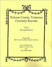
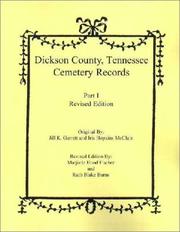
Search results from Open Library.
Recent natural events nearby
Ground air-quality sensors
Recently spotted species
Nearest stream gauge
Events
Gallery
Sources
- • Wikipedia
- • US Census Bureau (ACS 5-year estimates)
- • Wikidata
- • NCES via Urban Institute Education Data Portal
- • CDC PLACES
- • Open-Meteo / sunrise-sunset.org
- • Wikipedia Pageviews API
- • Open Library